

Skydio Partners with Taser-Maker Axon to Bring Autonomous Drones to Public Safety Agencies
BY Zacc Dukowitz
18 March 2021Right on the heels of news that Skydio has been valued at $1 billion following a $170 million Series D funding round, the autonomous drone maker has some news that could seriously shake up how drones are used in law enforcement.
Axon, a company best known as the makers of the Taser, recently announced a partnership with Skydio to bring its autonomous drones further into U.S. public safety agencies.
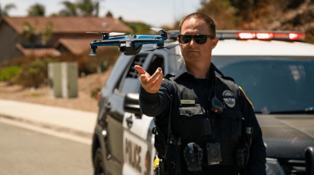
Photo credit: Skydio
Through the partnership, Axon Air—the unmanned arm of Axon—will now be the exclusive reseller of Skydio’s drones and Skydio’s digital management program to all public safety agencies in the world. Also, Skydio will now be able to offer Axon’s public safety-focused drone software on its drones.
Although the exclusive reseller agreement is significant, the partnership announcement is actually much bigger than that: the two companies have announced plans for a product roadmap that will integrate Skydio’s drones into Axon’s robust infrastructure for supporting law enforcement work.
Once completed, the integration will make Skydio’s drones an integral tool in the law enforcement toolbox.
Before this announcement, Skydio already had a foothold in the public safety drone market.
But given Axon’s significant presence in public safety, this partnership could catapult Skydio from a niche solution used by a few early-adopter police departments into a household name in public safety.
Over the last year, we’ve seen strong momentum of Skydio drones in public safety. We are excited to partner with Axon . . . to accelerate this trend globally.
– Mark Cranney, Skydio COO
Axon / Skydio Product Roadmap
According to a recent statement, the two companies are working on a joint product roadmap with the goal of seamlessly integrating Skydio’s drones into Axon’s existing public safety ecosystem.
. . . by next year Skydio’s offerings will be integrated with Axon’s suite of products to improve evidence management, real-time situational awareness and scene reconstruction for agencies.
– Aydin Ghajar, General Manager of Axon Air
Currently, that ecosystem includes:
- Axon Air. Drone-focused section of Axon.
- Axon Evidence. Software for managing evidence data.
- Axon Respond. Software for managing and sharing emergency operations data in real-time, including data to support real-time communications, dispatching, and situational awareness.
The goal here is to make it easier for public safety agencies to incorporate drones into their work.
This is done by 1) Making it easier to fly the drones using Skydio’s autonomous technology, and 2) Making it easier to manage the data drones collect by using Axon’s existing public safety software solutions.
In a recent post on the Axon website Aydin Ghajar, Axon Air’s General Manager, imagines a future where Skydio’s drones might be able to fly regularly Beyond Visual Line of Sight (BVLOS) “to power a true ‘drone as first responder’ system.”
The Chula Vista Police Department, which has been a leader in testing the use of drones in public safety, already has a program called “Drone as First Responder” that immediately dispatches Skydio drones BVLOS to fly to the scene of 911 calls to provide a livestream as officers travel there.
We imagine Axon has similar capabilities in mind when it uses the same phrase.
Of course, regulatory hurdles stand in the way of scaling the Chula Vista model, but Axon’s long-term plan seems to be to make autonomous drones as common in law enforcement work as bodycams (another public safety tool that Axon makes).
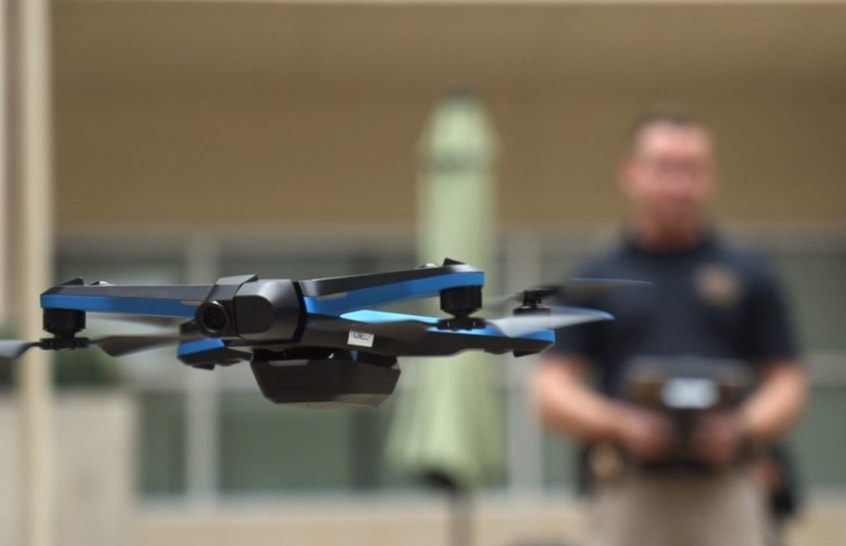
Photo credit: Skydio
Here is the Axon / Skydio integration roadmap, as described in the post by Aydin Ghajar we mentioned above:
Step 1: Focus on evidence—data management after an incident takes place
First, Axon plans to integrate Skydio drones with Axon Evidence for seamless upload and evidence management. This integration will allow law enforcement to manage, share, and build cases with drone files alongside existing Axon-generated evidence, including body-cam video, bringing all the data collected by law enforcement under one roof.
Step 2: Focus on live responses—sharing data while an incident takes place
Second, Axon plans to integrate Skydio drones with Axon Respond for Devices so that officers can view streams from Skydio drones to improve their situational awareness before they get to a developing incident.
Axon Respond is an app officers can use that tracks locational, visual, and other data to help them understand what is happening on-scene as it unfolds.
Step 3: Focus on scene reconstruction
Third, Axon plans to create a way for public safety personnel to manage 3D models created by Skydio’s 3D Scan within both Axon Evidence and Axon Records, which can then be used for scene reconstruction.
These 3D models will most likely be used primarily for accident reconstruction, but they might also be used for reconstructing fire scenes, or even to reconstruct shooting scenes and other crime scenes to better understand what transpired.
How Skydio’s Drones Are Already Being Used in Public Safety
Last year, as part of a series we wrote on the American Security Drone Act, we interviewed Fritz Reber, Skydio’s Head of Public Safety Integration, and he shared some common use cases for Skydio’s autonomous drone technology in law enforcement.
At the time, he emphasized the ability to use Skydio’s drones to quickly get eyes in the sky so that you can have a better tactical understanding of a developing situation.
Here are two examples Reber shared with us from actual incidents that took place in the field, which highlight how Skydio’s drones support public safety work.
Assessing Harm after a Car Accident
Officers found a car upside down in an overgrown area that was inaccessible by foot. It was unclear whether anyone was inside the crashed car or had been injured and was in need of assistance.
The Skydio 2’s self-flying feature let officers on the scene to avoid the debris and see inside the car, allowing them to determine that no one was inside.
Finding a Hidden Suspect
Officers were looking for a female suspect who had been threatening people with an icepick.
They believed she was hiding in a backyard, but due to intervening obstacles like trees and patio covers they couldn’t see what was happening with the drone they had been using.
According to Reber, they put the Skydio 2 in the air and used its obstacle-avoidance technology to fly through power lines, below the tree line, and along the ground at head height. This approach let them clear each area before sending officers in, and ultimately helped them find the suspect.
Do you think Skydio will become the most common public safety drone over the next few years? Share your thoughts in this thread on the UAV Coach community forum.


