
-
FREE RESOURCES
Drone flying & skills
Drone careers & jobs
Drone industry applications

- SCHOOLS
- NEWS
- (888) 626-1490
- Course Login
- SUBSCRIBE
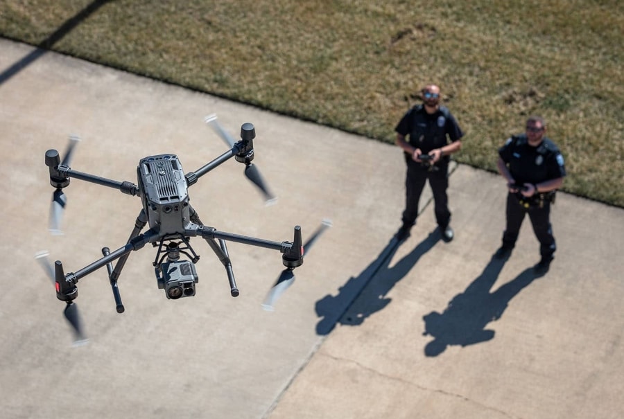
Public safety drones are any drone used to support the work of first responders.
While there are a handful of drones made specifically for work in public safety, the term can apply generally to describe whatever drone a public safety agency has chosen to use in its work, regardless of how the drone is marketed or the original use cases its manufacturer may have imagined for it.
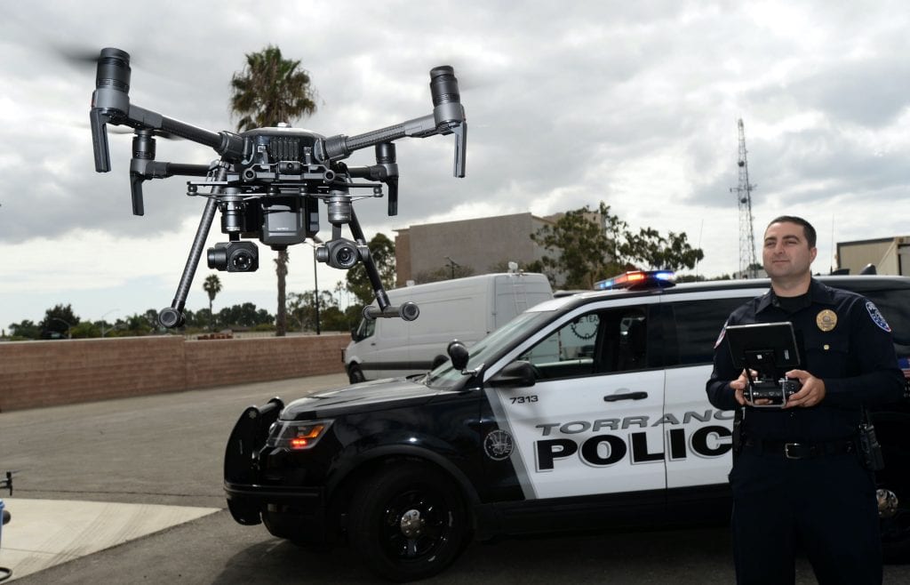
Credit: Torrance Police Department / Axel Koester
In the last ten years, the use of drones to support public safety work has gone from an interesting concept to a tried and tested reality. This fact is demonstrated in the phrase itself—a decade ago, the term “public safety drone” hadn’t yet entered our general vocabulary.
Now, public safety drones are commonplace. In any major city you’ll find drones supporting the work of police departments, fire departments, search and rescue teams, and disaster management personnel.
It’s also now common knowledge that you’ll probably need several types of drones to support public safety work, especially if you’re a larger organization. While some drones are good for their autonomy and suited for quickly searching an area for victims after a crash, other drones are good for collecting LiDAR data in rugged environments to support the creation of detailed 3D maps for disaster planning or risk mitigation.
If you’re just getting started in your public safety drone journey, this in-depth guide is for you. In the guide we cover the best public safety drones on the market, the ways that different types of public safety agencies are using drones in their work, legal considerations for adopting public safety drones, and more.
Here’s a table of contents in case you’d like to jump around:
Here are some resources to help you get started:
This article is part of a series on drones in public safety. Here are the other articles in the series:

Credit: Skydio
The Skydio X2 is a portable and ruggedized drone equipped for both day and night operations. Skydio is best known for its autonomy—a feature that lets the drone basically fly itself, allowing the pilot to pursue a suspect on foot, or gain situational awareness while focused on what’s happening in an unfolding situation.
Features and Specs:
Learn more about the Skydio X2.
Credit: BRINC
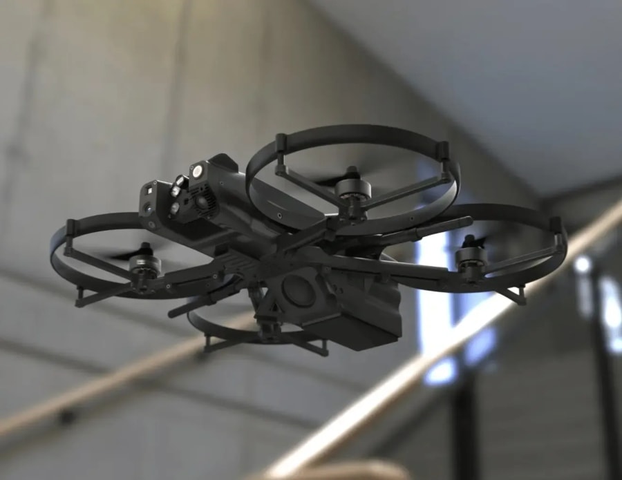
The BRINC Lemur 2 is a public safety drone first, meaning it was designed specifically for work in public safety, with a focus on law enforcement and use in hostage / active shooter situations. The Lemur 2 has unique features that make it capable of navigating tight indoor spaces, providing two-way communication, and breaking through glass windows to enter buildings.
Features and Specs:

Credit: DJI
DJI’s Matrice series is widely used by law enforcement and other public safety agencies. The Matrice 30 is the smallest model in the Matrice line, which is why it’s called the first “backpack drone” in the series. The M30 can be equipped with an optional thermal camera, and it’s a rugged, portable drone made to support work in the field, including public safety work.
Features and Specs:
Learn more about the Matrice 30.

Credit: DJI
The Matrice 300 RTK is a slightly older large drone in the Matrice line. The M300 is a solid public safety drone for entities who want to do 3D mapping, since the RTK system enables high-accuracy mapping for precise data collection, making it ideal for detailed 2D and 3D mapping of crime scenes or traffic accidents. It’s also good for longer-range missions, like those over active wildfires or in search of missing persons.
Features and Specs:
Learn more about the Matrice 300 RTK.
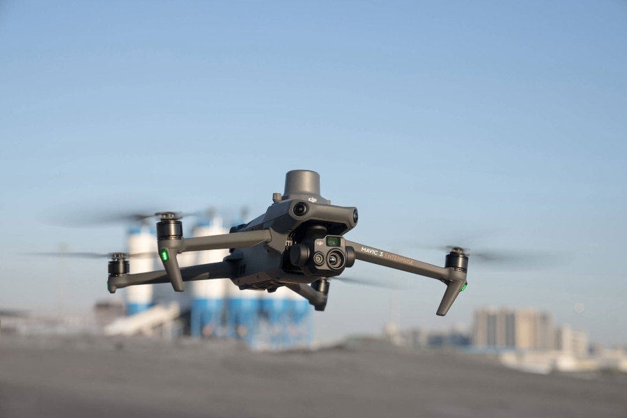
Credit: DJI
The DJI Mavic 3T is a version of the Mavic 3 Enterprise that comes equipped with a thermal camera. It offers a combination of advanced features that make it a powerful tool for public safety applications, including extended flight time and advanced safety features. It also has robust data protection measures, including a local data mode to prevent data transmission over the internet and AES-256 bit encryption for data transmission.
Features and Specs:
For a drone to be useful for public safety applications it should come with certain key features.
Here’s what to look for:
Just getting started with public safety drones? Here are some tips to help.
Make sure to do your research and choose a drone, or drones, suitable for public safety operations.
The drones you choose should be equipped with essential features, which could include thermal imaging (if you’re doing firefighting work), real-time video streaming, GPS, and autonomous flight capabilities.
See the previous section for guidelines on choosing public safety drone hardware as well as our list of the best public safety drones on the market.

Credit: BRINC
You may need software both for managing your drone operations and for creating 3D models (if you need them in your work).
There are software providers out there that specialize in supporting public safety work with drones. Axon, makers of the Taser, has a division called Axon Air that provides both drone hardware and drone software tailored for law enforcement.
And for 3D mapping or orthomosaics, there are software companies that specialize in making software just for drone operations.
Here are some resources to guide your software research:
Before you start flying, make sure to obtain all necessary permissions and licenses from relevant authorities.
This will include:
Your drone pilots should be adequately trained and familiar with the capabilities of every drone you use, and know how to operate each one safely and proficiently.
Training considerations are important not just for one-off skill building but also for maintaining piloting skills.
When thinking about training, make sure to schedule refreshers so your pilots stay current on all your drone models. One way to do this is to have a minimum flight hour requirement per month or quarter, which could be assigned for each type of drone your agency owns.
In addition to training, you’ll want to put in the work to create a full fledged drone program. This includes:
Here are some resources to help you get started:
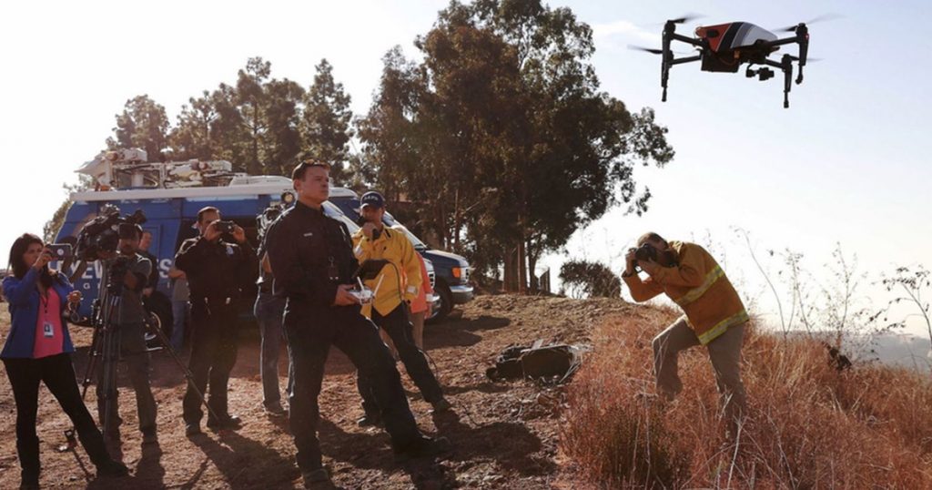
Credit: LAFD
Once you’ve created your drone program, here’s a brief guide to planning and executing a drone operation in the field:
Carefully plan the operation by assessing the situation, defining the objectives, and determining the best approach.
For example, if you are using a drone for search and rescue, define the search area, identify potential hazards, and determine the best time to conduct the operation.
Of course, in public safety you may not have a lot of time for planning—sometimes you need aerial data right away. But even in emergencies, take a moment to think through the goals of the operation and what you plan to accomplish. Pre-planning will pay dividends in helping you achieve your goals for the mission.
Before launching the drone, conduct pre-flight checks to ensure that all systems are functioning correctly, the batteries are fully charged, and the drone is ready for operation.
Operate the drone according to plan, using it to get the data you need and then bringing it back down as soon as you have that data.
Analyze the data collected by the drone to extract valuable information. This may include reviewing the video footage, analyzing the thermal images, or creating maps of the affected area.
Analysis may happen as the drone flies, with the pilot and others looking at the live feed to make decisions on the spot.
After the operation, conduct an assessment to evaluate the success of the operation, identify areas for improvement, and document the lessons learned.
One key decision for a public safety agency is whether to operate under the FAA’s Part 107 rules or a Certificate of Authorization (COA).
You can operate under just one, or both. Keep reading for more information about each.
Part 107 is the FAA’s small UAS rule, which lays out all the rules for commercial drone operations in the U.S.
Operating under the Part 107 is often quicker to set up and has fewer restrictions, but it comes with certain limitations that might not be suitable for all public safety operations. For example, Part 107 does not allow operations beyond visual line of sight (BVLOS), over people, or at night without a waiver—activities you may want to unlock for your public safety work.
Additionally, each drone pilot on your team must have a Remote Pilot Certificate (commonly called a drone license) to fly under the Part 107 rules. (The biggest hurdle for getting the certificate is the FAA’s Part 107 test, also called the Aeronautical Knowledge Test.).
A Certificate of Authorization (COA) is an authorization issued by the FAA that allows public entities like law enforcement agencies, fire departments, and search and rescue teams to operate drones.
Operating under a COA can come with fewer restrictions than operating under the Part 107 rules, and can include permissions for BVLOS operations, operations over people, and night operations.
However, obtaining a COA can be a more complex and time-consuming process. Additionally, a COA often requires the public safety agency to have a comprehensive drone program, including trained operators, maintenance procedures, and operational guidelines.
Here’s some guidelines to help you choose:
The first step in choosing between operating under the Part 107 rules or a COA is to assess the needs of your agency. Determine the types of operations you will be conducting, the locations you will be operating in, and any special requirements you may have, such as BVLOS operations or night operations, which might make a COA more appealing.
Consider the limitations of Part 107 and the COA. If your agency can operate within the limitations of Part 107, it may be the quickest and easiest way to get started. However, if your operations require more flexibility, a COA may be necessary.
Consider the resources available to your agency. Obtaining and operating under a COA may require more resources in terms of training, documentation, and operational procedures, as well as possible consulting fees if you seek the support of a third party to navigate the process.
It is always advisable to consult legal and regulatory experts to understand the implications of operating under Part 107 or a COA, and to ensure compliance with all legal requirements.
Some public safety agencies decide to obtain Part 107 certification for their pilots so they can get up and running right away, and then work on obtaining a COA. By doing both, the agency is able to move quickly on launching its drone program while also carrying out the slower work of getting more expansive permissions, which will be unlocked once the COA is secured.
For more on navigating the Part 107 vs. COA decision, see our guide on the subject.
One other regulatory tool all public safety drone program leads should know about is the TBVLOS waiver.

During emergencies, public safety agencies can obtain special permission to fly BVLOS (Beyond Visual Line of Sight) by obtaining a TBVLOS waiver (the T stands for Tactical).
To get a TBVLOS waiver you must have a COA—Part 107-only operators can’t apply, unfortunately.
Also, it’s important to note that you can get a TBVLOS waiver before an anticipated emergency or during an emergency, and there is a different process for each. (The process for those obtaining waivers during an emergency is accelerated to provide support as fast as possible.)
Here’s how to get a TBVLOS waiver before an emergency:
Here’s how to get a TBVLOS waiver during an emergency:
These are just the steps at a high level. For specific step-by-step instructions, see our guide to TBVLOS waivers.
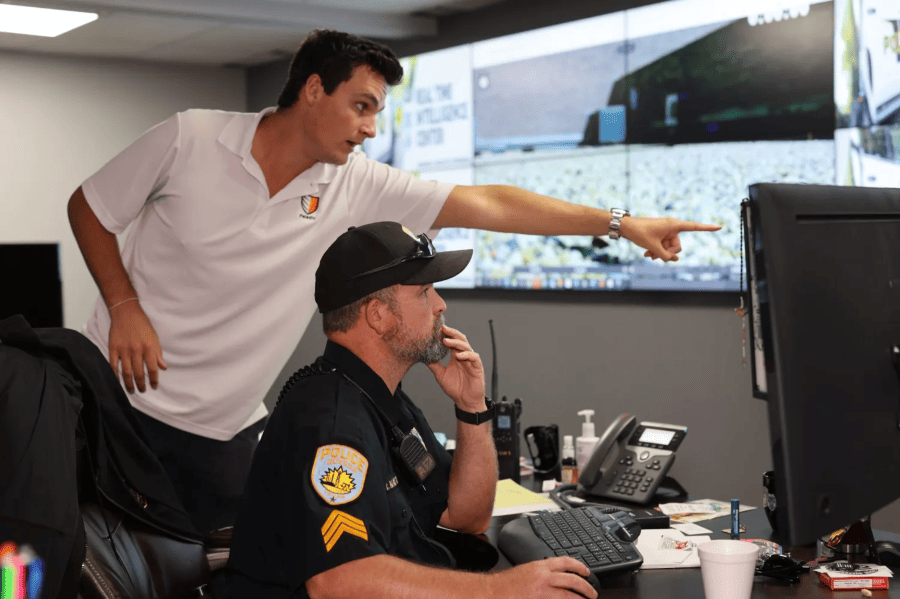
The “Drone as First Responder” (DFR) program is a relatively new way of using drones in public safety that integrates drones into the emergency response operation of public safety agencies.
Credit: Odessa Police Department
Traditionally, first responders such as police, firefighters, and emergency medical teams are dispatched to the scene of an incident as soon as a distress call is received. In a DFR program, a drone is deployed to the scene immediately after a 911 call is received, often arriving before human responders.
The drone, equipped with high-resolution cameras and other sensors, provides real-time aerial footage and data to the emergency response teams, often while they are still en route to the incident. This live feed allows first responders to assess the situation, understand the terrain, identify potential threats, and make informed decisions before they arrive.
The DFR program not only improves the efficiency and effectiveness of emergency response operations but also enhances the safety of the first responders by providing them with critical information before they arrive on the scene. By having a clearer picture of the situation, responders can better prepare and equip themselves, ultimately leading to more successful outcomes and safer operations.
For now, the approach is used only by law enforcement, but the model could potentially be adopted by fire departments or other public safety agencies.
How exactly are public safety professionals using drones in the field?
Here’s a list of over 50 use cases for public safety drones, organized by the different types of public safety agencies that might use them.
Scroll through the list to see them all, or use the menu below to jump around.

Credit: DJI
After a natural disaster such as a hurricane, earthquake, or flood, drones can quickly assess the damage to infrastructure, buildings, and roads. They can provide real-time images and videos that help in understanding the scale of the damage and prioritizing response efforts.
In the aftermath of a disaster, finding and rescuing survivors is the top priority. Drones equipped with thermal cameras can locate survivors in hard-to-reach areas, at night, or under debris.
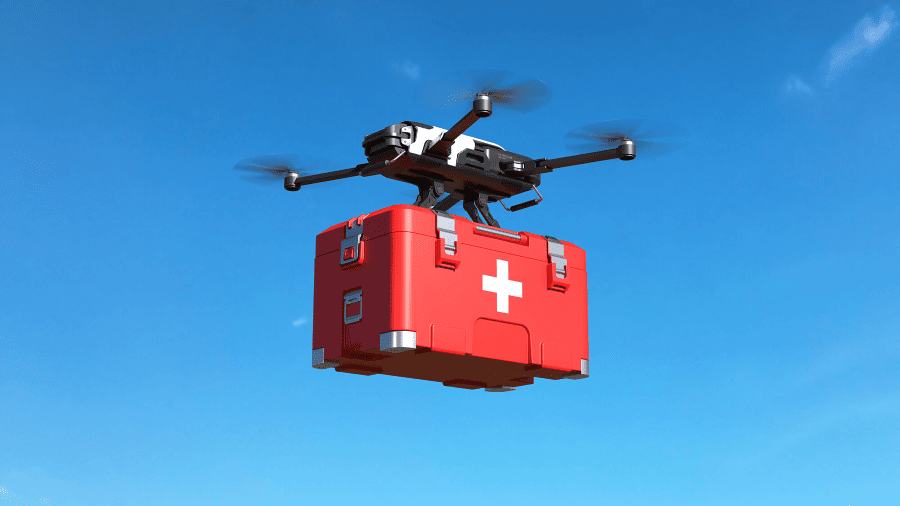
Drones can be used to deliver essential supplies like food, water, and medicine to areas that are difficult to access due to damaged infrastructure or ongoing hazards.
Drones can provide a real-time aerial view of evacuation routes and help in monitoring the movement of people and vehicles. This information is critical for managing traffic and ensuring the safety of evacuees.
Drones can quickly create detailed maps of affected areas, providing emergency responders with essential information for planning and coordinating their efforts.
Drones can inspect critical infrastructure such as bridges, dams, and power lines for damage that might not be visible from the ground or might be too dangerous for human inspection.
Drones equipped with sensors can detect hazardous materials that might have been released during a disaster, helping protect first responders and the public.
In situations where communication networks are down, drones can act as temporary communication relays, helping to restore communication between emergency responders and command centers.
Drones can monitor the rise of water levels in real-time and help in predicting the areas that are at risk of flooding. This information is crucial for issuing warnings to the public and planning evacuations.
Drones can monitor areas that are at risk of landslides and provide early warnings to communities and emergency responders.
After the immediate emergency has passed, drones can continue to support recovery efforts by assessing the damage, supporting the rebuilding of infrastructure, and monitoring the recovery process.
Credit: Iris Automation
Drones can be dispatched immediately to the scene of an accident or emergency to provide real-time video feed to emergency responders. The feed can help them assess the situation and prepare necessary equipment and personnel before arriving at the scene.
Drones can quickly deliver essential medical supplies such as defibrillators, epinephrine, or tourniquets to remote or inaccessible areas, saving crucial time in life-threatening situations.
Before ambulances are dispatched, drones can be used to assess traffic conditions and find the quickest route to the emergency site, helping to reduce response times.
During large events, drones can be used to monitor crowds and identify potential medical emergencies or disturbances, enabling a quicker response from EMTs and security personnel.
Drones can capture aerial images and videos of accident scenes, which can be helpful for insurance purposes and for authorities to better understand the cause of accidents.
In situations involving hazardous materials, drones can be equipped with sensors to detect the presence of harmful substances, helping to keep EMTs and other first responders safe.
In some cases, drones equipped with communication devices can be used to assess a patient’s condition remotely, helping to determine the level of care required before EMTs arrive on the scene.
Drones can be used to quickly transport blood samples or other medical specimens from the emergency site to a laboratory for analysis.
In the aftermath of natural disasters, drones can be used to assess damage, locate survivors, and deliver essential medical supplies to areas that are difficult to access by ground.

Credit: DJI
Public safety drones support firefighting operations by providing a real-time overhead view of the fire scene, helping firefighters understand the fire’s spread and its potential path.
For structure fires, drones can reveal key information about exits and entry points and the fire’s nature. Additionally, thermal cameras attached to drones can help firefighters locate smoldering hot spots invisible to the naked eye, ensuring they are completely extinguished.
Firefighters use drones to capture quick, safe information related to catastrophic events like floods, earthquakes, and hurricanes.
Early information can help incident commanders and emergency managers understand the community impact on building infrastructure, road conditions, and living conditions, aiding in determining additional resources needed from FEMA, neighboring communities, or other organizations. Drones can also help locate people trapped in homes or vehicles, diverting rescue efforts to assist them.
Using thermal cameras, firefighters can locate people trapped in a building’s upper level during a structure fire or within a wildfire, focusing their efforts on saving them. Even without thermal imagery, the ability to see into windows and gain real-time information on a burning building or wildfire situation can give firefighters crucial information to save lives.
Firefighters use public safety drones to make emergency deliveries in disaster situations, carrying items like Automated External Defibrillators (AEDs) and other necessary ground equipment.
Firefighters use drones to capture images and create orthomosaic maps of key buildings and facilities, like schools, within their work areas. These maps help firefighters know the exits and can be used by the incident commander during a fire to compare normal and fire conditions for different building parts.
Drones capture aerial footage while a fire is burning, providing situational awareness and first-hand information on how the fire burned while active. This information, archived in photos and videos, can be used for investigations into the fire’s cause and progression.
After a fire burns out, drones can survey the scene and collect images turned into orthomosaic maps, serving as a complete data set for investigating the fire’s cause and progression.
Aerial video footage and images captured while a fire is burning are crucial in after-action assessments, where firefighters critique their efforts to improve their approach and identify future training needs. These materials can also be used to train new firefighters, providing real-life examples of how a fire might unfold and decisions made on the ground.
Public safety drones equipped with thermal cameras can monitor controlled or prescribed burns to ensure the fire stays within the designated area and doesn’t pose a threat to nearby structures or wildlife.
Drones equipped with thermal cameras can quickly search large areas for missing persons or pets in the aftermath of a fire, especially in challenging terrains or low-visibility conditions.
Drones equipped with communication devices can serve as aerial communication hubs, enhancing radio signals in areas with poor reception, ensuring clear and continuous communication among firefighting teams and command centers.
Although not widely adopted, some specialized drones can carry and drop water or fire retardant on fires in hard-to-reach areas, reducing the risk for firefighters and aiding in quickly containing the fire.
Drones equipped with specialized sensors can detect hazardous materials at a fire scene, helping firefighters identify potential risks and take appropriate safety measures.

Credit: Skydio
Public safety drones can provide real-time aerial surveillance during large public events, protests, or gatherings, helping law enforcement agencies to monitor crowd movements, identify potential threats, and deploy resources more effectively.
Drones can aid in the pursuit of suspects by providing real-time aerial tracking, allowing ground units to better coordinate their efforts and capture suspects more efficiently while minimizing risks to the public.
In hostage situations, drones equipped with audio and video capabilities can provide law enforcement with valuable intelligence without risking personnel, helping in the negotiation process and planning a tactical response if necessary.
Public safety drones can be deployed to monitor high crime areas, providing a deterrent effect and helping in the early detection and response to criminal activities.
Drones can be used to monitor wildlife reserves and detect illegal activities such as poaching, helping law enforcement to protect endangered species and apprehend offenders.
Police drones equipped with specialized sensors can monitor environmental parameters, helping in the detection of illegal activities such as dumping of hazardous waste, and facilitating the collection of evidence for legal proceedings.
Drones can be used for the covert surveillance of suspected criminal activities, helping law enforcement agencies gather evidence without being detected.
Public safety drones equipped with communication devices can facilitate communication in remote areas, where conventional communication systems are not available or have been compromised.
Drones can be used to deliver emergency supplies such as water, food, and medical supplies to victims of natural disasters, accidents, or other emergencies in areas that are difficult to access by foot or ground vehicle.
Drones can create detailed aerial maps of crime scenes or areas of interest, providing valuable data for crime analysis and investigative purposes.
Public safety drones can monitor traffic flow and identify traffic congestion, accidents, or illegal activities such as reckless driving, helping law enforcement agencies manage traffic more effectively and ensure road safety.
Drones can be used to inspect critical infrastructure such as bridges, dams, and power lines, helping law enforcement agencies identify potential threats and vulnerabilities and take preventive measures to ensure public safety.
Credit: DJI
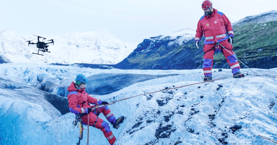
Drones equipped with thermal cameras can quickly scan large areas to locate missing persons, even in challenging environments like dense forests or at night.
Drones can deliver essential supplies such as water, food, and first aid kits to stranded or injured individuals in remote or inaccessible areas until rescue teams can reach them.
Drones can create real-time maps of areas where victims may be in need of help, providing search and rescue teams with up-to-date information to plan and execute their operations more effectively.
Drones can monitor natural disasters such as floods, landslides, and avalanches in real-time, helping search and rescue teams assess the situation and respond accordingly.
Drones can assess structural damage to buildings, bridges, and other infrastructure after natural disasters, helping search and rescue teams identify safe routes and areas to avoid.
Providing a bird’s-eye view of the rescue operation, drones can help coordinate the efforts of different teams on the ground and ensure their safety.
Drones can fly over rivers or the ocean to locate survivors in water, helping search and rescue teams to focus their efforts and save lives.
Drones can assist in mountain rescues by locating stranded or injured hikers, assessing their condition, and helping rescue teams plan their approach.
Public safety drones can quickly scan avalanche areas to locate buried victims, helping rescue teams focus their efforts and save valuable time.
Drones can monitor wildlife movements in affected areas, helping search and rescue teams avoid dangerous animals and ensure their safety.


