NEW COURSE
Mapping & Modeling for Drone Pilots
Use photogrammetry to create accurate 2D maps and 3D models, from mission plan to data capture and processing, for smarter, faster decision-making.
Price goes up July 15
“Excellent course that provides a deep-dive into the drone mapping discipline. Highly recommend!“
Kevin
Arizona
“I didn’t realize how much I didn’t know until I took this course. Awesome information, and a fantastic course. I’m inspired to get mapping.”
Kip
California
“Great training with very useful hands on exercises to help walk through mission planning, the mission, downloading and processing to create amazing deliverables.”
Matthew
Iowa

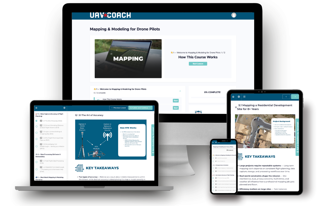
Practical, No-Fluff Lessons
Learn drone mapping through clear, real-world instruction designed to simplify complex concepts and help you confidently apply them in the field.

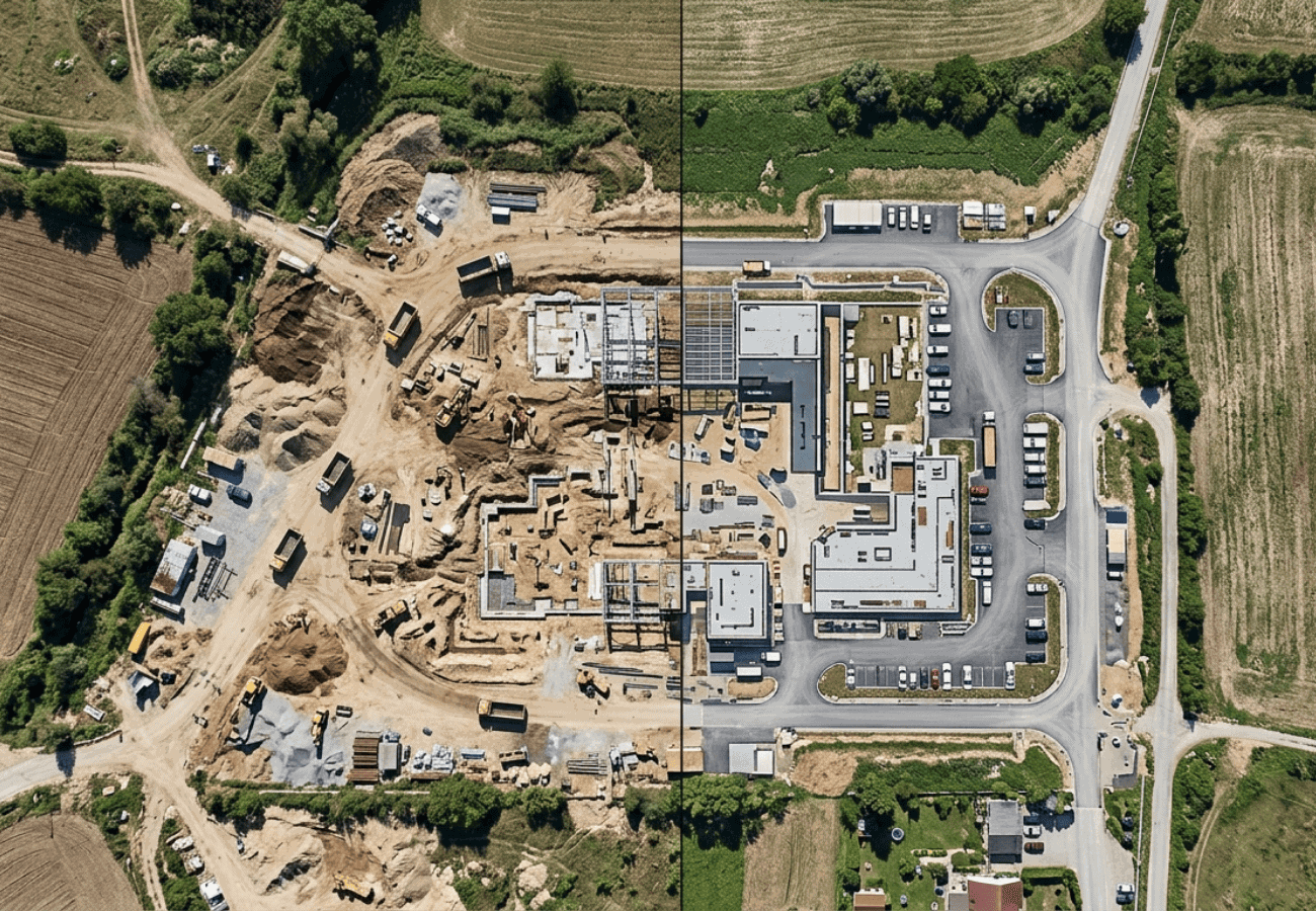
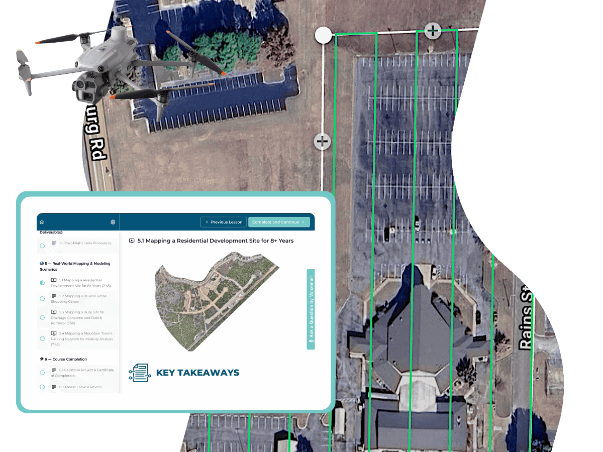
Real-World Mapping Workflows
Follow practical mapping scenarios — from construction sites to a mobility analysis project — to see how professionals plan, capture, and process mapping data.

Hardware & Software Recs
Learn about drone platforms, cameras, and mapping software options, from affordable beginner tools to more advanced professional workflows.

Learn with Real Mapping Data
Work with downloadable datasets and real project examples to better understand photogrammetry workflows and processing decisions.
Early bird pricing ends 7/15
What You’ll Learn
Which Industries Need Mapping & What They Look For
Explore industry use cases like construction progress and crop health & learn the outputs from orthomosaics to DSMs and beyond.
Mapping a
Project from Start
to Finish
Understand the full process from planning a flight to creating a finished map, broken down step-by-step in plain English.
How to Achieve
Data Accuracy &
Map Quality
Learn how RTK, PPK and GCPs improve positioning, nadir vs. oblique capture, and optimizing lighting, shutter type, and GSD.
Software Demos & Real Projects from Pilots in the Field
See real software demos and case studies from mapping professionals who help clients make decisions in multiple industries.
Build Confidence in Drone Mapping
- Understand the core concepts behind drone mapping and modeling without getting lost in technical jargon.
- Learn how flight altitude, overlap, camera settings, and lighting impact the quality of your maps and models.
- Build confidence planning mapping missions with practical workflows used on real-world projects.
- Learn how to capture cleaner, more accurate datasets using proven field techniques and flight patterns.
- Understand the tradeoffs between accuracy, flight time, image quality, and processing workflows.
- Follow real-world mapping scenarios — from construction sites to a mobility analysis projects — to see how professionals approach drone mapping in the field.
High Resolution Data for Smarter, Faster Decision-Making
- Orthomosaic Map
- Digital Surface Model
- Digital Terrain Model
- Normalized Difference Vegetation Index (NDVI) Map
- Point Cloud
- Textured Mesh Model
WHAT'S INCLUDED
- 11 video lessons covering everything from equipment to data processing
- Capstone project using image datasets from real-world projects
- Resource links & software recommendations for your workflow
- Dynamic lessons with English and Spanish subtitles, complete lesson text for each video, and key takeaways
Why Choose Us
1
One-on-one
Support
2
Money-back
guarantee
3
lifetime
access
Early bird pricing ends 7/15
Full Curriculum
Learn everything in 3 hours — with 11 step-by-step lessons you can watch anytime, anywhere.
Course Overview
1.1 How This Course Works
1.2 How to Contact Us
Photogrammetry Orientation
2.1 Drone Mapping vs. Modeling
What is Photogrammetry?
2D and 3D Outputs
Visual Layer: Creating an Orthomosaic
Elevation Layer: Mapping the Terrain
Analytic Layer: Plant Health (NDVI)
Point Cloud Data
3D Textured Mesh Model
2.2 Drone Platforms & Equipment Costs
Prosumer Drones
Electronic vs. Mechanical Camera Shutters
Purpose-Built Mapping Drones
Advanced Mapping Platforms
Positioning & Accuracy Equipment
LiDAR: A Separate Mapping Technology
Data Capture (Accuracy & Flight Planning)
3.1 The Art of Accuracy
Relative vs. Absolute Accuracy
Survey-Grade Data
Real-Time Kinematic (RTK)
Post-Processed Kinematic (PPK)
Ground Control Points (GCPs)
3.2 Ground Sampling Distance (GSD) & Flight Patterns
Ground Sampling Distance (GSD)
Flight Altitude, Sensor Resolution & Focal
Length
Drone Flight Patterns
Nadir and Oblique Capture
2D Grid, Crosshatch & Perimeter
Data Capture (Accuracy & Flight Planning)
3.3 Light, Camera Settings & Image Quality
Best Light Conditions
Setting Shutter Speed
Shutter Types & Why It Matters
Lens Choice
3.4 Pre-Flight Planning & Data Capture
Client Communication & Site Research
Airspace Research & Mission Planning
Programming Your Autonomous Flight
Pre-Flight Checks & On-Site Setup
Data Capture: Running the Mission
Data Processing (Software & Deliverables)
4.1 Post-Flight Data Processing
Photogrammetry Software Options
Choosing the Software For the Job
Processing the Data
Quality Control
Real-World Mapping & Modeling Scenarios
5.1 Mapping a Residential Development Site for 8+ Years
5.2 Mapping a 10-Acre Retail Shopping Center
5.3 Mapping a Busy Site for Drainage Concerns and Debris Removal
5.4 Mapping a Mountain Town’s Parking Network for Mobility Analysis
Course Completion
6.1 Capstone Project & Certificate of Completion
Your Drone Mapping Course Instructor
Alan Perlman
Founder, UAV Coach
This course is taught by UAV Coach founder Alan Perlman. Alan started UAV Coach in 2014 with a focus on drone education and safety. For 3 years, he taught hands-on drone flight training classes while growing our program to 40 flight instructors nationwide. Alan is also the course instructor for Drone Pilot Ground School, our industry-leading Part 107 exam prep course that has trained 85,000+ people to pass the FAA knowledge test to obtain a Remote Pilot Certificate. Alan has a BA from Washington University in St. Louis. In his free time, he plays with his kids and dog and is always planning his next outdoor adventure.
Frequently Asked Questions
ABOUT THE COURSE
PAYING FOR THE COURSE
CUSTOMER SUPPORT