

Drone News Roundup: Formula 1 Racing by Drone, Police Disarm Suspect with a Drone, and More!
BY Zacc Dukowitz
30 June 2026This week we’re covering high-speed drone footage of Formula 1 cars in action.
We’re also covering police using a drone to disarm a knife-wielding suspect, thermal drones helping firefighters locate hidden hot spots, BRINC’s new real-time mapping partnership, and how Flytrex and Wing are safely sharing the skies for drone deliveries.
Now let’s get to those links!
Super Fast FPV Drones Are Transforming How We Watch Formula 1
View this post on Instagram
Formula 1 recently shared this high-octane drone footage, with the drone keeping pace with the race cars even at really high speeds. Following the cars through tight corners and high-speed straightaways, the FPV perspective gives you an up-close feeling you couldn’t capture any other way. The footage was captured by Red Bull’s custom-built FPV drone, made with the Dutch Drone Gods specifically to keep pace with Formula 1 cars at full speed. It took over a year to develop the drone, which can accelerate to 186 mph (300 km/h) in four seconds and reach speeds of more than 217 mph (350 km/h)—fast enough to chase an F1 car around the track.
LEARN MORE
Police Drone Helps Disarm Knife-Wielding Suspect

Officers in Sacramento recently used a DJI Avata 2 to disarm a suspect holding a knife, who was hiding inside a garage. After the suspect lost consciousness, deputies attached a magnet to the drone and flew it inside the garage, lifting the knife out of the suspect’s hand. Officers then used a police robot and K-9 unit to safely take the man into custody. According to the Sacramento County Sheriff’s Office, it’s the first time a drone has been used to disarm a suspect during a SWAT operation.
LEARN MORE
Thermal Drone Helps Firefighters Find Hidden Hot Spots

Firefighters responding to an apartment fire in Clarkson, New York recently used a thermal drone to locate hot spots that weren’t visible to the naked eye. After the main fire had been put out, the drone’s thermal camera helped crews identify lingering pockets of heat so they could fully extinguish them before they reignited. Instead of guessing where heat might still be hiding, crews could go directly to those remaining hot spots and put them out, reducing the chances of the fire flaring back up.
LEARN MORE
BRINC Partners with Nova to Deliver Real-Time Emergency Mapping
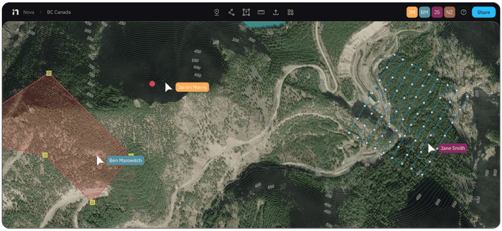
Credit: BRINC
BRINC has announced a new partnership with Nova Software Company that will bring real-time aerial mapping to public safety agencies. The integration allows imagery from BRINC drones to be processed and shared with incident commanders in real time, as an emergency is still unfolding. These aerial maps can help first responders visualize scenes, coordinate resources, and make decisions more quickly. For agencies already using drones during emergencies, the partnership could help responders make faster, more informed decisions when every minute counts.
LEARN MORE
Wing and Flytrex Demonstrate How Delivery Drones Can Share Airspace
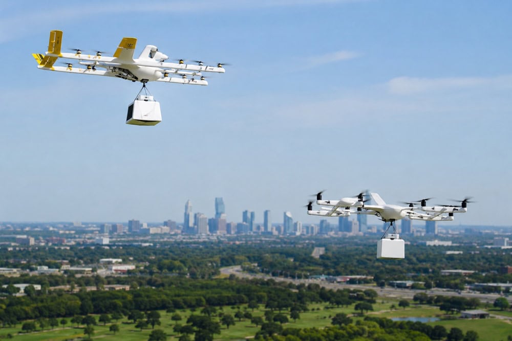
Concept illustration (not an actual photo)
Wing and Flytrex have completed the first demonstration of two independent drone delivery companies safely operating in the same airspace using a unified traffic management system. The milestone took place in the Dallas-Fort Worth area, where both companies are expanding commercial delivery operations. As drone delivery expands, more companies will need to share the same low-altitude airspace without creating conflicts or requiring each operator to manage traffic independently. This demonstration shows how competing drone delivery networks could safely share the skies—an important step toward making large-scale drone delivery practical in the U.S.
LEARN MORE
Make sure to sign up for our free weekly newsletter using the button below so you can get our weekly newsletter every Saturday, with this roundup and our other featured stories from the week.


