

How Are Skydio Drones Being Used in the Field?
BY Zacc Dukowitz
9 February 2022Skydio launched the Skydio 2+ last month at CES 2022, announcing that it will be discontinuing the Skydio 2 and shifting to making only the 2+ going forward.
[Use code UAVCOACH to get $50 off the Skydio 2+]
The two big upgrades on the Skydio 2+ are:
- It has a longer battery life—27 minutes of flight vs. 24 with the Skydio 2.
- It has a longer range—1.9 miles with the Skydio 2+ Beacon Controller and 3.7 miles with the twin-stick Skydio Controller vs. 1 mile and 2.2 miles respectively with the Skydio 2.

Along with the Skydio 2+, Skydio released KeyFrame, a new mode that allows you to program an autonomous flight path by selecting the key shots (or keyframes) you want to capture.
In the drone industry, Skydio has become famous for its autonomous technology. Three years ago, when the company released a video of the first Skydio drone flying autonomously through the woods shooting a woman doing parkour, the technology seemed so futuristic that it was almost hard to believe.
To this day, many experienced videographers say that one of their favorite aspects of Skydio’s drones is their ability to track subjects while moving through space and avoiding obstacles—all autonomously, of course.
The only drawback has been that subject tracking was limited to people.
If you wanted to pick a specific Point of Interest (POI) and circle around it, as you can with other consumer drones, this wasn’t possible. But KeyFrame helps with this issue by allowing you to select specific locations along a flight path—the “key frames” in your video—to ensure that they’re all captured.
Want to buy a Skydio 2+? Use code UAVCOACH to get $50 off—visit the Skydio website now to learn more.
So How Are Skydio Drones Being Used in the Field?
Between KeyFrame and Skydio’s 3D Scan software, Skydio can support both aerial cinematography work, like real estate videography and heavy duty industrial work, like inspections and site surveys.
Defense

Credit: Skydio
Skydio just won a massive contract with the U.S. Army to provide drones that soldiers will use for reconnaissance, search, rescue, and security patrol capabilities.
The contract is worth $100 million over five years, with a little more than $20 million committed annually to buy Skydio X2D units for the Army’s Short-Range Reconnaissance Program (SRR).
Mining
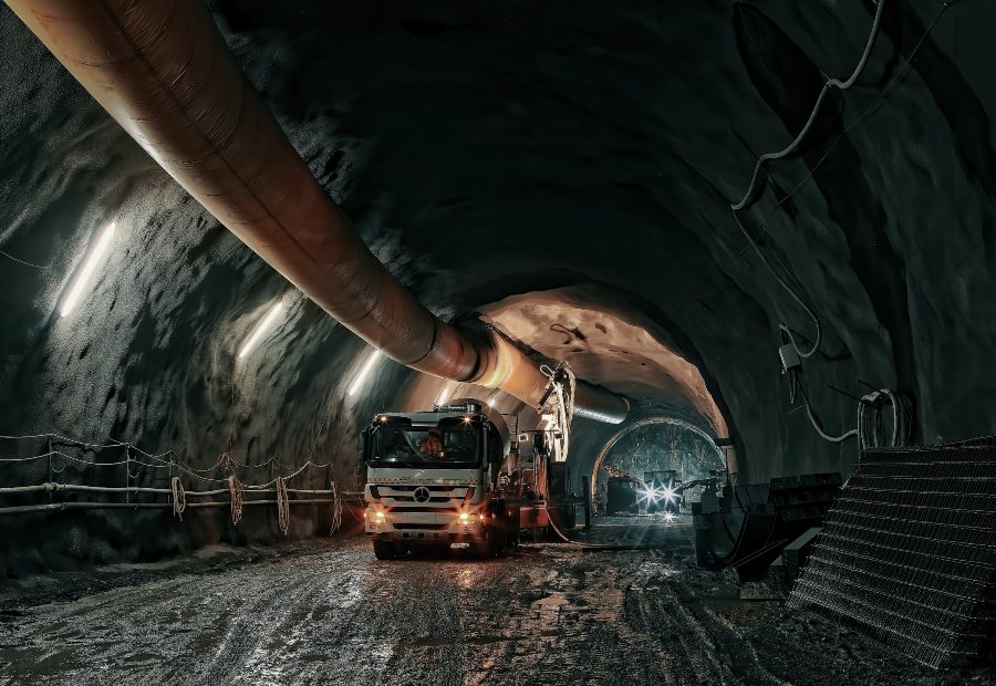
Mining operations are using Skydio’s drones to fly missions inside large excavations in mines, called stopes (these are the big holes from which ore is extracted).
Using 3D Scan, drone pilots can autonomously collect all the data they need inside areas within a mine to create a digital twin, which can then be used to better understand the conditions inside the area.
Public Safety
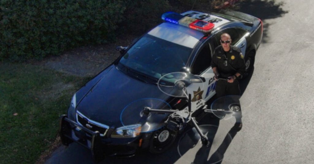
Credit: Skydio
Skydio’s drones can give those working in law enforcement or search and rescue a quick way to get an aerial view, without the need to have an expert pilot on hand. Because it’s small and can fly where most drones can’t, such as below tree cover, it provides a unique platform for this kind of work.
Also, through its partnership with Axon—known as the makers of the taser—Skydio offers a huge suite of software made just for law enforcement, which is slated to be fully integrated with the Skydio platform.
Railway Inspections
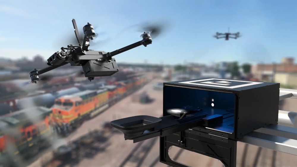
Credit: Skydio
Last year, BNSF Railway secured a first-of-its-kind waiver to fly BVLOS (Beyond Visual Line of Sight) using Skydio drones stationed in docks in remote areas where it operates.
The waiver will be used to monitor the railway’s infrastructure without the need for a pilot to be physically present during flights, and the docking stations allow the entire operation to be remote, since the drones can land, charge, and redeploy without the need for human intervention.
Real Estate
KeyFrame is a useful mode for a variety of drone videography work, but it could be most useful for real estate marketing. Watch the video above to see an example real estate marketing video shot with a Skydio drone flying autonomously using KeyFrame.
Of course, this list of use cases isn’t at all exhaustive.
3D Scan can be used to produce digital twins for inspections in a variety of other industries and scenarios, and the autonomous flight capabilities have all kinds of use cases in shooting extreme sports or live action cinematography—not to mention the potential for remote asset monitoring that could follow the BNSF Railway model for assets like power lines, oil pipelines, and other critical infrastructure.
Learn More about How to Fly Your Skydio Drone
Want to learn more about how to fly your Skydio drone? Check out these video tutorials:


Want to buy a Skydio 2+? Use code UAVCOACH to get $50 off—visit the Skydio website now to learn more.


