

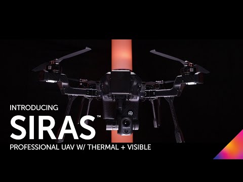
Teledyne FLIR Launches the SIRAS, a Commercial Drone with a Dual Thermal/Visual Payload that’s Cheaper than the M300
BY Zacc Dukowitz
13 September 2022Last week, FLIR launched a rugged commercial drone called the SIRAS that comes with a dual thermal and visual camera.
The new drone comes with an interchangeable payload, potentially allowing people from different types of industries to attach the specific sensor they need to it for their work. The primary use cases for the SIRAS are in public safety and industrial and utilities inspections.
FLIR has been involved in the drone industry for years as a provider of thermal imaging cameras. And Teledyne FLIR’s Ion M440 drone is already on the Blue UAS list, positioning the company well for the launch of a more generally approachable commercial platform like the SIRAS.
A Matrice 300 RTK Killer?
Speaking of approachability, the SIRAS sells for $9,695. While that’s certainly not cheap, it’s still $4,000 less than the Matrice 300 RTK, which sells for $13,700.
The Matrice 300 RTK is one of the go-to platforms for public safety work, as well as several other professional drone applications—including inspections. And the SIRAS is well poised to take a chunk of that market, not just because of its price, but also because of where and who is making it.

Credit: Teledyne FLIR
Teledyne FLIR is an American company, and the SIRAS’ “final payload integration and quality control are completed in the U.S.”
Although the drone is manufactured in Taiwan by a company called Coretronic Intelligent Robotics Corporation (CIRC), its association with a trusted U.S. company and the fact that part of the finishing process for the drone happens in the U.S. will be appealing to many government entities, including law enforcement.
An additional appeal of the SIRAS for public safety is its data security features.
Data security is a concern for government entities when it comes to using drones, and the SIRAS was made with this in mind. For enhanced security, the drone stores images and video on an onboard microSD card and doesn’t come with cloud connection capability.
A further security measure with the SIRAS is that pilots aren’t required to create an online profile to use it. Teledyne FLIR says that doing this increases “ease of use and [reduces] potential unintended online data access.”

Credit: Teledyne FLIR
Specs and Features for the SIRAS
Here are the main specs for Teledyne FLIR’s new drone:
- Speed. Max speed of 59 feet/second (40 mph) and default ground speed of 4 feet/second (13.4 mph).
- Flight time. 31 minutes.
- Front collision avoidance. A front facing radar senses obstacles at up to 98 feet away when flying at less than 16.4 feet/second.
- Lights for night flying. Lights have red and white on/off & blink options.
The SIRAS also comes with useful features for a commercial drone like return to home, foldable props, hot swappable batteries, and no restrictive geofencing.
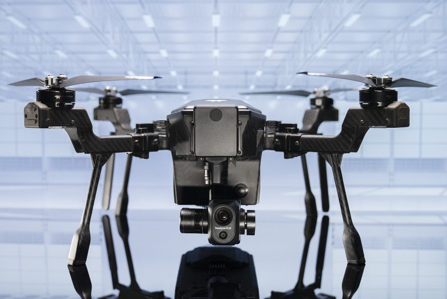
Dual Thermal/Visual Payload
The SIRAS’ dual camera system is worth highlighting on its own, since it’s one of the standout features of the drone.

Credit: Teledyne FLIR
The payload is called a Vue TV128, and it allows you to add visible-light outlines to thermal imagery.
The thermal camera that comes on the Vue TV128 is a radiometric FLIR Boson that captures sharp thermal imagery at 640×512-pixels and has 5x digital zoom, allowing for accurate temperature measurements. A 16MP visual camera also comes with the payload. The camera has 128x zoom, allowing you to capture clear images from a distance for cell tower inspections, or in other scenarios where you need to get clear imagery without flying too close.
Toughness Features
The SIRAS was clearly made for operations in rugged environments—here are some features that help make it ready to fly in harsh conditions:
- Temperatures. Can withstand temperatures of 10 °F-104 °F.
- Wind resistance. Can withstand winds of up to 6.8 feet/second (22.4 mph).
- Ingress protection. Rated at IP54.
Targeted Industries for the SIRAS
What are some of the target use cases for the SIRAS?
As we mentioned above, they fall into two categories—public safety and inspections. We’ll cover the most common in each below.
Credit: Teledyne FLIR
Public Safety

Credit: Teledyne FLIR
Firefighting
The combination of thermal and visual aerial imagery has a number of helpful uses in firefighting scenarios, allowing firefighters to improve their situational awareness for making quick decisions on the ground. Spot temperature checks can identify smoldering fires that aren’t visible to the naked eye, and thermal data can help find those in need of rescuing that may not be visible from the ground.
Search & Rescue
Thermal imagery can be incredibly helpful for those working in search and rescue, allowing a disoriented or lost person to be found in minutes instead of hours, or even days.
Using a thermal drone, you can cover a large area and see through intervening foliage, identifying the location of a person’s heat signature so they can be rescued in a timely manner.
Inspections
Credit: FLIR
Commercial Roofing
Thermal drones can capture important insights for roof inspections, since the drone can provide a unique vantage point for collecting thermal data. Using thermal drone data to guide them, a contractor can limit their inspections on a roof to spots already identified as problem areas in the thermal data.
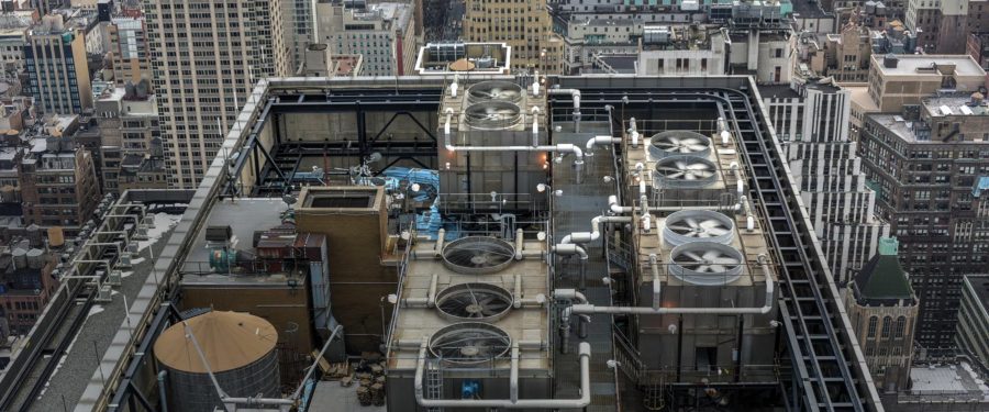
Utility Inspections and Monitoring
Aerial thermal imagery can help inspectors catch potential energy leaks before they get worse, helping improve the maintenance process by providing inspectors and maintenance personnel with quick, actionable data.
Solar Inspections
Solar inspectors who work manually, collecting data with handheld sensors, can take hours to get all the data needed and must often work in hot conditions outside while doing so. Using a drone equipped with a thermal camera, they can get all the data they need a lot more quickly by finding the locations of potential problems within a solar array from the air.


