
-
FREE RESOURCES
Drone flying & skills
Drone careers & jobs
Drone industry applications

- SCHOOLS
- NEWS
- (888) 626-1490
- Course Login
- SUBSCRIBE
Note: Fly safely and responsibly, folks. Never flown before? Learn to fly for free over here or sign up for an in-person drone flight training over here. Need to get your FAA commercial drone certificate? Start studying over here.
A commercial UAV pilot is only as good as the equipment they use.
No amount of skill can overcome poor camera quality or an unstable drone.
So today, I’m going to show you the top professional drones that serious commercial pilots should consider.
The Best Professional Drones: Our Top Picks
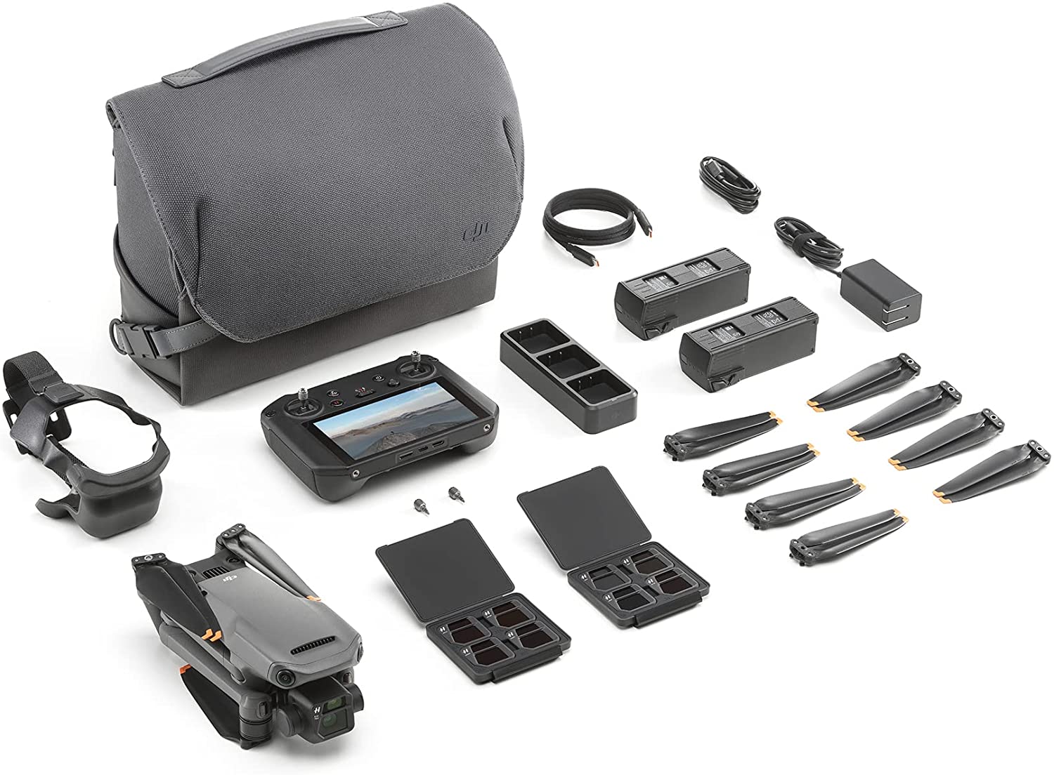
Filmmaking DJI Mavic 3 CINE (Premium Combo) Camera | 20 MP, 5.1K/50fps Flight Time | 46 Minutes Camera | 20 MP, 5.1K/50fps Flight Time | 46 Minutes |
Mapping-Firefighting-Search & Rescue-Inspection-Night Ops  DJI Mavic 3 Enterprise Camera | 20 MP, 4/3 CMOS Flight Time | 45 Minutes Camera | 20 MP, 4/3 CMOS Flight Time | 45 Minutes |
Filmmaking-Agriculture-Delivery  Freefly Alta X Camera | Compatible with various cinema cameras Flight Time | Varies with payload Camera | Compatible with various cinema cameras Flight Time | Varies with payload |
Indoor Inspections  Flyabilty Elios 3 Camera | 12 MP Flight Time | 12 Minutes Camera | 12 MP Flight Time | 12 Minutes |
Agriculture 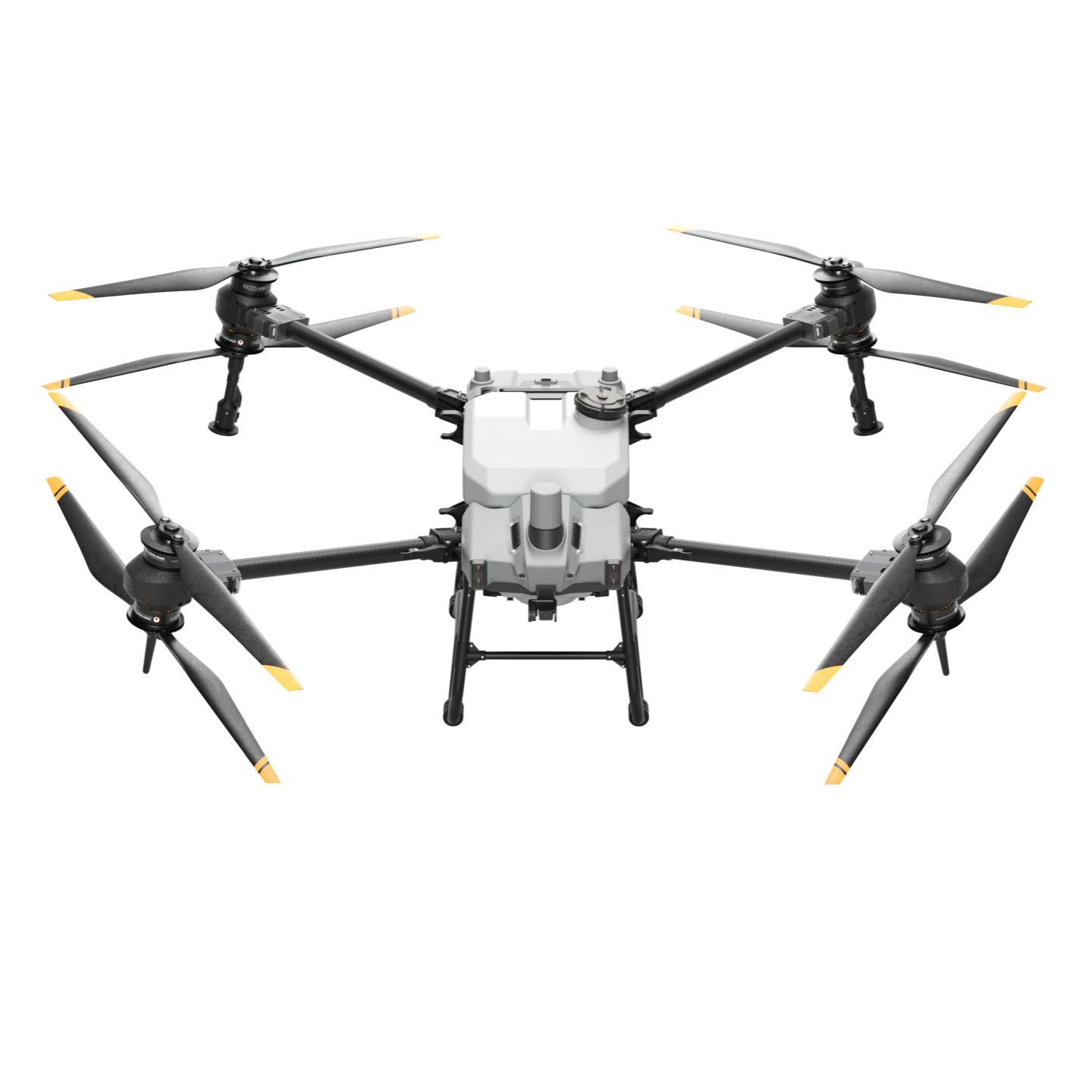 DJI Agras T40 Flight Time | 2 Hours Flight Time | 2 Hours |
Surveying & GIS  senseFly eBeeX Camera | Compatible with various sensors Flight Time | 90 Minutes Camera | Compatible with various sensors Flight Time | 90 Minutes |
Construction-Inspection-Public Safety 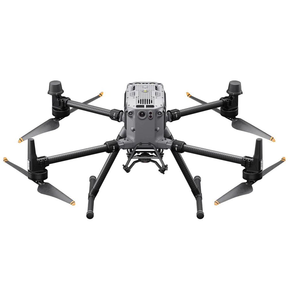 DJI Matrice 350 RTK Camera | Compatible with various Zenmuse sensors Flight Time | 55 Minutes Camera | Compatible with various Zenmuse sensors Flight Time | 55 Minutes |
Inspections-Emergency 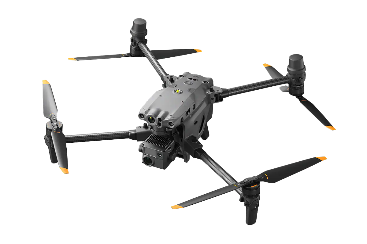 DJI Matrice 30 Series Camera | 12 MP wide + 48 MP zoom (‑M30T adds thermal) Flight Time | 41 Minutes Camera | 12 MP wide + 48 MP zoom (‑M30T adds thermal) Flight Time | 41 Minutes |
Filmmaking  DJI Inspire 3 Camera | 35mm full-frame CMOS Flight Time | 28 Minutes Camera | 35mm full-frame CMOS Flight Time | 28 Minutes |
Inspections-Firefighting-Law Enforcement-Search and Rescue 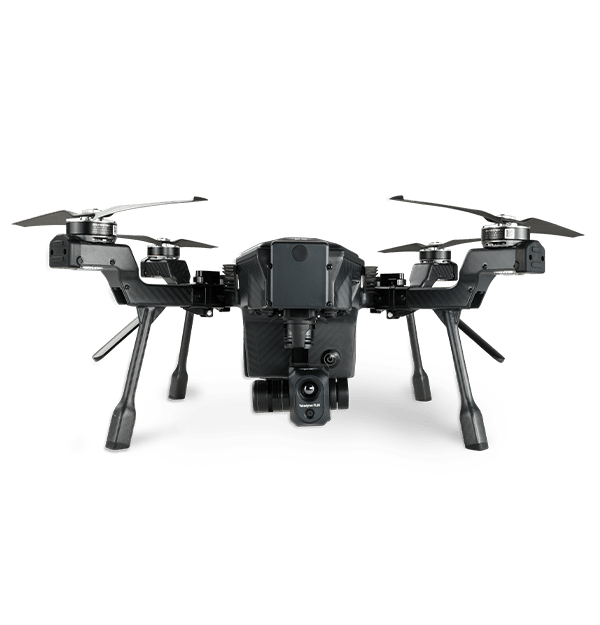 Teledyne FLIR SIRAS Camera | 16MP with 128x zoom Flight Time |Minutes31 Minutes Camera | 16MP with 128x zoom Flight Time | 31 Minutes |
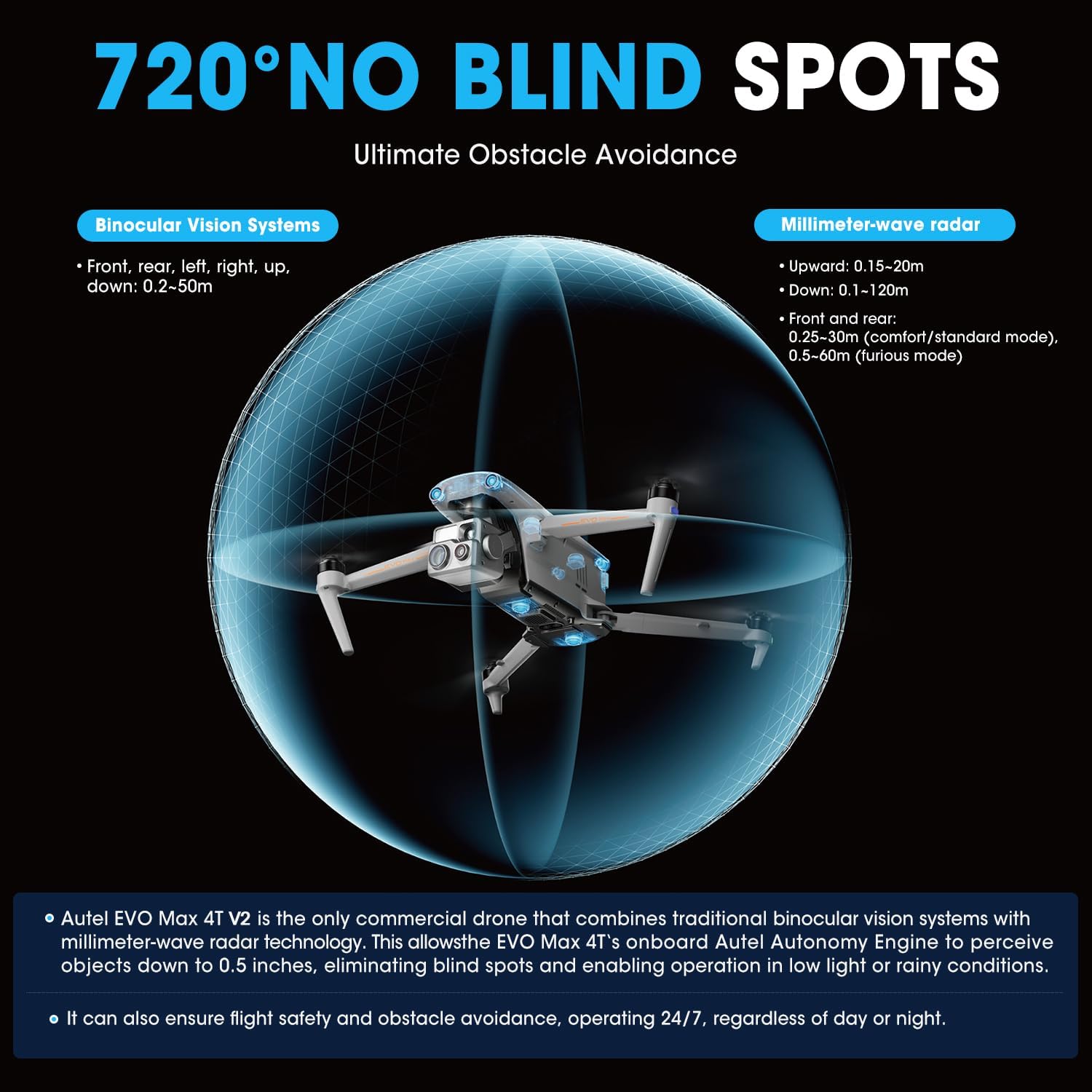
Public Safety-Surveying-Inspections 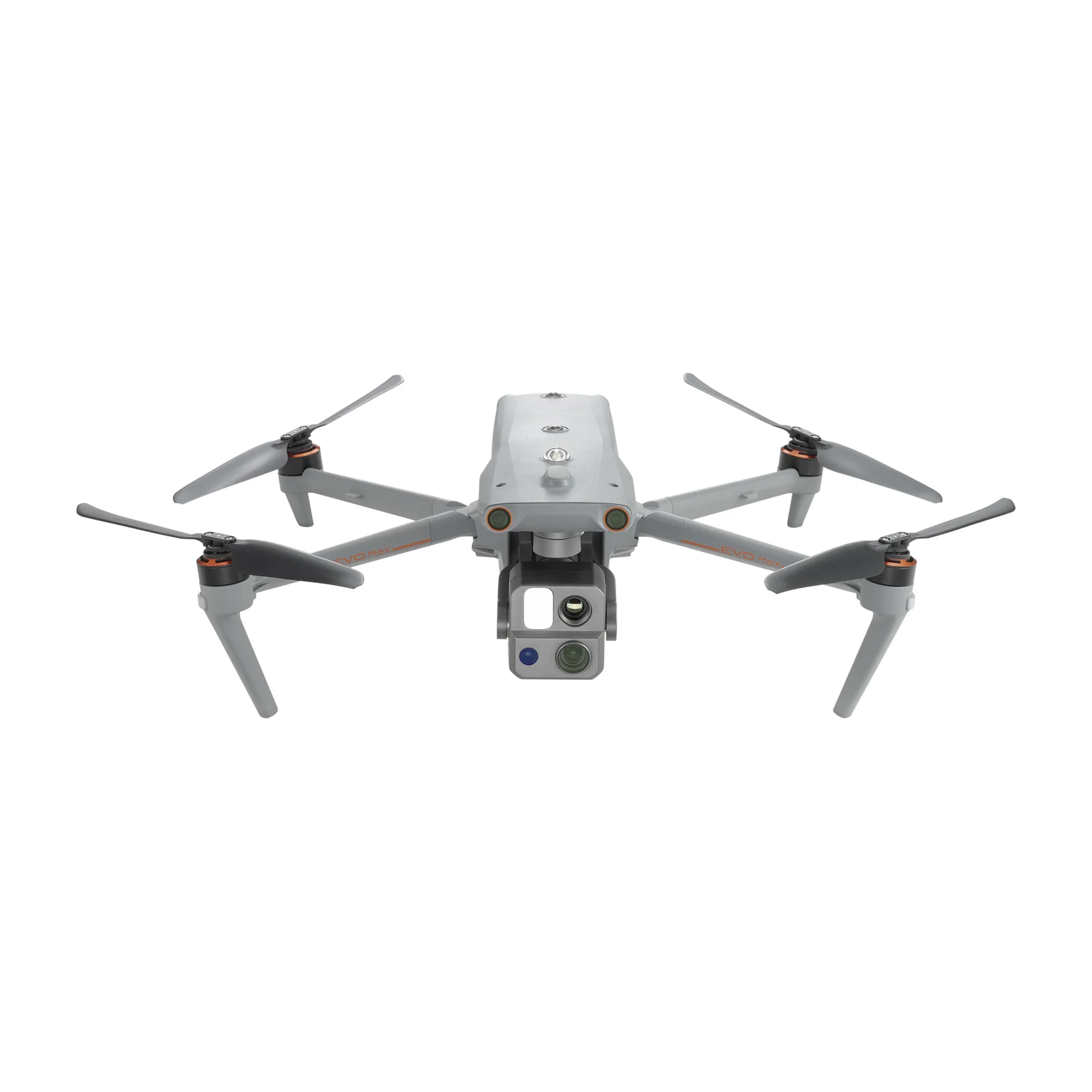 Autel Evo Max 4T V2 Camera | Integrated Wide, Zoom, and Thermal cameras with a Laser Rangefinder sensor Flight Time | 42 Minutes Camera | Integrated Wide, Zoom, and Thermal cameras with a Laser Rangefinder sensor Flight Time | 42 Minutes |
Firefighting-Inspection-Search and Rescue  Matrice 30T Camera | 1/2" CMOS, Effective pixels: 48M Flight Time | 41 Minutes Camera | 1/2" CMOS, Effective pixels: 48M Flight Time | 41 Minutes |
Firefighting-Inspection-Search and Rescue 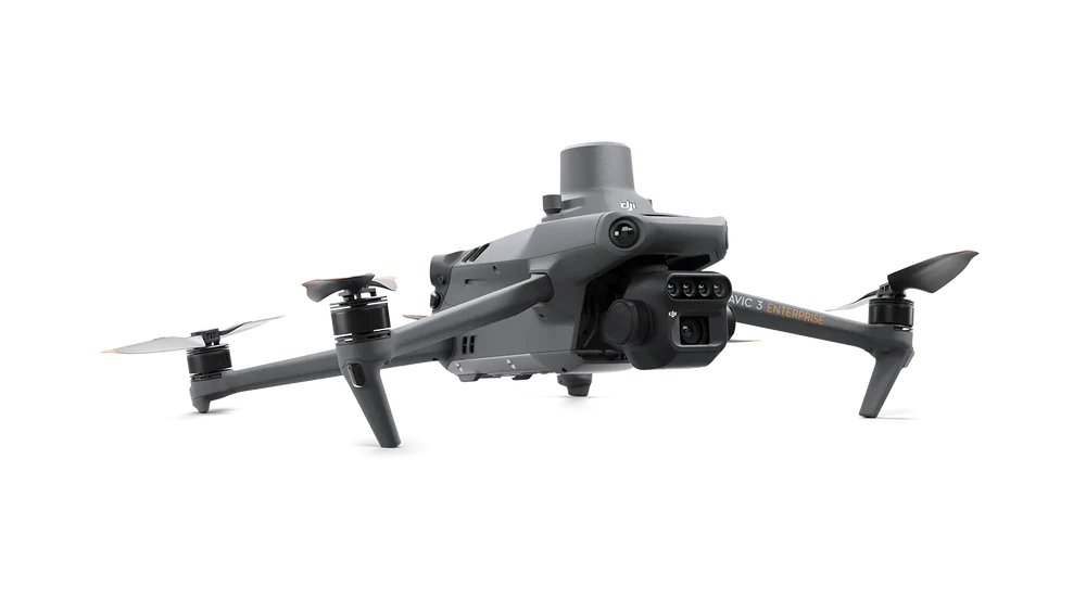 DJI Mavic 3M Camera | Multispectral Flight Time | 43 Minutes Camera | Multispectral Flight Time | 43 Minutes |
Public Safety-Energy-Utilities  Skydio X10 Camera | VT300-Z & VT300-L Flight Time | 40 Minutes Camera | VT300-Z & VT300-L Flight Time | 40 Minutes |
Enterprise Inspection-Surveying-Security & Monitoring  ACSL SOTEN Camera | 1″ standard (20 MP) with hot‑swappable payloads Flight Time | 25 Minutes Camera | 1″ standard (20 MP) with hot‑swappable payloads Flight Time | 25 Minutes |
There are many options out there, so it can be easy to get bogged down. The multirotors we’ve chosen were manufactured by some of the best, most reliable drone brands, they have excellent online support (forums, blogs), and they provide the quality you need to do your best work.
Here’s the full list in case you don’t feel like scrolling down and want to open some tabs to compare:
Let’s get started!
Note #1: Trying to get your Part 107 certificate? Click here to see our Drone Pilot Ground School coupon codes.
Note #2: All specs/features are obtained from the manufacturer or retailer.
Note #3: On this list, we’ve included models available for sale on Amazon and DJI — as Amazon and DJI, Skydio, and Autel Associate partners, we earn a small commission for qualifying purchases. Please know that we’ve tested many of the models on this list, and we wouldn’t recommend anything we wouldn’t fly ourselves!

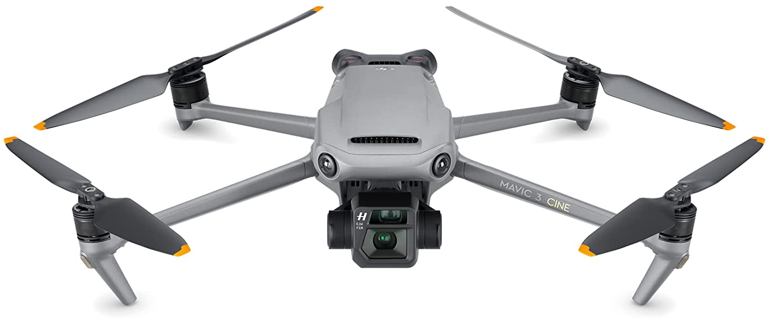
20 MP, 5.1K/50fps

46 Minutes

Filmmaking
The Mavic 3 CINE is DJI’s latest creation that pushes the boundaries of what a foldable drone can achieve. It builds on everything that made the Mavic 2 Pro successful, but the CINE version is unlike any Mavic drone before it. The dual-camera system features a Hasselblad 4/3” sensor and a ½” Tele camera sensor that has 28x hybrid zoom.
With up to 46 minutes of flight time, you will not have to worry about having enough battery life to get that picture-perfect shot. Speaking of its imagery capabilities, The Hasselblad sensor provides a 12.8-stop dynamic range that retains more details in highlights and shadows, upgrading your work to a professional level. Drone pilots will also enjoy the built-in Apple ProRes 422 HQ encoding and 1 TB SSD for a super smooth professional workflow.
The Mavic 3 CINE premium combo includes:
This drone is Standard Remote ID Compliant. Review Declaration of Compliance here.
See our review of the Mavic 3 CINE here.
4/3 CMOS, Effective pixels: 20 MP
45 Minutes
Mapping, Firefighting, Search & Rescue, Inspection, Night Ops
The DJI Mavic 3 Enterprise Series redefines industry standards for small commercial drones. With a mechanical shutter, a 56× zoom camera, and an RTK module for centimeter-level precision, the Mavic 3E brings mapping and mission efficiency to new heights. A thermal version is available for firefighting, search and rescue, inspection, and night operations.
The Mavic 3 Enterprise can be carried in one hand and deployed at a moment’s notice. There are two different models in this series: Enterprise and Thermal. The thermal camera has 640 x 512 resolution and supports point and area temperature measurement, high temperature alerts, color palettes and isotherms to help you find your targets and make quick decisions.
The DJI Mavic 3 Enterprise and the DJI Mavic 3T (Thermal) are both Standard Remote ID Compliant.

Filmmaking, Agriculture, Delivery
The FreeFly Alta X drone is a quad-rotor configuration designed for professional and industrial partners. It is truly an engineering marvel with the ability to carry up to a 35-pound payload. Foldable carbon fiber propeller arms, propellers, and Freefly’s quick-release gimbal system ensure simple set-up and increased portability.
Flying a large drone does not need to be complicated, fly with ease with Freefly’s PX4 flight controller. No matter how you use the Alta X, the drone is engineered for easy transport and quick deployment. The propellers and arms fold to cut its physical size by half, and with just a push of your finger, you can expand the drone to full size. When expanded, the linkages stiffen the booms to help ensure accurate, low-vibration flight.

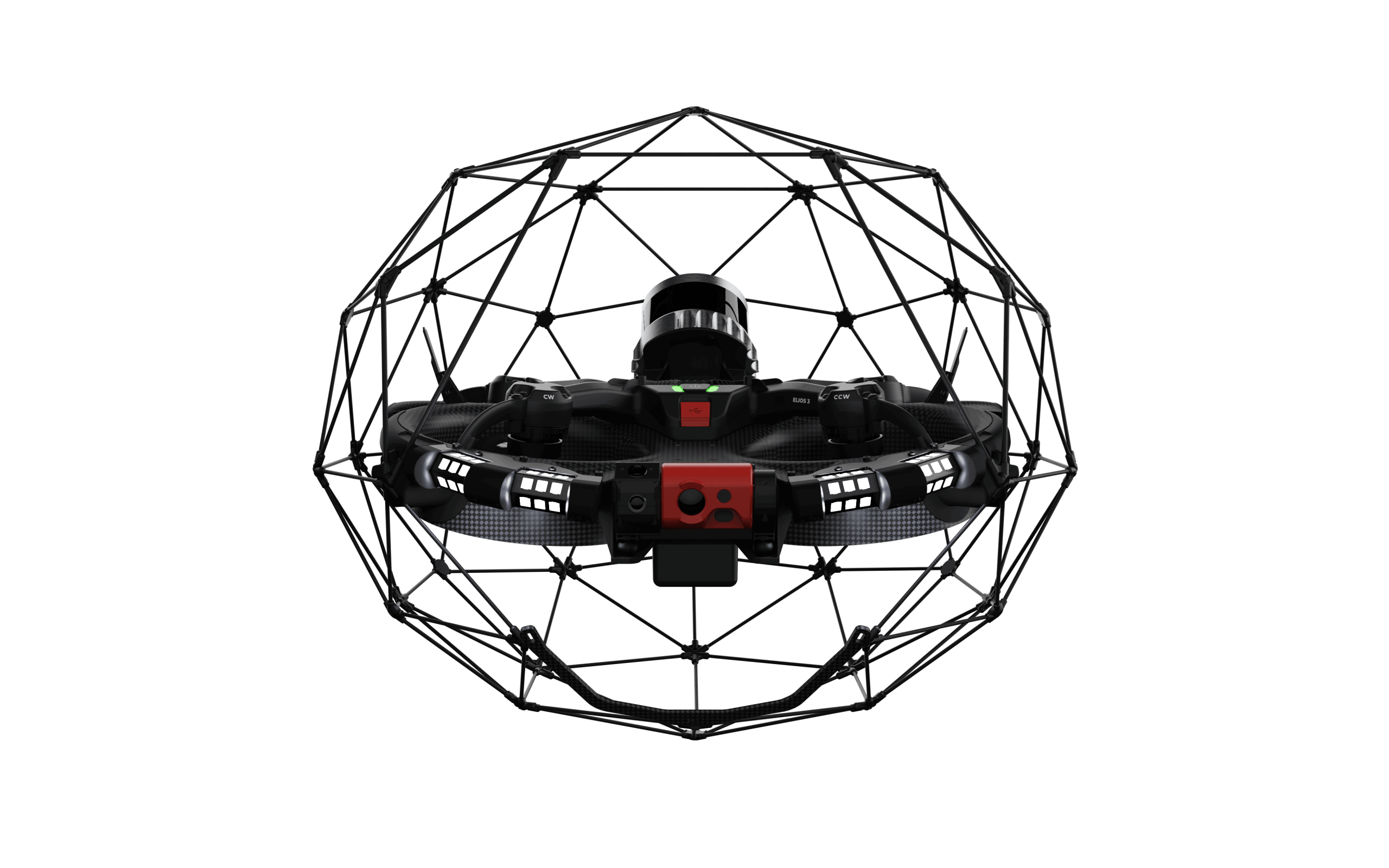
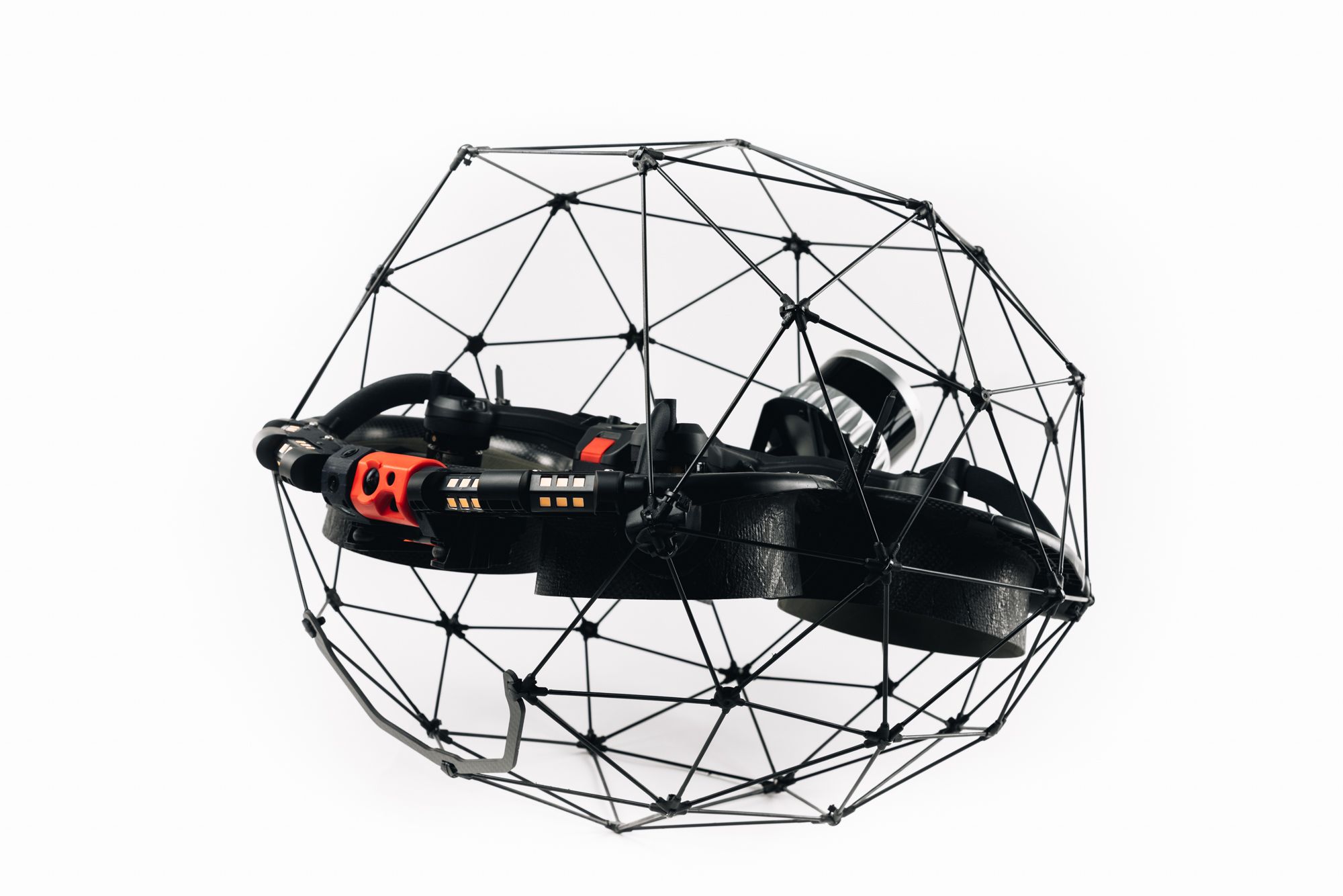
12 MP
10 Minutes
Indoor Inspections
Flyability pioneered confined space inspection drones with its first product in 2016. With the launch of the Elios 3, it continues its pledge to create cutting edge technology designed to keep humans out of dangerous places to perform the most demanding inspection tasks.
The Elios 3 was made to address the need companies have for reliable inspection tools. As industries around the world scale up their use of drones, they need technology that is easy to use, performs the same way every time, and remains stable when working inside highly sensitive assets.
The Elios 3 comes with an Ouster OS0-32 LiDAR sensor, allowing inspectors to collect data for the creation of survey-grade 3D models using software from Flyability’s new partner, GeoSLAM. Mapping areas that are out of reach or too dangerous for humans is very difficult, yet critical to support operational decisions in many industries.
By combining the best of confined space drone data capture and 3D geospatial software technology, Flyability’s partnership with GeoSLAM enables professionals to produce survey-grade point clouds of the most inaccessible places in their workplace, completely removing the strain of approximations and guesswork from their operations. In addition to carrying a LiDAR sensor, the Elios 3 can accommodate a second payload that allows it to be customized for each individual user’s needs.
This drone is Standard Remote ID Compliant. Review Declaration of Compliance here.
2 hours
Agriculture
The DJI Agras T40 is equipped with the revolutionary Coaxial Twin Rotor design, enabling it to carry a spray load of 40 kg and a spread load of 50 kg (70 L). The aircraft is built in with a Dual Atomized Spraying System, DJI Terra, Active Phased array Radar and Binocular Vision. It supports multiple missions from surveying, mapping, to spraying and spreading, helping you achieve ultimate precision in your agricultural operations.
The Agras T40 features a coaxial twin rotor design that increases the payload capacity by 30% with a maximum payload of 50 kg. Its foldable design reduces the aircraft size by 70% for greater portability.
The new magnetic transmission design completely isolates the pesticide from the motor, making the aircraft corrosion-proof and ultra-durable. Quick disassembly by hand for easy cleaning.
The core components are designed to withstand complex and harsh farmland environments. They have passed a host of rigorous tests such as corrosion prevention, high and low temperature, and aging tests, to ensure peace of mind for the user.
By pairing AGRAS T40 with the Phantom 4 Multispectral, the platform allows you to perform variable spraying/spreading operations with precision based on the farmland’s prescription map. The feature is useful for the spraying of fertilizers on rice, fertilizers and defoliants on cotton crops, and nutrient solutions on soybeans and corn.
This drone is Standard Remote ID Compliant. Review Declaration of Compliance here.
*Flight times vary on the payload weight.

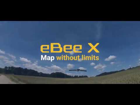
Compatible with various sensors
90 Minutes
Surveying & GIS
The senseFly eBeeX is a fixed-wing drone that is fully autonomous and is designed to capture high-resolution aerial images for mapping and 3D modeling. No piloting skills are needed for this drone, simply throw the drone and it will follow a pre-planned flight plan. Fixed-wing aircraft are ideal for large mapping jobs due to the efficient aerodynamic properties of this configuration. The eBee can cover 1200 acres within one planned flight, making it a very efficient option for aerial mapping.
It only weighs 1.7 lbs and can be equipped with seven interchangeable cameras and includes the senseFly eMotion software. Various optional accessories make the drone configurable for just about any mapping mission. The eMotion software is loaded with advanced flight control features and mapping parameters but is designed with a user-friendly interface that is great for beginners.
This drone is Standard Remote ID Compliant. Review Declaration of Compliance here.
See a comparison of other senseFly eBee drones here.
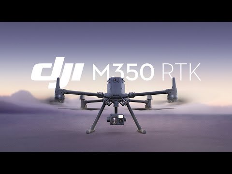
55 Minutes
Public Safety Inspections Construction
The DJI Matrice 350 RTK is DJI’s upgraded flagship enterprise drone that can be configured for a multitude of applications, including inspections, public safety, and surveying on construction sites. This next-generation drone platform features an all-new video transmission system and control experience, a more efficient battery system, and more comprehensive safety features, as well as robust payload and expansion capabilities. It is fully powered to inject innovative strength into any aerial operation.
The M350 RTK can carry up to six pounds and up to three different payloads at the same time. Need to change a payload or battery? Not a problem, with Hot-Swappable Batteries, the battery can be changed while still providing power without shutting down the drone. Automate routine inspections and capture consistent results every time. There are two many advanced features to list, but here are a few: AI Spot Check, Live Mission Recording, Pinpoint, and Dual Control.
This drone is Standard Remote ID Compliant. Review Declaration of Compliance here.
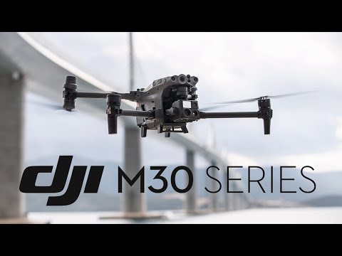
12 MP wide + 48 MP zoom (‑M30T adds thermal)
41 Minutes
Inspections, Emergency Response, Construction, Mapping, Public Safety
The DJI Matrice 30 Series is a rugged enterprise‑grade quadcopter built for demanding industry applications — from critical infrastructure inspection to public safety missions and beyond. Combining a multi‑sensor camera array with advanced flight performance, omnidirectional sensing, and robust weather resistance, it serves as a versatile backbone for enterprise operations. The twin wide and zoom payloads deliver professional‑quality aerial intelligence, while optional thermal variants (M30T) expand capabilities into inspection, search‑and‑rescue, and energy sector workflows.
This drone is Standard Remote ID Compliant. Review Declaration of Compliance here.
35mm full-frame CMOS
28 Minutes
Filmmakers
The DJI Inspire 3 offers unprecedented workflow efficiency, camera language, and creative freedom. This all-in-one 8K camera drone empowers professional-level filmmakers to fully maximize the potential of any shot and master the unseen. Inspire 3 is a professional camera drone that adopts a fluid new design that takes aerodynamics fully into consideration to reduce air resistance.
Both the front and the rear of Inspire 3 have a built-in stacked ceramic antenna, providing powerful anti-magnetic-interference capability to further improve flight accuracy and safety. Specially designed for aerial cinematography, Waypoint Pro enables flight-route and shot planning with a wide range of customized settings. With the new Repeatable Routes and 3D Dolly modes, an innovative automated shooting experience can be easily achieved. In addition, RTK centimeter-level positioning ensures more accurate flight-route planning and execution. Whether solo shooting or in a professional crew, use Waypoint Pro to master even highly-complex scenes.

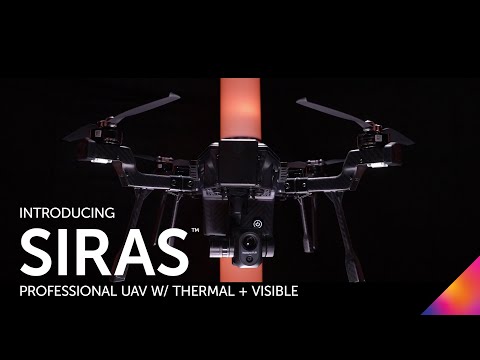
16MP with 128x zoom
31 Minutes
Inspections, Firefighting, Law Enforcement & Search and Rescue Operations
SIRAS is an affordable, easy-to-fly, IP54-rated professional drone with an interchangeable payload system for industrial and utilities inspection, firefighting, law enforcement, and search and rescue missions. With front collision avoidance, hot swappable batteries, a 31-minute flight time, and no restrictive geofencing, professional UAV pilots can fly safely when and where the mission demands.
The quick-connect Vue® TV128 payload features patented MSX® technology, adding visible-light outlines to thermal imagery to provide critical information in real time. The 16MP visible camera delivers clear, pinpoint details with a 128x zoom. A 640×512-pixel, radiometric FLIR Boson® provides sharp thermal imagery, 5x digital zoom, accurate temperature-measurement, and compatibility with FLIR Thermal Studio™ analysis software.
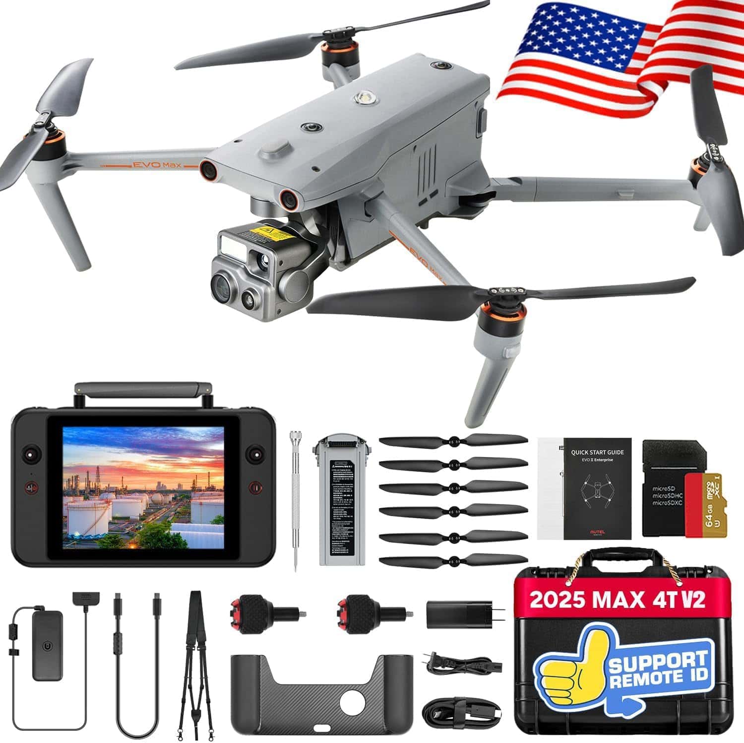
Wide + zoom + thermal integrated payload
42 Minutes
Inspection, Public Safety, Energy & Utilities, Emergency Response, Surveying
The Autel EVO Max 4T V2 is a high‑performance enterprise UAV designed for advanced commercial missions — from detailed infrastructure inspection to public safety, emergency response, and complex survey work. Combining a multi‑sensor Fusion payload (wide, zoom, and thermal cameras) with long flight time, extended transmission range, and robust environmental sensing, this platform delivers actionable aerial intelligence in challenging real‑world conditions. Its advanced autonomy helps safely navigate complex environments and gather precise visual and thermal data in one flight.
This drone is Standard Remote ID Compliant. Review Declaration of Compliance here.
1/2" CMOS, Effective pixels: 48M
41 min
Firefighting Inspection Search and Rescue
The DJI Matrice 30 Series is a safe and reliable drone for commercial drone pilots. The Matrice 30 has a powerful flight performance and can easily handle adverse weather and temperatures ranging from -20° C~50° C. With sual-vision and ToF sensors on all six sides of the aircraft, it will keep your mission safe. The built-in ADS-B receiver provides timely warnings of any incoming crewed aircraft nearby.
The M30 Series integrates wide, zoom, and thermal cameras (M30T only) with a laser rangefinder, which together can capture the aerial data you need, when you need it. It also has superior image quality including; night flight, smart low-light photo, RGB, infrared, and laser rangefinder.
The M30 Series also offers a DJI Dock option. DJI Docks are rugged, reliable, and are built to operate 24/7,
day or night, rain or shine. Each DJI Dock houses a Matrice 30 where it lands, recharges, takes off, and executes missions programmed in DJI FlightHub 2.
The DJI Matrice 30 and Dock Version are both Standard Remote ID Compliant.
DJI Enterprise - Introducing the DJI M30 Series
Multispectral
43 minutes
Mapping Surveying Agriculture
Effective aerial surveying needs to see the invisible. That’s why Mavic 3 Multispectral has two forms of sight. It combines an RGB camera with a multispectral camera to scan and analyze crop growth with total clarity. Agricultural production management requires precision and data, and Mavic 3M delivers both.
Mavic 3M with RTK module for centimeter-level positioning. Flight control, the camera, and the RTK module sync in microseconds to accurately capture the location of each camera’s imaging center. This enables Mavic 3M to do high-precision aerial surveying without using ground control points.
Introducing DJI Mavic 3 Multispectral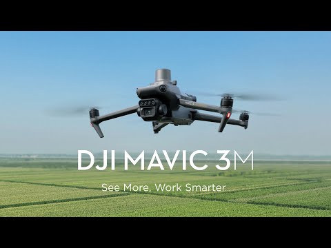
VT300-Z & VT300-L
40 min
Public Safety Energy Utilities
Packing more megapixels and better optics than any drone its size, Skydio X10 boasts high resolution visual and radiometric cameras in modular sensor packages. So you can capture the right details for your job. With the powerful sensors, you can see impressive details that are unlike any other. For example, you can detect a .1 mm crack in concrete under a bridge in low light. You can also read a license plate from 800 feet.
Skydio X10 is the first drone ever to integrate a FLIR Boson+ sensor, delivering the highest quality thermal imaging. Capable of resolutions of 640 x 512 px and offering increased sensitivity down to <=30 mK, the X10 delivers more accurate radiometric readings, anytime, any place.
Navigate the most complex missions confidently, even in GPS-denied or high EMI environments. With superior AI flight assistance and obstacle avoidance, you no longer need to hire a specialist to get the job done, whether you’re in the field with your drone, or piloting from a hundred miles away.
Complete targeted inspections automatically, with a new Spatial AI Engine that senses and understands what you’re scanning. Efficiently build 2D maps and 3D models onboard, in real time. Or export data to Pix4D, Bentley iTwin Capture, DroneDeploy, or ESRI SiteScan.
Skydio Delivers a Breakthrough for Enterprise Drones with the Launch of Skydio X10
1″ standard (20 MP) with hot‑swappable payloads
25 Minutes
Enterprise Inspection, Surveying, Security & Monitoring
| View Pricing |
The ACSL SOTEN is a secure, modular enterprise drone engineered for mission‑critical operations where data integrity, scalability, and flexibility matter most. Made in Japan with a swappable sensor architecture — including RGB, thermal, multispectral, and optical zoom payloads — SOTEN adapts quickly to different workflows without landing. Built‑in encryption, LTE BVLOS support, and robust obstacle avoidance make it ideal for inspection, surveying, and public safety tasks across industrial and urban environments.
This drone is Standard Remote ID Compliant. Review Declaration of Compliance here.
ACSL SOTEN Drones Arrive in the US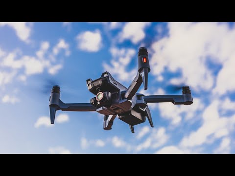


