

How Does Parrot’s ANAFI USA Stack Up Against the Competition?
BY Zacc Dukowitz
9 July 2020Parrot’s ANAFI USA is a tough new drone that comes with thermal imaging, high quality zoom power, and can be flown in harsh weather.
Although Parrot is based in France, its new drone is manufactured in the U.S., as indicated by its name, and has the same “high-end security, durability and imaging capabilities as Parrot’s Short-Range Reconnaissance (SRR) drone designed for the U.S. Army.”
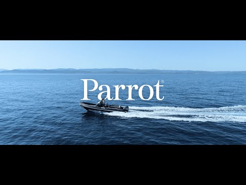
As you can see in the video, the ANAFI USA has a small, foldable airframe that makes it highly portable.
Despite its small size it’s made for rugged work—Parrot uses the word “ruggedized” to describe some of its features—and can fly in the rain, which is a first for any Parrot drone.
Here are some of the key specs and features for the ANAFI USA:
- Flight time—32 minutes
- Visual camera—4K HDR / 21 MP camera with 32X zoom
- Thermal camera—FLIR BOSON thermal sensor
- GPS-less environments—works indoors without GPS
- Made for harsh conditions—protected from dust and rain, with an impressive IP53 qualification
- Ease of use—can launch from the palm of the hand, making it easy to fly
A Drone for Public Safety and Inspections
Watching Parrot’s promo video (shown above), it’s clear the ANAFI USA has a few target sectors:
- Public safety. Law enforcement and search & rescue are featured, and the drone clearly has fire fighting potential as well.
- Inspections. Solar panels and power line inspections are featured, probably to highlight the drone’s thermal imaging, but it could also be used in several other inspection scenarios, including indoor inspections, since it can fly without GPS.
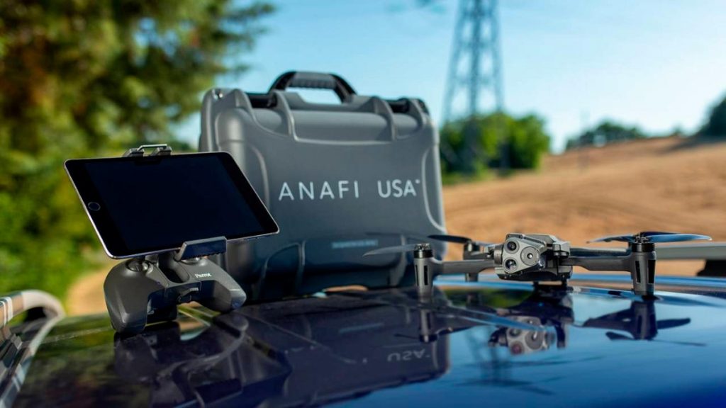
Photo credit: Parrot
Public Safety
The drone industry fight for the public safety sector has intensified recently, with DJI releasing its Matrice 300, public safety-devoted Impossible Aerospace announcing the launch of Air Support, and Skydio ramping up its public safety work.
The ANAFI USA will be a strong contender in this space, with the following features to support public safety applications:
- Rapid deployment. In 55 seconds, you can unfold, turn on, establish a secure radio link, and take off with the ANAFI USA.
- Flying in harsh conditions. Public safety work can’t wait for good weather, especially when it comes to fighting fires or finding lost people in search and rescue scenarios. The ANAFI USA has weatherproofing with some water resistance and excellent dust resistance, as reflected by its Ingress Protection rating (the USA is rated IP53), making it a good option for dusty conditions.
- No fly zone limitations. The ANAFI USA has no built-in limitations for no-fly zones, which “gives first responders the freedom to fly responsibly at a moment’s notice and wherever their missions may take them.”
- Lightweight and portable. The ANAFI USA weighs just 1.1 lbs (500 grams) and can fold up into a small, portable size.
- Long flight time. A 32-minute flight time will help first responders who need to stay in the air until the job is done.
- Thermal and visual sensors. The thermal camera has obvious fire fighting applications, and can also be helpful for search & rescue and law enforcement.

Photo credit: Parrot
Inspections
- Indoor flying. The ANAFI USA can be flown without GPS, allowing operators to fly indoors for inspections.
Stabilized imaging. ANAFI USA’s stabilized imaging ensures high-quality footage, even at 15 m/s wind conditions. - Thermal imaging. For solar panel inspections and other inspection scenarios, the ability to view thermal data will allow energy leaks and other heat-related concerns to be easily detected.
- High power zooming. 32X zoom allows inspectors to capture high quality visual data of an asset, even at a distance.
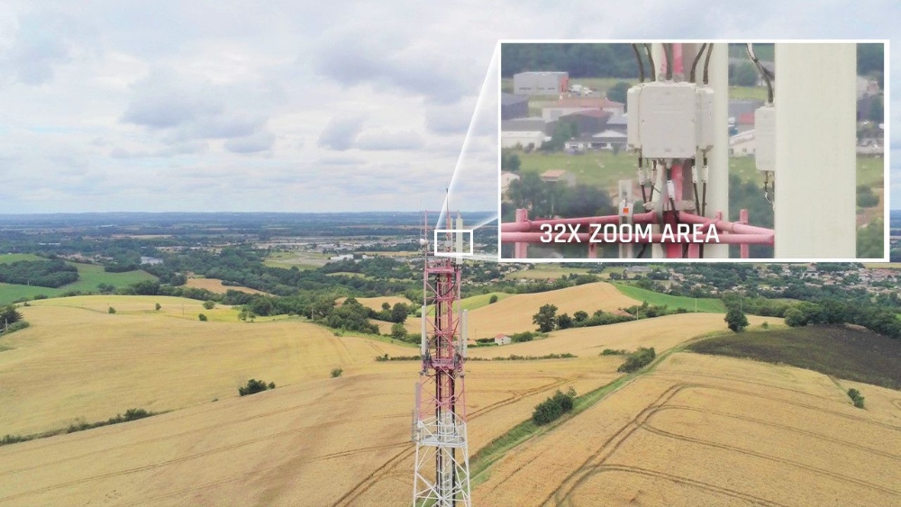
Photo credit: Parrot
How the ANAFI USA Stacks Up
Given all the buzz about drones for public safety, we wanted to see how the ANAFI stacks up against some of the most popular public safety drones out there.
Here’s a chart comparing specs and features:
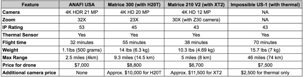
Notes on payloads:
- We’ve paired the M300 with the Zenmuse H20T. Pricing is not yet public for the H20T so we have included an approximate price based on the information we could find.
- We’ve paired the M200 V2 with the Zenmuse XT2, which has both a visual and thermal sensor and costs about $11,500.
- If you wanted to pair the M200 V2 with the Zenmuse Z30 to enable enhanced zooming for inspection applications the cost would be around $2,500 (but you would only have a visual sensor).
- The Impossible 1 starts at $7,500 with no payload. Adding a thermal camera pushes the cost up to $10,000 but that still doesn’t include a visual camera (as indicated in the chart). We were not able to find a price for the Impossible 1 with both visual and thermal sensors.
Comparing these features reveals some interesting strengths and disparities between some of the top public safety agency drones on the market.
Some standout features of the ANAFI USA are that it has a great IP rating for dusty conditions (IP53), though it’s small size might make it harder to fly in harsh weather. It also has the highest zoom power of all these options, even beating out DJI’s Zenmuse Z30, which was created just for inspections (and which, we should point out, you’d have to buy in addition to the M200 V2).
The ANAFI USA also comes out ahead on price. When you look at the additional payload costs that come with the other drones, the fact that the USA comes with a visual and thermal sensor gives it a distinct pricing advantage.
[Related read: American Drone Companies: A Master List]
But when it comes to battery life and range, the Impossible 1 is a clear standout. With a record-breaking flight time and the ability to fly more than 18 times farther than the ANAFI USA, the Impossible 1 is a powerful option for scenarios that call for long, extended flights.
That being said, both Matrice models stand out for their long flight times as well—especially the M300—and for the flexibility they offer regarding payloads, since you have multiple Zenmuse camera options for each one.
Parrot’s Play to Leverage U.S. Distrust of Chinese Drones
The name of Parrot’s new drone makes it clear the company is trying to leverage mistrust of Chinese-made drones to gain market share among U.S. public safety agencies.
Manufactured in the U.S., ANAFI USA offers the same high-end security, durability and imaging capabilities as Parrot’s Short-Range Reconnaissance (SRR) drone designed for the U.S. Army.
This is a smart play.
It looks likely that the American Security Drone Act (ASDA) will pass within the next year, and its impending passage has some public safety agencies wondering what they’ll do, given that the vast majority of them rely on DJI drones.
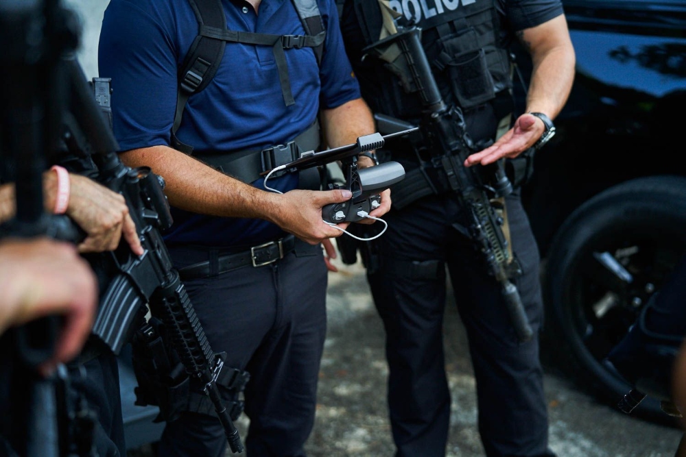
Photo credit: Parrot
However, the ASDA will not require public safety agencies to get rid of their drones—in fact, it only pertains to drone use at the federal level. It will require federal grants given to public safety agencies to be used only for non-Chinese drones and drone components, but this stipulation only goes into effect two years after the act’s passage.
How do you think the ANAFI USA stacks up? Chime in on this thread in the UAV Coach community forum to share your thoughts.


