

Drone Mapping Helps Indigenous People Impacted by Climate Change in Panama Find a New Home
BY Zacc Dukowitz
14 July 2021In Panama, the Guna people have been facing a rapid loss of their land due to rising waters caused by climate change.
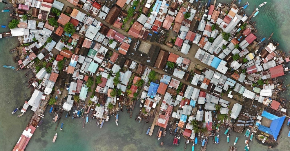
Photo credit: Panama Flying Labs
For many of the Guna, relocation is now the only option.
To help with relocation planning, Panama Flying Labs used Pix4D’s Pix4Dmapper software to map possible relocation targets so the Guna could better understand their options and make informed decisions about where they wanted their future homes to be located.
How Drone Mapping Helped the Guna People
The Guna are an indigenous people who live on a series of islands off the Panamanian coast.
Currently, they are impacted by two interconnected issues:
- Rising sea levels caused by climate change is rapidly eating up their land
- Overpopulation has grown significantly as land becomes more scarce, leading to a housing crisis
To address the situation, Panama Flying Labs partnered with leaders in the Guna community on the island of Gardi Sugdub, where a majority of the Guna people live.
The goal of the project was to understand what could be done to ease the housing crisis by surveying the land already in use on Gardi Sugdub, as well as surveying uninhabited land that could potentially be used for relocation on the Panamanian mainland.
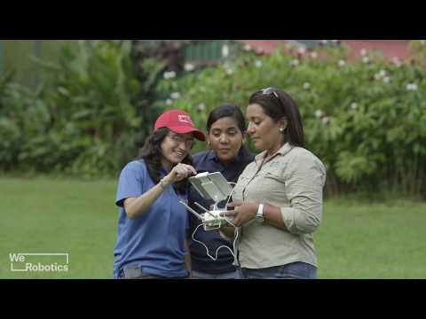
Drone pilots from Panama Flying Labs flew over the island collecting visual data, which was then used to create detailed orthomosaic maps.
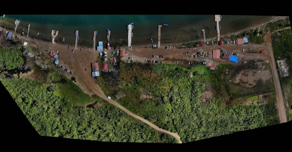
Photo credit: Panama Flying Labs
Two big challenges for the mapping effort were the remote location of the island and the weather.
To get to the areas that needed to be mapped, drone pilots and supporting team members traveled from Panama City across rural mountain roads to the coast. From there, they traveled by boat to Gardi Sugdub.
Given the length of the journey, they carried the minimum amount of gear possible—just a single DJI Mavic Air, an iPad Mini 4, and a few changes of clothes.
Once on the island, the team faced several challenges due to the weather, since they were trying to conduct these flights during the rainy season.
And it wasn’t just the rain that made flying hard. When it wasn’t raining, the heat was so intense that the drone had to be placed inside a car under air conditioning to cool it down before it could be used again, and this process had to be repeated several times throughout the day.
But the pilots were ultimately able to complete the mission and get all the visual data they needed.
After collecting the data, the Panama Flying Labs team used it to generate 2D orthomosaic maps in Pix4Dmapper of both the island and of uninhabited parts of the mainland. These maps were then shared with the Guna people to help them make an informed decision about what should be done next to alleviate their housing crisis.
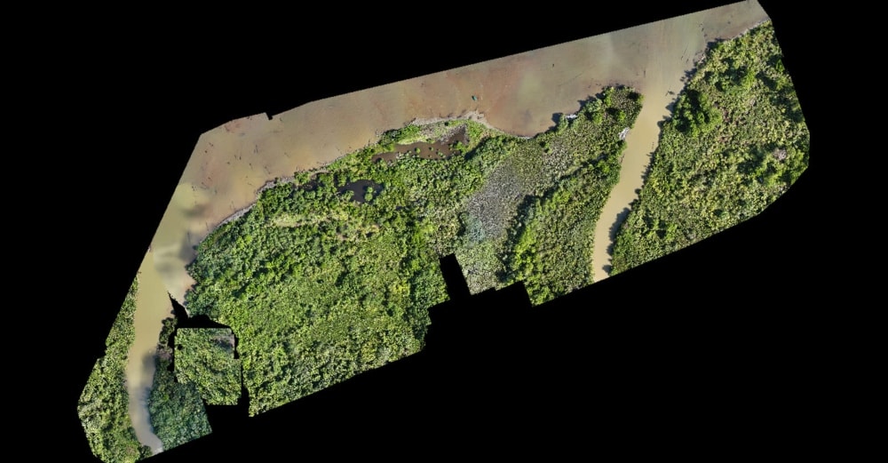
Photo credit: Panama Flying Labs
A Collaborative Effort
Whenever an indigenous people is facing relocation, the specter of history looms.
Perhaps the worst example is the Trail of Tears, in which approximately 60,000 Native American people were forcibly moved west over a period of twenty years, from 1830 to 1850.
To avoid dictating to the Guna people, the Inter-American Development Bank—the organization that launched the surveying project to assist the Guna with relocation—made sure to include Guna community leaders, giving them a voice in how the drone surveying was done and the relocation planning done with the results of the surveys.
These community leaders came from the Gardi Sugdub Committee, a Guna governmental body that helps both to make decisions and to relay them back to the Guna population.
When the drone pilots from Panama Flying Labs came to Gardi Sugdub to collect aerial data, Guna locals helped guide them through the area, pointing out landmarks and assisting in navigation through the remote terrain both by land and sea.
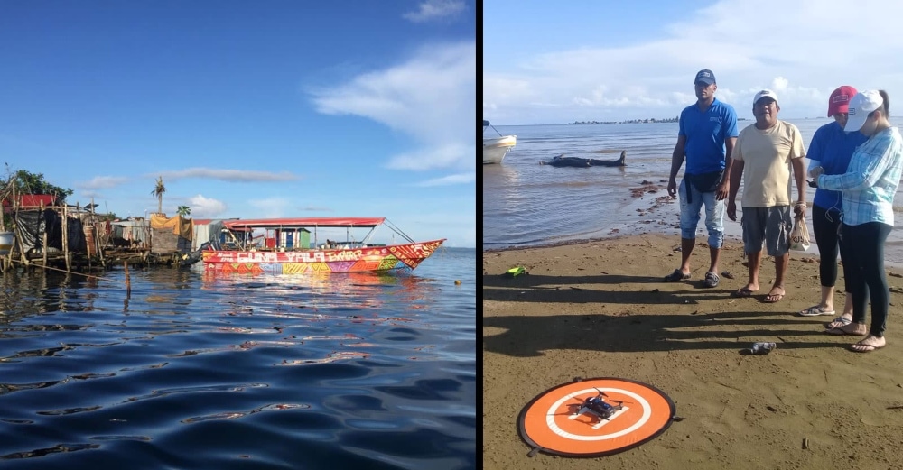
Photo credit: Panama Flying Labs
After Panama Flying Labs had collected all of its aerial imagery and used it to create orthomosaics, it set up two workshops to share the findings with the Guna.
Orthomosaics are easy to understand, since they are essentially a large image comprised of several photos stitched together. But they’re also a powerful surveying and planning tool, since they contain accurate distance data that can be used to create estimations of how much space there might be in an area for building—a crucial detail for the Guna relocation effort.
About Panama Flying Labs
Panama Flying Labs is a branch of Flying Labs, a non-profit with chapters around the world that offers training and assistance to people on how to use drones and drone data for various purposes.
The organization is hosted by the Universidad Tecnológica de Panamá in Panama City. It has a core team of five people that work at the university, as well as a large network for volunteers that help in various capacities.
These volunteers and core members offer training and support throughout the country to help people understand how to use drones and drone data.
The Guna project is one of several that Panama Flying Labs has worked on that analyzes the impact of climate change, providing aerial data to help formulate solutions to the problems created by rising sea levels, dwindling land, and the increase in number and strength of storms associated with the phenomenon.


