Drone Pilot Files Lawsuit Against North Carolina Board of Surveyors After It Threatens Him with Jail Time, Fines for Taking Aerial Photos

BY Zacc Dukowitz
31 March 2021

Should commercial drone pilots obtain a surveyor’s license to sell aerial photos and videos of a piece of property?

This question is at the heart of a lawsuit recently filed in North Carolina. And the outcome could have big implications about the future of commercial drone operations not just there, but throughout the U.S.

The trouble started in late 2018, when commercial drone pilot Michael Jones received a letter from North Carolina’s Board of Examiners for Engineers and Surveyors.

nc-drones-michael-jones-lawsuit
A picture of Jones taken while flying his DJI Phantom

The letter warned him that the commercial drone work he did was illegal because it constituted surveying without a license. The Board demanded that he stop immediately.

Jones had been careful to say on his website and in other marketing materials that his aerial shots did not establish property lines and couldn’t be used for legal surveying needs because he was not a licensed surveyor.

Despite these precautions, an investigator from the state Board claimed that he would be liable for criminal and civil prosecution if he didn’t stop selling aerial shots of properties.

According to the investigator, taking any of these actions without a surveyor’s license was illegal:

  • Providing stitched together images of a property (i.e., orthomosaics)—even if you didn’t take the pictures, just stitching them together using orthomosaic software could get you in trouble, according to the Board investigator
  • Providing images of a property that contained metadata (i.e., elevation, distance, or GPS coordinates)
  • Drawing approximations—even rough ones—of property lines on images

From Warning Letter to Lawsuit

Jones’ first reaction when he got the letter from the Board was to shut down his Goldsboro-based drone services business, 360 Virtual Drone Services.

It seemed clear to him that the Board was overreaching in an effort to protect surveyors from competition, but he was worried he might get in legal trouble, and didn’t want to risk fines or a costly battle in the courts.

And he wasn’t alone in taking these threats seriously.

At least half a dozen other drone service providers in North Carolina have received similar letters from the North Carolina Board of Examiners for Engineers and Surveyors, and closed shop or changed their offerings afterward.

But for Jones, the story didn’t stop with him closing his business. He eventually partnered with the Institute for Justice, and has now filed a lawsuit against the Board.

Drone Operator Threatened with Jail for Helping Local Businesses Make Maps

The lawsuit claims that the act of capturing videos and photos for informational purposes—including videos and photos taken by drone—is protected as a type of speech under the First Amendment of the U.S. constitution.

By trying to stop Jones from taking pictures and videos of places that he has express permission to document, the Board is using governmental power to control the collection and dissemination of information (i.e., speech). And this violates the First Amendment.

Drone technology may be new, but the principles at stake in Michael’s case are as old as the nation itself. Taking photos and providing information to willing clients isn’t ‘surveying’; it’s speech, and it’s protected by the First Amendment.

– Sam Gedge, Attorney with the Institute for Justice

Read the full complaint from Michael Jones and the Institute for Justice here.

Why Does this Lawsuit Matter?

At bottom, Jones’ case against the N.C. state Board has to do with whether governmental organizations can wield their power to resist change and prevent competition.

This is just the newest example of a licensing board expanding its authority to crack down on competition. But licensing boards should not be able to use their authority just to protect businesses from competition. The government should step out of the way and let innovative businesses like Michael’s continue serving their customers.

– James Knight, Attorney with the Institute for Justice

An interesting parallel to the surveyors’ plight can be seen in the work done for industrial inspections, where drone service providers may be hired to collect aerial data during inspections but they are not necessarily certified to perform the actual inspection.

In the inspection space, certification bodies like the American Petroleum Institute (API) haven’t moved to require drone pilots to get unique certifications before they can collect photos and videos for a given inspection, nor have they issued rules about whether the inspection camera used to collect visual data during an inspection can be controlled remotely or must be held by the inspector while in use.

Instead, API, ASME, and other inspection standards organizations have embraced the new technology, forming UAV task forces and working to provide helpful guidelines for the use of drones, instead of setting up hurdles to delay adoption.

If Jones wins his lawsuit, the outcome could send a clear message to other governmental bodies trying to use similar tactics to prevent competition.

But if the Board wins then a cascade of new requirements might be enacted in North Carolina, with drone service providers kneecapped in their ability to provide aerial photos.

Suddenly, people who want aerial shots for real estate marketing—or for agriculture, or conservation projects, to name just a few other types of aerial work that would be impacted—will have to hire a licensed surveyor. A licensed surveyor who also has a Part 107 certificate, that is.

Public safety use cases would also be impacted.

drones-accident-reconstruction
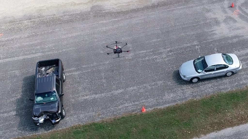
Photo credit: John Bullock and Erin Easterling/Purdue University

If the Board has its way, common public safety use cases like these would all now required a licensed surveyor:

  • A highway patrolman collecting aerial data for a crash scene investigation
  • A firefighter collecting aerial data for a 3D model to support an arson investigation
  • A police officer collecting aerial data to create an orthomosaic of a public place to use in the event of an active shooter scenario

What do you think the outcome will be for Jones’ lawsuit? Share your thoughts in this thread on the UAV Coach community forum.

Join a global community of

100,000+

drone enthusiasts.

Subscribe

Drone Pilot's Guide to DJI Mini 4 Pro

  • Navigate the DJI Fly app and flight modes with ease
  • Adjust camera and safety settings for better control
  • Understand intelligent flight features and how to use them
  • Avoid common beginner mistakes
  • Get the most out of your drone—without the guesswork

Drone Pilot's Guide to DJI Air 3S

  • Navigate the DJI Fly app and flight modes with ease
  • Adjust camera and safety settings for better control
  • Understand intelligent flight features and how to use them
  • Avoid common beginner mistakes
  • Get the most out of your drone—without the guesswork

Hands-On Flight Training

$295

400+ 5-Star Reviews

  • Team up with a knowledgeable, friendly instructor at a convenient outdoor spot — like a park or athletic field
  • Fly a top-rated drone provided for you, or bring your own to get personalized guidance
  • Spend most of your time in the air with hands-on practice — learning about composition, camera angles and cinematic motion
  • Explore the DJI Fly app and learn how to use camera settings like ISO, shutter speed and aperture
  • Unlock the power of Intelligent Flight Modes to fly smoother, smarter, and with less stress
  • Get access to our Aerial Photo & Video online course with additional exercises and pro-level editing workflows – using Snapseed, Photopea, Adobe Lightroom, DJI LightCut, and Premiere Pro

Aerial Photo & Video for Drone Pilots

$179

3,500+ 5-Star Reviews

  • How to dial in the right camera settings like ISO, shutter speed, and aperture
  • The best angles & altitudes for different types of shots (real estate, landscapes, cityscapes, and more)
  • The secret to cinematic drone motion that makes your footage feel like a Hollywood movie
  • How to enhance colors, remove distractions, and sharpen details – even in tricky lighting
  • Pro-level editing workflows – whether you’re using Lightroom, free tools, or mobile apps

The Recreational UAS Safety Test

Free

150+ 5-Star Reviews

  • Required for U.S. recreational flyers of drones
  • Launched June 2021 by the FAA
  • Takes about 30 minutes to complete
  • No prior drone knowledge needed
  • Test allows unlimited attempts to pass

Drone Mapping Essentials Workshop

$799

3,500+ 5-Star Reviews

  • Expert instruction from expert drone pilots with over 100 hours of flying experience
  • Hands-on training of live data capture and how to process deliverables for your clients
  • Peer-to-peer networking with other professional drone pilots in the mapping industry
  • Free access to the online course, Drone Mapping Essentials

Flight Skills for Drone Pilots

$99

75+ 5-Star Reviews

  • 16 engaging video lectures with key takeaways
  • Action items with concrete steps so you put into practice what you learn
  • Pre-flight checklists to help you plan your flights
  • Resource links to websites, products and software for further learning and discovery

Drone Business & Mapping Bundle

$617 $397

3,500+ 5-Star Reviews

  • Drone Pilot Ground School
    1. 1:1 support with a Part 107 exam success coach
    2. Study 100% online at your own pace
    3. Unlimited practice exams with 400+ real FAA test questions
  • Drone Mapping Essentials
    1. 100+ instructional videos focused on real-world application with high-quality videos
    2. Downloadable resources like data capture checklists to utilize in your missions
    3. Monthly live instruction with course instructor, Dylan Gorman, to go deeper on topics where you need more clarification
  • The Drone Business Blueprint
    1. Expert instruction from industry veteran, Eno Umoh, who brings real-world experience in building successful drone businesses.
    2. 14 Comprehensive modules covering everything from business setup to marketing strategies
    3. 30 Downloadable resources to apply your learning immediately

Hands-On Flight Training

$295

400+ 5-Star Reviews

  • 45-60 minutes of hands-on flying time to master orientation and flight maneuvers tailored to your skill level
  • Learn how to handle obstacles such as lost GPS, low battery charge or emergencies
  • Practice flying under various intelligent flight modes
  • Ask questions about regulations, software, flight operations management, and more

The Drone Business Blueprint

$119

3,500+ 5-Star Reviews

  • Expert instruction from industry veteran, Eno Umoh, who brings real-world experience in building successful drone businesses.
  • 14 Comprehensive modules covering everything from business setup to marketing strategies
  • 30 Downloadable resources to apply your learning immediately
  • AI tools and techniques to boost productivity and streamline your operations

Commercial Drone Business Bundle

$418 $334

4,000+ 5-Star Reviews

  • Drone Pilot Ground School
    1. 1:1 support with a Part 107 exam success coach
    2. Study 100% online at your own pace
    3. Unlimited practice exams with 400+ real FAA test questions
  • The Drone Business Blueprint
    1. Expert instruction from industry veteran, Eno Umoh, who brings real-world experience in building successful drone businesses.
    2. 14 Comprehensive modules covering everything from business setup to marketing strategies
    3. 30 Downloadable resources to apply your learning immediately

Drone Mapping Essentials

$199

3,500+ 5-Star Reviews

  • 100+ instructional videos focused on real-world application with high-quality videos
  • Downloadable resources like data capture checklists to utilize in your missions
  • Quizzes to test your knowledge so you can succeed in the field
  • Monthly live instruction with course instructor, Dylan Gorman, to go deeper on topics where you need more clarification

Drone Pilot Pro Bundle

$713 $499

3,500+ 5-Star Reviews

  • Drone Pilot Ground School
    1. 1:1 support with a Part 107 exam success coach
    2. Study 100% online at your own pace
    3. Unlimited practice exams with 400+ real FAA test questions
  • Drone Pilot Skill Builder
    1. 16 engaging video lectures with key takeaways
    2. Action items with concrete steps so you put into practice what you learn
  • Hands-On Flight Training
    1. 45-60 minutes of hands-on flying time to master orientation and flight maneuvers tailored to your skill level

Drone Pilot Ground School

$299

4,000+ 5-Star Reviews

  • 1:1 support with a Part 107 exam success coach
  • Study 100% online at your own pace
  • Unlimited practice exams with 400+ real FAA test questions
  • Personalized study plans, virtual flashcards, and 12-page cram sheet
  • Weekly webinars on acing the Part 107 exam and monthly webinars to elevate your journey post-certification