

What Are GPS-Denied Drones and Why Are They Important?
BY Zacc Dukowitz
16 September 2020Drones typically orient themselves using GPS, which helps keep them stable while in flight, allowing pilots to hover and to make sure they don’t fly above the 400-foot ceiling required by the FAA’s Part 107 rules.
But if you’re flying in a mine—or in a variety of other scenarios, as we’ll cover below—a GPS signal may simply not be available.

Photo credit: Flyability
Connecting to GPS may also be undesirable for perceived security concerns (although it seems that these concerns are unfounded).
When operating in sensitive areas, like nuclear power plants, where the visual data collected by drone could directly impact national security, any kind of connection, be it GPS or internet, may be seen as a liability—even though GPS does not require an external connection, and should therefore be free from these concerns.
The ability to operate without GPS is also a fundamental requirement for the FAA when it comes to its future considerations for incorporating drones into the National Airspace through UTM (Unmanned Traffic Management).
. . . one of the FAA’s requirements will be the ability to navigate in the event of a GPS outage . . . because GPS signals can often be degraded at low altitudes in urban areas—exactly where the highest precision is needed.
– NASA
Note: We owe a big thank you to James Orleff, retired Air Traffic Controller and current UAV pilot, for notes he provided us that helped us update the security concern-related information presented here and elsewhere in this article.
[Related read: What Is the Difference Between Absolute and Relative Location?]
What Scenarios Require Drones to Fly Without GPS?
Although the FAA eventually wants all drones to be able to fly without GPS, there are several scenarios that require this capability right now.
Here’s a list of situations that call for GPS-denied drones:
- Indoor inspections. When flying inside of assets like huge oil storage tanks or industrial boilers, accessing GPS may be really hard, if not impossible.
- Mining. Mines present the same kinds of challenges for GPS as flying inside huge above-ground assets—the signal just doesn’t reach.
- Bridge inspections. Flying near or under a metal bridge can interfere with your drone’s ability to connect to GPS.
- Critical infrastructure. Some governmental agencies may prefer to use a drone that doesn’t rely on GPS near critical infrastructure, such as military bases or power plants, due to an apparent misperception that GPS is vulnerable to security risks. Although GPS does not rely on an external connection and therefore this concern seems to be unfounded, security risks do linger for some who oversee sensitive sites.
- Search and rescue. When looking for a missing person in a forest, the GPS signal can weaken if the drone is required to operate under tree cover. Similar considerations apply for other natural obstructions you might encounter while on a Search and Rescue mission.
- Surveying disaster sites. Rubble and other obstructions may get in the way of a GPS signal when operating at a disaster site.
[Related reading: Drones in Search and Rescue—5 Stories Showcasing Ways Search and Rescue Uses Drones to Save Lives]
How Can a Drone Fly Without GPS?
So how does a GPS-denied drone fly?
There are a few different ways. Onboard visual sensors can help stabilize a drone while in flight, and obstacle avoidance sensors can provide a drone with reference points, allowing it to hover in place without GPS. These sensors can help the drone to determine key information for staying stable and in the air, including altitude, location, and tilt.
For example, Flyability’s Elios 2 was created specifically for flying indoors and allows for GPS-free stabilization through the use of seven vision stability sensors that are pointed in all directions while the drone is in flight. Its collision-tolerant design also helps it operate with GPS, since it allows the drone to collide and continue flying.
Another approach to supporting flying without GPS is the use of SLAM (Simultaneous Localization and Mapping), a system by which drones use visual and other sensors to map their surroundings in real time, while in flight.
Some SLAM systems rely on 2D LiDAR, which may require the floor to be flat or horizontal. Other systems, like the one released last year by NT Robotics, use 3D LiDAR, which supports more complicated operations by allowing the drone to build a 3D map with complete 360 degree coverage.
Drone Companies with GPS-Denied Technology
Here are some of the companies currently making GPS-denied drone technology.
Near Earth Autonomy
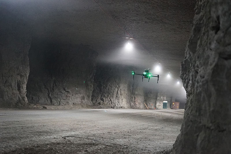
Photo credit: Near Earth Autonomy
In 2015, as part of NASA’s UTM project, Near Earth Autonomy received a grant to build the technology for safe, self-piloted takeoff and landing without the use of GPS or maps. Outfitted with this technology, a drone can now navigate without GPS, letting it find its way through tunnels and other areas where satellite signals are blocked.
NT Robotics

Photo credit: NT Robotics
NT Robotics has developed an Autonomous indoor navigation system that allows drones to perform technical inspections inside of oil tanks, mines, subways, warehouses, and other indoor scenarios, in conditions where there is no light, GPS, pilot, or pre-existing maps. NTR has developed unique indoor UAV control software that includes precision positioning, fully covered surface flying algorithms, obstacle flying algorithms, an intelligent image stabilization system, and improved image quality in low light conditions.
Emesent’s Hovermap

Photo credit: Emesent
Emesent’s Hovermap payload is a SLAM-based LiDAR mapping and autonomy payload that allows drones to map and explore challenging GPS-denied environments autonomously, beyond line-of-sight. Watch a webinar at Commercial UAV News to learn more about Hovermap.
Flyability
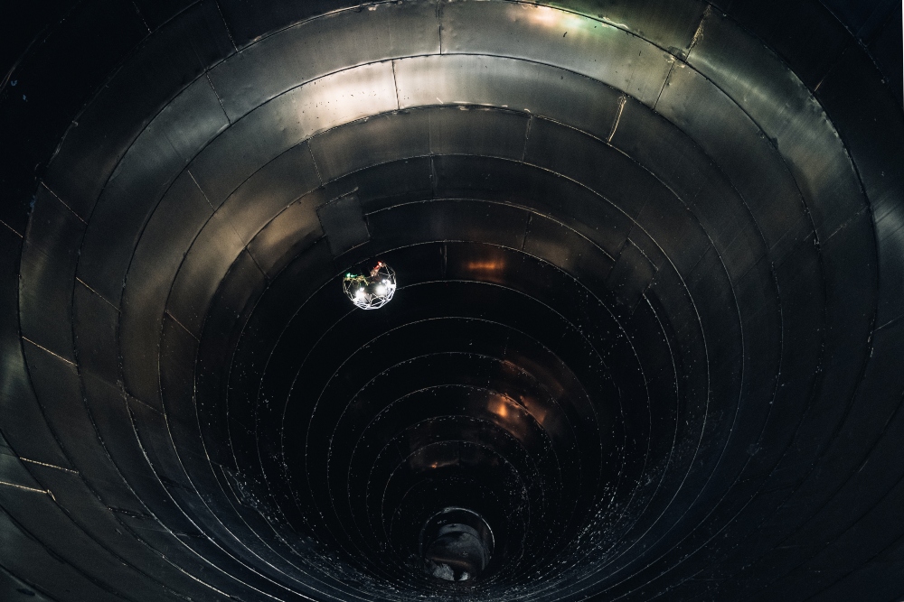
Photo credit: Flyability
Flyability’s Elios 2 is an indoor drone that was made to fly in GPS-denied environments, like mines or inside industrial boilers. The Elios 2 uses vision stability sensors to stabilize the drone in the absence of GPS. According to Flyabliity, data security was another reason for making the drone capable of operating without GPS, since Flyabilty’s drones are often used to inspect critical infrastructure like nuclear power plants, and the company knew that some clients would prefer to have an option for avoiding connections to GPS or the internet.
This list is not at all exhaustive. We hear about new companies working on GPS-denied drone capabilities all the time, and the list of companies offering it will probably continue to grow in the coming years.
Know of other companies working to develop drone technology for GPS-denied scenarios? Share what you know in this thread on the UAV Coach community forum.


