

Drones in Mining: How Drones Are Helping Visualize Underground Spaces too Dangerous to Enter
BY Zacc Dukowitz
30 July 2020When we created our in-depth guide to drone jobs a few years ago, we lumped mining-related drone jobs together with drone jobs in construction and aggregates because mining was still a relatively uncommon application for drones.
But these days it seems like we’re hearing more and more about the ways drones are being used to support mining operations.
Recently, enterprise drone manufacturer Kespry announced that The Shelly Company is using their drones for mine planning. And we’ve also been hearing about the ways that mining companies are using Flyability’s Elios 2, an indoor drone that sits in a protective cage, to create 3D maps of the inside of mines.
In this article, we’re going to go over the ways that drone technology is helping transform mining operations, and then take a closer look at how Kespry and Flyability are helping to support that work.
The Primary Benefits and Use Cases for Drones in Mining
As in many industries where drones are used, one of the biggest benefits drones provide to mining is improved safety.
Mining work is inherently dangerous. Materials in areas that have recently been excavated, called stopes, can shift and move, making them too dangerous for personnel to enter; blast sites can present uncertain conditions, making them hazardous to walk on foot; and even the surface of a mine can become unstable if there are problems underground, and potentially lead to a sudden collapse that could endanger those in the area.
But safety is only one of the ways drones are helping to improve work in mining. Here’s a list of all the benefits drones present to mining operations:
- Improved safety. Using drones to collect visual data on the status of potentially volatile areas of a mine, like highwalls, crests, and inside stopes, as well as blast sites, means fewer people are exposed to those dangers.
- Improved savings. Using drones to capture visual data inside of a stope can help identify remaining ore and geotechnical areas of interest, which could lead to additional revenue.
- Improved data. Capturing HD 4K video and high res images of a mine can help engineers and safety personnel do their jobs better, and create a historical record of the mine that can be used for future planning.
- Improved efficiency. Mining companies can use visual data captured by drone to quickly share the status of an ongoing operation with stakeholders.
So What Kinds of Work Are Drones Doing in Mining Operations?
In general, drones are being used in mining to capture raw visual data. This data can then be converted into several different outputs, including detailed photos, videos, 3D maps, and orthomosaics.
Here are some of the main ways these outputs are being used in mining operations:
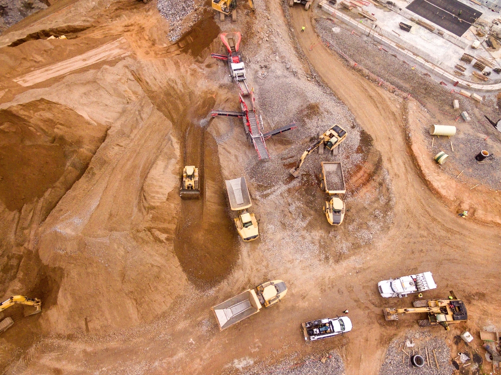
1. Mine planning
Detailed aerial data can help companies understand the elevation and contours of a mine so that they can do accurate planning.
2. Optimizing site development
Once a mining operation is underway, drone data can ensure that the site is being used in an optimal manner, with ongoing progress reports helping personnel identify ways that operations could be made more efficient or safer.
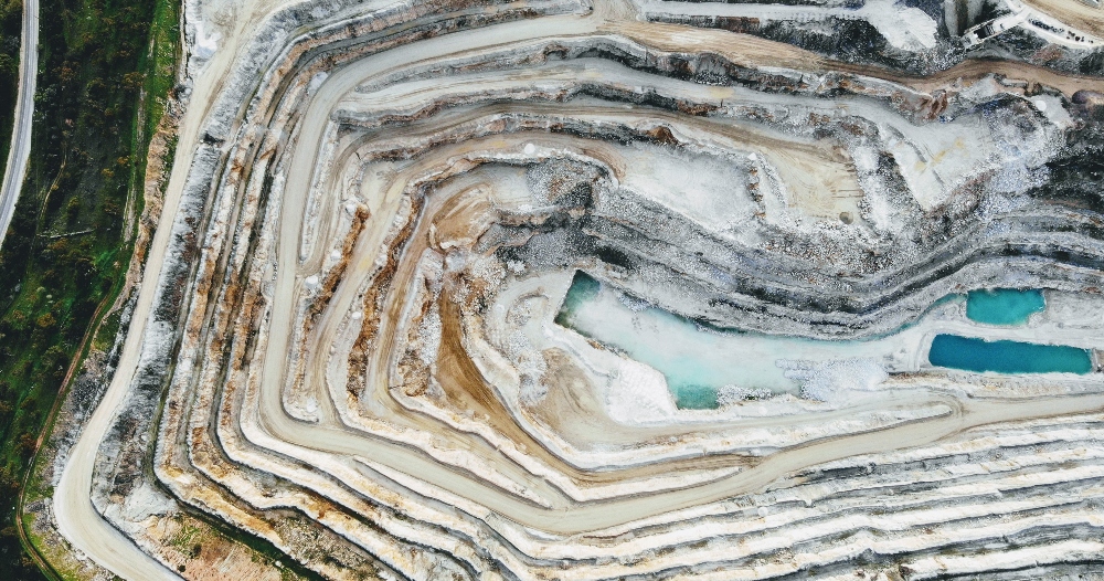
3. Environmental monitoring
3D maps created with aerial data can help monitor the impact a mining operation is having on the surrounding environment in real time, allowing mining companies to reduce their impact and ensure compliance with environmental regulations.
4. Blast engineering
Blast sites can be dangerous immediately following a detonation, presenting potential hazards to mining personnel. Using a drone, detailed aerial data can be collected for a post-blast inspection to ensure that the site is safe before anyone enters it to continue work.
5. Stockpile inventory monitoring
As drone software and technology improves, the ability to conduct accurate stockpile volumetry measurements completely by drone continues to develop. Using drones to inventory large stockpiles of mined materials poses a significant improvement over more manual methods, which are slow, cumbersome, and often inaccurate.
6. Mapping the inside of mines
Using special indoor commercial drones like Flyability’s Elios 2, which can fly in confined environments without GPS, mining operations have been able to start successfully creating 3D maps of the inside of mines. This use case is still relatively new, and the maps produced are not always perfect, but the value these maps can provide in terms of safety and enhanced situational awareness is immense.
Photo credit: Flyability
Kespry—The Shelly Company Case Study
The Shelly Company, an Ohio-based limestone, concrete, and asphalt paving firm, has been using Kespry’s drone technology to plan its mines and to monitor its inventory of mined materials.
Using Kespry helps us make informed decisions and work closely with contractors to compare stripping quantities. This ensures that we are charged the correct amount.
– Chris Pike, Performance Manager at The Shelly Company
The company works extensively throughout the state, with 90 locations and 1,600 employees in 81 of Ohio’s 88 counties. This means that there is a lot of work to manage, and even small mistakes can add up to major losses of potential revenue.

Using Kespry’s aerial intelligence platform, The Shelly Company has been able to measure contours to ensure that its mine plans are accurate, and thus avoid wasted expenses due to poor planning.
Kespry’s aerial data also allows the company to gather more accurate before-and-after stripping calculations, so they can validate the exact amount of ore or other material that’s been moved and avoid any revenue loss due to inaccurate reporting. Similarly, drone data is helping the company manage its inventory on sites, which includes activities like updating unit weights and product volumes.
Flyability—Barrick Gold Case Study
Not too long ago, Flyability’s Elios 2 was tested at the Barrick Gold Corporation’s Golden Sunlight Mine in Whitehall, Montana.
Although drones have become a go-to tool for mapping open pits and mining sites—that is, for flying outside of a mine—the tests conducted by Barrick Gold were for flying a drone inside the mine.

Until recently, collecting the amount of visual data needed to conduct indoor photogrammetry in mines has been almost impossible, primarily because most drones can’t fly in the cluttered, volatile, and GPS-denied environment of a mine.
Many mine operators can attest to this, having conducted experiments in which they’ve lost several drones into their mines. But Flyability’s Elios 2, with its unique cage design and its ability to fly without GPS, seems to have overcome these challenges and created a way for companies to create 3D maps of the inside of mines.
The result of the tests were very positive, according to Barrick Gold personnel.
With the Elios 2, we were able to see where the structures were releasing material. The imagery looked really good.
– Ryan Turner, Geotechnical Engineer for the Barrick Gold Corporation
Using data from the Elios 2 and software from Pix4D, Barrick Gold was able to create a 3D photogrammetric model of the large volume left behind after removing the ore vein (this is the area called a stope, as mentioned above).
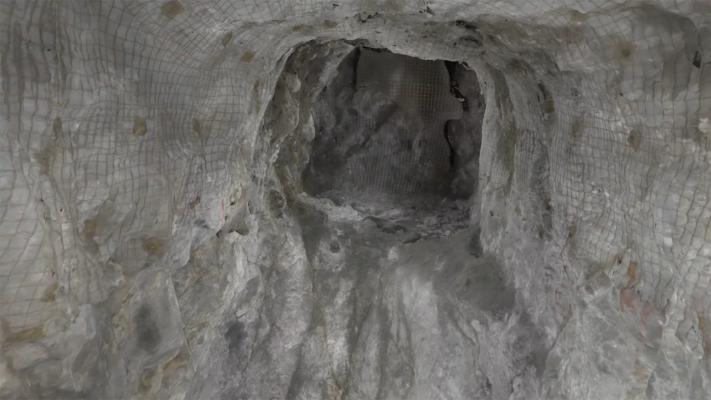
Image from a 3D Photogrammetric model of a stope (Photo credit: Flyability)
3D maps like this are crucial for understanding the condition of the stope.
They help identify loose material that may pose a threat to mine personnel or to remotely operated equipment, and they can aid in the identification of any remaining ore and geotechnical areas of interest that could help increase revenue for the company.
Know of other companies using drones in their mining operations, or other ways drones are supporting work in the mining industry? Share what you know in this thread on the UAV Coach community forum.


