

Drones in Construction: An In-Depth Guide [New for 2026]
BY Zacc Dukowitz
3 April 2026Once considered an emerging technology, drones are now widely used across construction sites.
And construction companies are reaping the benefits, using drones in construction to cut costs, improve decision-making, and increase efficiency.

Construction drones are transforming the industry by providing faster, safer, and more cost-effective ways to do key tasks, including:
- Site surveys
- Progress monitoring
- Safety inspections
- Resource management
AI-driven mapping software has developed alongside drone technology. This software contains powerful systems for processing a drone’s raw visual data to provide detailed maps of construction sites.
And the adoption of drones in construction is only going to grow. The global construction drone market is projected to reach $11.96 billion by 2027, and a whopping $19 billion by 2032.
This guide explores how drones are used on construction sites, the benefits of drones in construction, the top construction drones on the market, and more.
Here’s a menu in case you’d like to jump around:
- Drones in Construction: How Are Drones Used on a Construction Site?
- Best Construction Drones on the Market [New for 2026]
- 7 Benefits of Using Drones in Construction
- Jobs Flying Drones in Construction
- The ROI of Using Drones in Construction
- The Future of Drones in Construction
- Construction Drones FAQ
Drones in Construction: How Are Drones Used on a Construction Site?
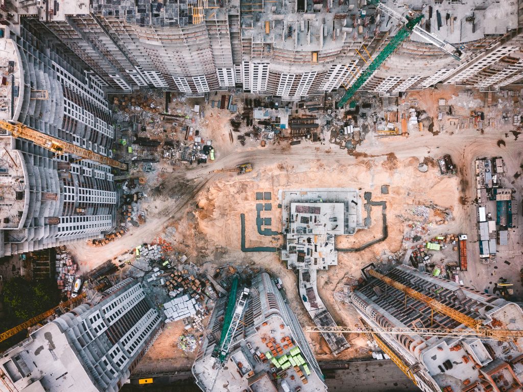
One of the main reasons to use a drone in construction is to capture quick, accurate visual data of a site.

With the ability to automate data collection and integrate with construction software, drones are now a key component of modern construction workflows.
Construction drones can generate a range of deliverables, including high-resolution aerial imagery, 2D orthomosaic maps, 3D models, digital elevation models (DEMs), and LiDAR scans, providing precise data for project managers and stakeholders.
[Calvin Ludwig built his construction drone business 4Blades Digital to a quarter million a year. Find out how he did it in this case study.]
Construction companies use these outputs in a range of ways, from site surveying, to progress monitoring, to safety inspections.
Here are the top 10 uses for drones in construction:
1. Site Surveying & Mapping
Drones equipped with high-resolution cameras and LiDAR sensors can swiftly capture detailed aerial imagery and topographic data of construction sites. This data facilitates the creation of accurate 2D maps and drone 3D models, streamlining the planning and design phases.
Top Surveying & Mapping Use Cases
- Generating orthomosaic maps. Provides an accurate, up-to-date view of the entire construction site.
- Creating 3D terrain models. Helps with earthwork calculations and site planning.
- Conducting topographic surveys. Assists in infrastructure development and site preparation.
2. Progress Monitoring
Regular drone flights enable project managers to monitor construction progress in real time, ensuring adherence to schedules and budgets. Aerial imagery provides a comprehensive view of the site, aiding in the identification of potential delays or issues.
Top Progress Monitoring Use Cases
- Documenting weekly progress. Captures aerial photographs for side-by-side comparisons.
- Comparing as-built conditions. Identifies discrepancies between plans and actual construction.
- Sharing visual updates. Provides stakeholders with real-time insights into project status.
3. Safety Inspections
Drones can access hazardous or hard-to-reach areas, conducting safety inspections without endangering personnel. They identify potential risks, such as structural weaknesses or compliance issues, contributing to a safer work environment.
Top Safety Inspection Use Cases
- Inspecting scaffolding and high structures. Reduces the need for manual inspections at height.
- Monitoring compliance with safety protocols. Ensures workers adhere to OSHA regulations.
- Detecting environmental hazards. Identifies gas leaks, unstable structures, or unsafe conditions.
4. Equipment Tracking
By providing an aerial perspective, drones assist in tracking the location and utilization of equipment on large construction sites, optimizing asset management and reducing downtime.
Top Equipment Tracking Use Cases
- Locating machinery across expansive sites. Reduces time spent searching for misplaced equipment.
- Monitoring equipment usage. Helps schedule maintenance and prevent unexpected breakdowns.
- Preventing unauthorized use or theft. Enhances security by tracking movement and usage patterns.
5. Stockpile Measurement
Drone data enables the precise measurement of stockpiles, such as aggregates or soil, using photogrammetry techniques. This automation reduces the need for manual surveys and minimizes errors.
Top Stockpile Measurement Use Cases
- Calculating volumes of materials. Improves inventory management and ordering accuracy.
- Assessing material usage rates. Helps optimize supply chain efficiency.
- Planning material orders. Reduces waste and ensures resources are available when needed.
6. Quality Control
High-resolution drone imagery allows for detailed inspections of construction quality, identifying defects or deviations from plans early in the process.
Top Quality Control Use Cases
- Detecting misalignments in structural components. Ensures construction accuracy before major work continues.
- Ensuring uniformity in installations. Identifies inconsistencies in materials or finishes.
- Verifying compliance with building codes. Provides documentation for regulatory approvals.
7. Environmental Monitoring
Drones equipped with specialized sensors monitor environmental factors, ensuring compliance with regulations and minimizing ecological impact.
Top Environmental Monitoring Use Cases
- Measuring air quality. Detects pollutants and ensures workplace safety.
- Monitoring water runoff and sediment control. Helps prevent environmental damage from construction activities.
- Assessing noise levels. Ensures compliance with local noise regulations.
8. Security Surveillance
Regular drone patrols enhance site security by monitoring for unauthorized access, theft, or vandalism, especially during off-hours.
Top Security Surveillance Use Cases
- Conducting perimeter surveillance. Helps secure construction sites from intruders.
- Identifying unauthorized personnel. Tracks movements and alerts security teams.
- Deterring potential intruders. Visible drone presence discourages theft and vandalism.
9. Marketing & Client Updates
Aerial footage captured by drones serves as valuable marketing material, showcasing project progress and completed works to clients and stakeholders.
Top Marketing & Client Update Use Cases
- Creating promotional videos. Highlights projects for marketing and investor presentations.
- Providing clients with visual progress reports. Keeps stakeholders informed with professional aerial imagery.
- Documenting milestones. Preserves key project achievements for historical records.
10. Infrastructure Inspections
Drones facilitate the inspection of existing infrastructure, such as bridges and roads, to assess conditions and plan maintenance or integration with new projects.
Top Infrastructure Inspection Use Cases
- Inspecting bridge integrity. Identifies cracks, corrosion, and structural weaknesses.
- Assessing road surface conditions. Helps prioritize maintenance and resurfacing projects.
- Evaluating utility lines. Ensures infrastructure is compatible with new construction.

Best Construction Drones on the Market [New for 2025]
Looking for a construction drone?
While many consumer drones can be used for construction, there are standout options that are ideally suited for this type of work.
Here’s our list of the top 5 construction drones on the market:
1. The Skydio X10

The Skydio X10 is a professional autonomous drone designed for a wide range of applications, including construction site monitoring and inspection. Equipped with multiple high-resolution cameras and advanced AI capabilities, it offers professional-grade obstacle avoidance and autonomous flight features.
Why good for construction: The X10’s advanced obstacle avoidance and autonomous capabilities make it ideal for navigating complex construction sites, enabling comprehensive data collection with minimal manual intervention.
Key Specs
- Weight. 4.65 lbs (2.11 kg).
- Flight time. 40 minutes
- Camera. 1″ 50MP wide sensor with 4K video, telephoto zoom, and thermal imaging capabilities.
- Autonomy. AI-powered obstacle avoidance with true 360° environmental awareness and autonomous flight capabilities.
- Thermal imaging. Teledyne FLIR Boson+ sensor with 640×512 resolution
Learn more about the Skydio X10.
2. The Freefly Astro Max

The Freefly Astro Max is a robust industrial drone designed to handle demanding tasks like LiDAR scanning, aerial photogrammetry, and infrastructure inspection. With a significant increase in payload capacity and thrust compared to its predecessors in the Astro line, the Astro Max has upgraded versatility and performance for complex construction projects.
Why good for construction: The Astro Max’s high payload capacity and compatibility with advanced sensors make it ideal for detailed mapping, surveying, and inspection tasks on construction sites.
Key Specs
- Flight time. Up to 39 minutes with no payload.
- Maximum payload capacity. 6.6 lbs (3 kg).
- Weight. 6.8 pounds (3,095 g).
- Camera. Various options including the Sony LR1 Payload, which has 61MP resolution and a range of lens options including 24mm, 35mm, 50mm, and 75mm.
- Durability. Tested to IP43.
Learn more about the Astro Max.
3. The Parrot ANAFI USA

The Parrot ANAFI USA is a compact drone offering advanced imaging capabilities, including thermal imaging, making it suitable for a range of inspection tasks on construction sites.
Why good for construction: The ANAFI USA’s thermal imaging capabilities and compact design make it ideal for detailed inspections and hard-to-reach areas.
Key Specs
- Flight time. Up to 32 minutes.
- Weight. 1.1 pounds (500 g).
- Camera. 32x zoom, 4K HDR video, 21 MP photos.
- Thermal imaging: FLIR Boson 320×256.
Learn more about the ANAFI USA.
4. DJI Mavic 3E

The DJI Mavic 3E is a compact enterprise drone equipped with a high-resolution camera and mechanical shutter, making it ideal for mapping and surveying tasks in construction.
Why good for construction: The Mavic 3E’s high-resolution camera and mechanical shutter enable precise mapping and surveying, essential for construction planning and monitoring.
Key Specs
- Flight time. Up to 45 minutes
- Weight. 2 pounds (900 grams)—without battery
- Camera. 20MP wide-angle with 4/3 CMOS sensor
- Video resolution. Up to 5.1K/30fps
Learn more about the Mavic 3E.
5. DJI Matrice 350 RTK
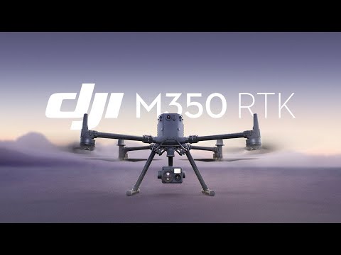
The DJI Matrice 350 RTK features a high-quality video transmission system, efficient battery system, and comprehensive safety features, making it a solid platform for construction applications.
Why good for construction: The Matrice 350 RTK’s robust design, advanced safety features, and compatibility with multiple payloads make it a good choice for complex construction tasks.
Key Specs
- Flight time. 55 minutes.
- Durability. IP55 rating.
- Camera. Compatible with a range of payloads, including the Zenmuse H20 series, which features a 20MP zoom camera, a 12MP wide camera, and a laser rangefinder.
- Transmission system. DJI O3 Enterprise Transmission.
Learn more about the Matrice 350 RTK.
7 Benefits of Using Drones in Construction
Integrating drones into construction projects offers several benefits, from enhancing efficiency, to improving safety, to cutting costs.
In this section we cover the top seven benefits of using drones in construction, each supported by concrete examples and industry-specific data.
1. Increased Efficiency
Drones can expedite construction processes, leading to significant time savings.
For example, traditional land surveying methods can be labor-intensive and time-consuming. In contrast, drones equipped with high-resolution cameras and LiDAR sensors can survey large areas swiftly, providing precise data for site analysis and planning.
Drones increase efficiency in construction with:
- Accelerated site surveys. Drones can survey up to 120 acres per hour, compared to approximately five acres per hour using traditional methods, resulting in a 60-fold increase in efficiency.
- Rapid progress assessments. Regular drone flights allow for quick documentation of construction progress, enabling timely decision-making and adjustments.
- Efficient resource allocation. By providing real-time aerial overviews, drones assist in monitoring equipment and materials, ensuring optimal utilization and reducing downtime.
2. Cost Savings
Implementing drones in construction can lead to substantial cost reductions by minimizing labor expenses, preventing costly errors, and optimizing resource management.
Drones increase savings in construction with:
- Reduced surveying costs. Drone surveys require fewer personnel and less time, lowering overall expenses.
- Minimized rework. Accurate data collection helps identify potential issues early, reducing the likelihood of expensive rework and project delays.
- Enhanced asset management. Drones assist in tracking equipment and materials, reducing losses due to theft or misplacement, and optimizing inventory levels.
3. Improved Safety
Drones enhance safety on construction sites by performing tasks that would otherwise expose workers to hazardous conditions.
Drones improve safety in construction with:
- Hazardous area inspections. Drones can safely inspect high-risk areas such as unstable structures or tall buildings, eliminating the need for workers to be placed in dangerous situations.
- Monitoring compliance. Aerial surveillance ensures adherence to safety protocols, helping to prevent accidents and injuries.
- Emergency response. In case of incidents, drones provide real-time visuals, aiding in swift and safe emergency responses.
4. Enhanced Data Accuracy
Drones equipped with advanced sensors and imaging technology capture precise data, improving the accuracy of measurements and assessments.
Drones enhance data accuracy in construction with:
- Accurate topographic mapping. High-resolution imagery and LiDAR data enable the creation of detailed topographic maps, essential for effective planning and design.
- Precise volume calculations. Drones facilitate accurate measurements of stockpile volumes, aiding in inventory management and cost estimation.
- Detailed progress documentation. Consistent and accurate data collection allows for meticulous tracking of project milestones and quality control.
5. Better Communication and Collaboration
Drones enhance communication among project stakeholders by providing clear, up-to-date visuals of the construction site.
Drones improve communication and collaboration in construction with:
- Real-time updates. Aerial footage offers immediate insights into project status, facilitating timely discussions and decisions.
- Improved stakeholder engagement. Visual data helps convey complex information to clients and team members, ensuring everyone is aligned.
- Streamlined reporting. Drones simplify the creation of reports by providing comprehensive visual documentation, reducing the time spent on manual data collection.
6. Enhanced Project Planning
By providing detailed site information, drones assist in more accurate and efficient project planning.
Drones step up project planning in construction with:
- Site analysis. Drones capture comprehensive data on site conditions, informing better design and construction strategies.
- Logistical planning. Aerial views aid in planning the layout of equipment, materials, and personnel, optimizing workflow and site organization.
- Risk identification. Early detection of potential site issues allows for proactive mitigation, reducing the likelihood of project disruptions.
7. Environmental Compliance
Drones assist in monitoring environmental factors, ensuring that construction activities adhere to regulatory standards and minimize ecological impact.
Drones help with environmental compliance in construction with:
- Monitoring environmental impact. Drones track changes in vegetation, water bodies, and wildlife habitats, helping to mitigate negative effects.
- Ensuring regulatory compliance. Regular aerial assessments ensure that construction practices meet environmental regulations, avoiding potential fines and project delays.
- Supporting sustainable practices. By providing detailed environmental data, drones enable the implementation of more sustainable construction methods.
Jobs Flying Drones in Construction
In a report from a few years back, 35% of the companies surveyed—the largest amount of respondents from a single sector—who used drones in their operations worked in Construction & Engineering
So if you’re a drone pilot interested in finding work on a construction site, the data seems to indicate that there’s work to be had.

In-House or Freelance?
OK, so you want to work as a pilot flying drones in construction.
Related read: Drone Pilot Salary: How Much Does a Drone Pilot Make? [New for 2025]
But should you try to get hired by a company’s in-house drone program, or should you try to get hired as a freelance pilot?
In our 2019 Drone Industry Survey, 23% of respondents (86 out of 370) who worked for a company as a drone pilot reported working in Construction/Mining/Aggregates. This was the largest single category for those flying drones as part of an in-house drone operation.
And the percentage of freelance/self-employed drone pilots who worked in construction was the same, with 23% of self-employed respondents (81 out of 353) working in Construction/Mining/Aggregates.
More recently, the 2023 drone market report from Drone Industry Insights (DII) found that the Construction/Infrastructure/Mining sector accounts for about 15% of commercial drone market share. That percentage made it the third-largest sector for drone applications, following Agriculture (20%) and Energy (17%).
Based on this data, it seems likely that there’s work to be had either by joining an in-house drone program or by going the freelance route.
How Much Can You Make Flying a Drone in Construction?
According to recent surveys and industry reports, self-employed drone pilots in the construction sector are now starting at around $50/hour on average, with experienced freelancers earning up to $132/hour or more for specialized work.
However, the majority of freelance drone pilots earn between $25 and $65 per hour.
For those working in in-house drone programs in construction, salaries have increased. Recent data shows that drone pilots in the construction industry now earn an average of about $80,000 annually. However, this can vary based on experience, location, and specific job responsibilities, with some experienced pilots earning up to $90,000 or more per year.
It’s important to note that salary figures can fluctuate based on factors like geographic location, level of expertise, and the specific requirements of each project or position.
The ROI of Using Drones in Construction
Integrating drones into construction workflows offers measurable returns on investment (ROI) through cost reductions, enhanced efficiency, and improved safety.
Below are four key areas where drones contribute to significant ROI.
1. Cost Savings
- Reduced surveying expenses. Traditional surveying methods are labor-intensive and time-consuming. Drones can perform site surveys faster and with fewer personnel, leading to direct cost savings. By some estimates, drones can reduce surveying time for a 12-acre property from 100 hours to as little as 2 hours by eliminating the need to walk the area on foot.
- Minimized rework costs. Accurate data collection via drones helps identify potential issues early, reducing costly rework. This precision ensures that projects adhere to design specifications, preventing budget overruns.
2. Time Savings
- Accelerated data collection. Drones expedite data gathering, enabling rapid decision-making and keeping projects on schedule. This efficiency is crucial in an industry where delays can lead to substantial financial losses.
- Enhanced progress monitoring. Regular aerial surveys provide up-to-date visuals of the construction site, facilitating real-time progress tracking and swift adjustments to project plans as needed.
3. Improved Safety
- Hazardous area access. Drones can safely inspect dangerous or hard-to-reach areas, reducing the need for personnel to be exposed to potential hazards. This capability decreases the risk of accidents and associated costs.
- Compliance and documentation. Drones provide accurate records of site conditions, aiding in compliance with safety regulations and reducing the likelihood of fines or work stoppages due to safety violations.
4. Enhanced Communication and Collaboration
- Visual data sharing. High-resolution images and videos captured by drones facilitate better communication among stakeholders, ensuring everyone has a clear understanding of project status and any issues that arise.
- Improved client transparency. Providing clients with detailed aerial views of project progress enhances transparency and can lead to increased client satisfaction and trust.
The Future of Drones in Construction
Eight trillion dollars a year—that’s how much the construction industry is currently worth.
But it’s incredibly inefficient. In fact, the typical commercial construction project runs 80% over budget and 20 months behind schedule.
This inefficiency presents a massive opportunity for drones in construction, as 3DR’s CEO Chris Anderson has pointed out.
On-screen, in the architect’s CAD file, everything looks perfect. But on-site, in the mud and dust, things are different. And the difference between concept and reality is where about $3 trillion of that $8 trillion gets lost, in a cascade of change orders, rework, and schedule slips. Drones are meant to close that gap.
– Chris Anderson, CEO of 3DR
Drone pilots are already helping to change the way construction companies operate, tapping into a small but meaningful piece of that three trillion Anderson mentions above. And that adoption is only going to grow over the next several years.
In the next decade, we’re going to see drone technology and software continue to evolve, with improvements in automation helping drone companies get the drone data they need even more quickly, at a lower and lower cost.
[Want to break into working with drones in construction? Learn more about how you can improve your drone pilot skills and start an exciting new career path today.]
Construction Drones FAQ
Here are answers to the most commonly asked questions about drones in construction.
What do construction companies use drone surveying for?
Construction companies use drone surveying for site analysis, topographic mapping, progress monitoring, and volumetric calculations. Drones provide high-accuracy data for terrain modeling, earthwork estimation, and quality control, helping engineers make informed decisions.
What types of drones are used in construction?
Construction sites use a variety of drones, including fixed-wing drones for large-scale mapping, multirotor drones for inspections and site monitoring, and hybrid drones that combine the benefits of both. High-end models like the DJI Matrice 350 RTK, Freefly Astro Max, and Skydio X10 are common in commercial applications.
What are the advantages and disadvantages of using drones in construction?
Advantages: Drones improve efficiency, reduce costs, enhance safety, and provide high-resolution data for decision-making. They also minimize the need for manual surveys and inspections in hazardous areas.
Disadvantages: Regulations, weather conditions, and battery life can limit drone operations. Additionally, training and licensing are required for professional drone pilots, adding an initial investment cost.
How big is the construction drone market?
The global construction drone market is projected to reach $19 billion by 2032, driven by increasing adoption of drone technology for automation, AI-driven analytics, and real-time data collection. Growth is fueled by demand for safer and more efficient construction workflows.
Who uses drones in construction?
Drones are used by construction firms, general contractors, surveyors, engineers, project managers, and site supervisors. They are also employed by government agencies and real estate developers for large-scale infrastructure projects.
How do drones improve safety on construction sites?
Drones reduce the need for workers to enter hazardous areas by performing aerial inspections and monitoring site conditions. They can assess unstable structures, detect safety violations, and provide real-time footage of incidents, improving overall site security.
Can drones be used for equipment tracking?
Yes, drones help track construction equipment by providing aerial overviews of the site. They assist in locating machinery, preventing theft, and ensuring proper utilization of resources.
What regulations apply to construction drones?
In the U.S., construction drones must comply with FAA Part 107 regulations, which include pilot certification, airspace restrictions, and operational guidelines. Some projects may require additional waivers for flying beyond visual line of sight (BVLOS) or at night.


