Drone News Roundup: DJI Ban Moves Forward in Congress, First Drone Delivery Made on Mt. Everest, and More!

BY Zacc Dukowitz
13 June 2024

This week we’re covering the fact that the DJI ban law has advanced in a congressional committee, moving it closer to potentially becoming law.

We’re also covering the first drone delivery ever made on Mt. Everest, drones and AI to detect landmines, turning 3D models into “walkable environments” with SkyBrowse, and DJI’s announcement that it will stop recording drone flight data.

Now let’s get to those links!

DJI Ban Moves Closer to Becoming Law—Now Is the Time to Speak Out

drone-ban-update-2024
Image source

The Countering CCP Drones Act, which would effectively ban DJI drones from use by anyone in the U.S., made progress toward becoming law this week. The measure was attached to the newest version of the NDAA (National Defense Authorization Act), receiving a 57-1 vote in a congressional committee to move forward to the House for a vote. The last NDAA included a ban on Chinese drones for use by the federal government, making it seem like the NDAA could be a successful vehicle for this ban, too.

If the law passes, DJI will be added to the FCC Covered List. Inclusion in that list would make it impossible to operate DJI drones in the U.S., since they would no longer have access to communication channels essential for drones to function. To put this plainly: Unlike the TikTok ban, which seems to have no teeth, the DJI ban could be real and make it so you can’t fly DJI drones in the U.S. First responders have written an open letter to the Senate Armed Services Committee voicing their strong opposition to the Countering CCP Drones Act. And we encourage you to do the same. If you feel like the ban is a bad idea, reach out to your representatives to share your opinion.

We believe in the right to consumer choice. It’s important that we fight to retain that choice in the face of such a sweeping ban, which will hurt the drone industry, including small business owners, and significantly reduce the options on the market.

TAKE ACTION

DJI FlyCart 30 Makes First Drone Delivery on Mt. Everest

Mount Everest's First Drone Delivery | DJI Flycart 30

The FlyCart 30—DJI’s first delivery drone—recently made the first drone delivery ever on Mount Everest. The drone was used to carry supplies up and then bring trash back, making use of both legs of the trip. The delivery payload consisted of oxygen bottles, which the FlyCart 30 carried from an elevation of 3.3 miles to 3.73 miles above sea level. Trash is a major issue on the mountain, and the drone carted back 33 pounds of it, helping reduce the load that sherpas would otherwise have to carry down. More than a stunt, drone deliveries like these could help reduce exposure to risks related to carrying mountain climbing materials up and trash down, work that leads to the death of sherpas every year.

LEARN MORE


Drones for Landmine Detection

These researchers are using drones and machine learning to detect land mines--and save lives

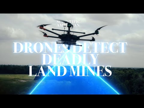
Most demining efforts—a term used to describe eliminating landmines from an area—is currently manual. That means people have to walk an area on foot using metal detectors, walking in a grid to ensure no mines are present. As you can imagine, this approach isn’t ideal, both because it’s slow and because people are exposed to the potential danger of accidentally stepping on a landmine. But researchers are investigating ways that AI powered by machine learning could be used with drones to automate landmine detection in a way that would make it faster and safer. Watch the video to see a test of the approach in a test field where landmines have been inserted in Oklahoma.

LEARN MORE


Turning Drone 3D Models into “Walkable Environments”

SkyeBrowse Partners with RSET for Virtual Simulations

A new partnership between SkyeBrowse and RSET lets you import SkyBrowse 3D models into RSET’s training simulation software to create “walkable environments.” This means that a static 3D model can become an interactive training environment, allowing police to do active shooter drills in digital twins of real locations in their area, or firefighters to carry out exercises in 3D models of real buildings where they live. And if you just want to play with the real world, there’s also a zombie mode, which lets you take a 3D model of a place you frequent—and add zombies.

LEARN MORE


DJI Won’t Record Drones Flight Records Any More

dji-flight-records-stop-syncing
Credit: DJI

Starting this month, DJI will no longer let drone pilots in the U.S. sync their flight records to DJI’s servers. Your flight records can still be stored in the controller or on an SD card, so you’ll still be able to access them manually. DJI never had automatic flight record syncing in place—this move just means that optional syncing will no longer be offered. In addition to dropping flight record syncing for U.S. operators, DJI will also stop offering thumbnail previews on the DJI Fly app throughout the world for consumers. (Enterprise drone operators are not affected, as their drones did not feature thumbnails to begin with.)

Although DJI hasn’t explicitly said it’s making these changes to address accusations that it’s spying on American citizens—made without evidence, we should note—the connection between recent calls for DJI bans that have stemmed from these accusations and this move are pretty clear.

Here are some key dates for the changes DJI is making:

  • June 12 in the U.S.—The “Sync Flight Data” option in the flight app’s Settings will be disabled. Operators who try to upload their local flight records will receive an error message that the upload failed.
  • June 27 in the U.S.—The “Sync Flight Data” option will disappear from the Settings page as part of the next update of DJI Fly (Mid-July for DJI Pilot 2).
  • June 27 globally—Thumbnail previews will no longer be generated or shown on the flight app interface as part of the next update.

LEARN MORE


Make sure to sign up for our free weekly newsletter using the button below so you can get our weekly newsletter every Saturday, with this roundup and our other featured stories from the week.

Join a global community of

100,000+

drone enthusiasts.

Subscribe

Drone Pilot's Guide to DJI Mini 4 Pro

  • Navigate the DJI Fly app and flight modes with ease
  • Adjust camera and safety settings for better control
  • Understand intelligent flight features and how to use them
  • Avoid common beginner mistakes
  • Get the most out of your drone—without the guesswork

Drone Pilot's Guide to DJI Air 3S

  • Navigate the DJI Fly app and flight modes with ease
  • Adjust camera and safety settings for better control
  • Understand intelligent flight features and how to use them
  • Avoid common beginner mistakes
  • Get the most out of your drone—without the guesswork

Hands-On Flight Training

$295

400+ 5-Star Reviews

  • Team up with a knowledgeable, friendly instructor at a convenient outdoor spot — like a park or athletic field
  • Fly a top-rated drone provided for you, or bring your own to get personalized guidance
  • Spend most of your time in the air with hands-on practice — learning about composition, camera angles and cinematic motion
  • Explore the DJI Fly app and learn how to use camera settings like ISO, shutter speed and aperture
  • Unlock the power of Intelligent Flight Modes to fly smoother, smarter, and with less stress
  • Get access to our Aerial Photo & Video online course with additional exercises and pro-level editing workflows – using Snapseed, Photopea, Adobe Lightroom, DJI LightCut, and Premiere Pro

Aerial Photo & Video for Drone Pilots

$179

3,500+ 5-Star Reviews

  • How to dial in the right camera settings like ISO, shutter speed, and aperture
  • The best angles & altitudes for different types of shots (real estate, landscapes, cityscapes, and more)
  • The secret to cinematic drone motion that makes your footage feel like a Hollywood movie
  • How to enhance colors, remove distractions, and sharpen details – even in tricky lighting
  • Pro-level editing workflows – whether you’re using Lightroom, free tools, or mobile apps

The Recreational UAS Safety Test

Free

150+ 5-Star Reviews

  • Required for U.S. recreational flyers of drones
  • Launched June 2021 by the FAA
  • Takes about 30 minutes to complete
  • No prior drone knowledge needed
  • Test allows unlimited attempts to pass

Drone Mapping Essentials Workshop

$799

3,500+ 5-Star Reviews

  • Expert instruction from expert drone pilots with over 100 hours of flying experience
  • Hands-on training of live data capture and how to process deliverables for your clients
  • Peer-to-peer networking with other professional drone pilots in the mapping industry
  • Free access to the online course, Drone Mapping Essentials

Flight Skills for Drone Pilots

$99

75+ 5-Star Reviews

  • 16 engaging video lectures with key takeaways
  • Action items with concrete steps so you put into practice what you learn
  • Pre-flight checklists to help you plan your flights
  • Resource links to websites, products and software for further learning and discovery

Drone Business & Mapping Bundle

$617 $397

3,500+ 5-Star Reviews

  • Drone Pilot Ground School
    1. 1:1 support with a Part 107 exam success coach
    2. Study 100% online at your own pace
    3. Unlimited practice exams with 400+ real FAA test questions
  • Drone Mapping Essentials
    1. 100+ instructional videos focused on real-world application with high-quality videos
    2. Downloadable resources like data capture checklists to utilize in your missions
    3. Monthly live instruction with course instructor, Dylan Gorman, to go deeper on topics where you need more clarification
  • The Drone Business Blueprint
    1. Expert instruction from industry veteran, Eno Umoh, who brings real-world experience in building successful drone businesses.
    2. 14 Comprehensive modules covering everything from business setup to marketing strategies
    3. 30 Downloadable resources to apply your learning immediately

Hands-On Flight Training

$295

400+ 5-Star Reviews

  • 45-60 minutes of hands-on flying time to master orientation and flight maneuvers tailored to your skill level
  • Learn how to handle obstacles such as lost GPS, low battery charge or emergencies
  • Practice flying under various intelligent flight modes
  • Ask questions about regulations, software, flight operations management, and more

The Drone Business Blueprint

$119

3,500+ 5-Star Reviews

  • Expert instruction from industry veteran, Eno Umoh, who brings real-world experience in building successful drone businesses.
  • 14 Comprehensive modules covering everything from business setup to marketing strategies
  • 30 Downloadable resources to apply your learning immediately
  • AI tools and techniques to boost productivity and streamline your operations

Commercial Drone Business Bundle

$418 $334

4,000+ 5-Star Reviews

  • Drone Pilot Ground School
    1. 1:1 support with a Part 107 exam success coach
    2. Study 100% online at your own pace
    3. Unlimited practice exams with 400+ real FAA test questions
  • The Drone Business Blueprint
    1. Expert instruction from industry veteran, Eno Umoh, who brings real-world experience in building successful drone businesses.
    2. 14 Comprehensive modules covering everything from business setup to marketing strategies
    3. 30 Downloadable resources to apply your learning immediately

Drone Mapping Essentials

$199

3,500+ 5-Star Reviews

  • 100+ instructional videos focused on real-world application with high-quality videos
  • Downloadable resources like data capture checklists to utilize in your missions
  • Quizzes to test your knowledge so you can succeed in the field
  • Monthly live instruction with course instructor, Dylan Gorman, to go deeper on topics where you need more clarification

Drone Pilot Pro Bundle

$713 $499

3,500+ 5-Star Reviews

  • Drone Pilot Ground School
    1. 1:1 support with a Part 107 exam success coach
    2. Study 100% online at your own pace
    3. Unlimited practice exams with 400+ real FAA test questions
  • Drone Pilot Skill Builder
    1. 16 engaging video lectures with key takeaways
    2. Action items with concrete steps so you put into practice what you learn
  • Hands-On Flight Training
    1. 45-60 minutes of hands-on flying time to master orientation and flight maneuvers tailored to your skill level

Drone Pilot Ground School

$299

4,000+ 5-Star Reviews

  • 1:1 support with a Part 107 exam success coach
  • Study 100% online at your own pace
  • Unlimited practice exams with 400+ real FAA test questions
  • Personalized study plans, virtual flashcards, and 12-page cram sheet
  • Weekly webinars on acing the Part 107 exam and monthly webinars to elevate your journey post-certification