

Drone News Roundup: Insane Matterhorn Drone Video, Mavic 4 Pro Mystery Sensor, and More!
BY Zacc Dukowitz
26 February 2025This week we’re covering an epic flight up the Matterhorn shot on an FPV drone by Joshua Turner, which won a GoPro Award.
We’re also covering speculation about the mysterious sensor revealed in recent Mavic 4 Pro leaks, police using a thermal drone to rescue an injured man on a cold night in New York, how drone LiDAR helps surveyors see through vegetation for mapping, and MFE Inspection Solution’s partnership to test the Elios 3 in the Chicago subway system.
Now let’s get to those links!
Matterhorn Drone Video Wins GoPro Award

Drone pilot and YouTuber Joshua Turner recently won a GoPro Award for this epic FPV video shot at the Matterhorn. In the video, Turner flies up the challenging Hornli Ridge using an iFlight Chimera 7 equipped with a GoPro HERO10 Black, capturing beautiful 5K footage of the iconic peak. The video showcases both Turner’s impressive piloting skills and the sweeping beauty of the famous mountain, not to mention pushing the boundaries of what consumer-grade FPV drones can do.
LEARN MORE
What Is that Mysterious Sensor on the Mavic 4 Pro?
New exclusive #Mavic4Pro image reveals some kind of measurement system integrated in arm under the propeller. Is this enough to be the #LiDAR we saw on the Air3S? Or is it the plain old infrared system? Special thanks to YueYue for sharing. More pictures later. Cheers! pic.twitter.com/UHXQblaR03
— Jasper Ellens | X27 (@JasperEllens) February 20, 2025
Recent leaks show a mysterious new sensor on the Mavic 4 Pro’s propeller arm. In the post above, we can see a large black area that differs from the typical obstacle avoidance cameras found on previous Mavic models. So what is it? Most likely it’s an infrared or LiDAR sensor, potentially included to step up the Mavic 4 Pro’s navigation and sensing capabilities from the Mavic 3 Pro. Given all the leaks, not to mention the fact that the drone has shown up in the FCC database, it’s likely we’ll know soon enough.
Want more Mavic 4 Pro leaks? Follow the link below for everything we know so far, including a list of major leaks.
LEARN MORE
Police Use Drone to Find Injured Man on Dangerously Cold Night
In Ossining, NY, police recently used a drone to find an injured man who had fallen into an icy ravine. Responding to a late-night call, officers deployed a drone equipped with an infrared camera and spotlight, quickly locating the man and guiding rescuers to his location. Firefighters were able to extricate him from the ravine, and the ambulance corps provided medical attention before transporting him to the hospital. In sharing the story, the Ossining Police Department emphasized that the mission was a collaborative effort—and that innovative drone technology was crucial to the positive outcome, showcasing the life-saving potential of drones in emergency response situations.
LEARN MORE
How Drone LiDAR Sees through Vegetation
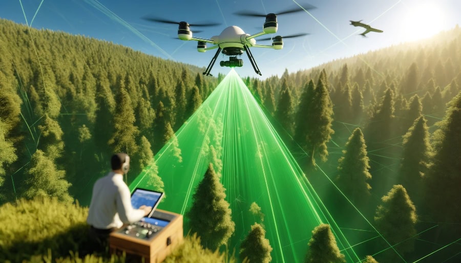
It’s common knowledge by now that aerial LiDAR can “see” through vegetation. By emitting laser pulses that penetrate gaps in vegetation, LiDAR creates accurate 3D models, even in challenging terrains where GPS signals are weak. This is how it’s helped researchers make archaeologic discoveries in the last decade, since LiDAR can reveal what lies beneath dense tree cover. But beyond archaeology, drone LiDAR offers a fast and cost-effective solution for surveying land covered in thick vegetation, overcoming the limitations of traditional methods. Drone LiDAR excels in wooded areas, helping surveyors differentiate between vegetation layers and the ground surface with high accuracy.
LEARN MORE
MFE Partners on Successful Elios 3 D.O.T. Testing in Chicago Subways
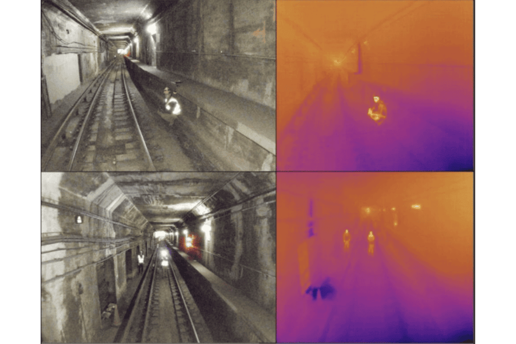
Credit: MFE Inspection Solutions
You can add subway inspections and subway search and rescue to the list of use cases for Flyability’s Elios 3. These capabilities were demonstrated in a recent mission in which the Elios 3 was used to navigate the challenging Chicago subway system during U.S. Department of Transportation (DOT) tests. In the tests, MFE Inspection Solutions clients Enspect Engineering, partnering with MTRI Inc., showcased the Elios 3’s ability to create real-time 3D maps, fly without GPS, and operate in low-light conditions, all while tolerating collisions in confined spaces, highlighting its suitability for underground inspections and emergency response. The Elios 3’s LiDAR, visual, and thermal data collection capabilities impressed D.O.T. officials, who used the drone for defect detection, heat mapping, and locating people in need of rescue.
LEARN MORE
Make sure to sign up for our free weekly newsletter using the button below so you can get our weekly newsletter every Saturday, with this roundup and our other featured stories from the week.


