

Drone Inspections Explained: How It Works, Use Cases & More
BY Zacc Dukowitz
4 March 2026In a drone inspection, a professional drone pilot uses a drone to collect inspection data on buildings, infrastructure, or industrial assets.
Because drones can collect this data remotely, inspectors can stay at a safe distance and avoid placing themselves in harm’s way.
Today, drone inspections are used in a wide range of industries—from oil and gas and utilities to construction, roofing, solar, wind energy, and public infrastructure.
Drones can’t replace every traditional inspection method. But in many cases they reduce risk, lower cost, and improve access to hard-to-reach areas.
In this guide, we’ll break down what drone inspections are, the technology and sensors they rely on, where they’re used across different industries, and how drone pilots can start getting inspection work.
Here’s everything we cover in case you’d like to jump around:
- What Is a Drone Inspection?
- Types of Drone Inspection Technology
- Where Drones Are Used for Inspections
- How Drone Inspections Work
- How to Get Drone Inspection Work
- How Much Do Drone Inspections Cost?
- Drone Inspections FAQ
What Is a Drone Inspection?
A drone inspection is the use of an inspection drone to evaluate the condition of an asset by capturing visual or sensor-based data from the air.
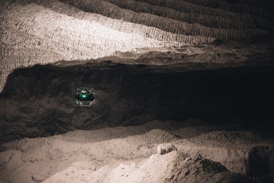
Flyability’s Elios 3 is designed for drone inspections in confined spaces
The term covers a wide range of applications. Depending on the industry and the equipment used, a drone inspection may be:
- Visual inspections (RVI): High-resolution photos or video used to check for corrosion, cracks, damage, missing components, or general wear.
- Thermal inspections: Infrared imaging used to detect heat anomalies in electrical systems, solar panels, roofs, and mechanical equipment.
- LiDAR inspections: Laser scanning used to generate 3D models or measure distances and vegetation encroachment.
- Non-destructive testing (NDT): Advanced payloads like ultrasonic thickness (UT) sensors used to measure material integrity.
- Gas detection: Optical gas imaging (OGI) systems used to visualize hydrocarbon leaks.
Some inspections are performed outdoors on large assets like power lines or wind turbines.
Others take place inside tanks, boilers, or industrial facilities using specialized indoor drones where GPS is unavailable. The equipment, flight plan, and reporting process vary depending on the environment and the data required.
Where Drone Inspections Win
Drone inspections can reduce exposure to working at height and make it easier to document asset conditions. But drone data isn’t automatically “proof” of the presence of a defect.
In practice, drones are strongest as a screening and documentation tool:
- They’re great for spotting obvious issues, documenting condition, and helping teams prioritize follow-up work
- They can capture repeatable visuals over time, which helps with change detection and maintenance planning
But there are limitations:
- Small defects can be missed if flight distance, lighting, or resolution aren’t sufficient
- Thermal, LiDAR, and other sensors can be misinterpreted without the right settings and training
- Many high-stakes findings still require confirmation (closer inspection, hands-on verification, or a dedicated NDT method)
The Evolution of Drone Inspections
Drone inspections have evolved slowly over about two decades as the technology has matured.
What began as experimental aerial photography has gradually become a serious inspection workflow used across energy, infrastructure, construction, and industrial facilities.
At a high level, the evolution of drone inspections can be broken into three phases:
Phase 1: Early Experimentation—Mid-2000s–Early 2010s
In the early days of commercial drones, they were occasionally used to capture aerial photos of towers, roofs, and construction sites, but reliability and image quality were limited.
But most drones lacked stabilized cameras, flight automation, or professional workflows, so the technology was used mainly for simple visual documentation rather than structured inspections.
Phase 2: Commercial Adoption—Mid-2010s
The release of stabilized camera drones and the introduction of the FAA’s Part 107 rule in 2016 marked a turning point. Drones became practical tools for industries like utilities, construction, and energy.
Utilities began inspecting power lines and transmission towers, construction firms used drones to document site progress, and photogrammetry software made it possible to generate maps and 3D models.
Phase 3: Sensor expansion and industrial workflows—Late 2010s–today
Today, drone inspections are widely used as a data collection method across many industries. New sensor payloads and specialized platforms have opened the door to more advanced inspection methods.
We’re seeing an array of sophisticated sensors designed for advanced data collection, from optical gas imaging (OGI) cameras to contact-based drones that can perform ultrasonic thickness (UT) testing.
In many cases, drones serve as a first-pass screening tool—allowing teams to quickly document asset conditions, identify potential issues, and decide where more detailed follow-up inspection or maintenance may be required.
Credit: DJI
Drone Inspections vs. Traditional Inspections
Drone inspections are often faster and lower-risk than traditional methods, especially for initial screening and documentation.
But they’re not always a full replacement.
In many industries, drone data is used to identify areas of concern, then a hands-on inspection or specialized NDT method is used to confirm findings.
Here’s the breakdown:
| Method | Strengths | Tradeoffs | Best fit |
|---|---|---|---|
| Drone inspection | Reduces working-at-height exposure, rapid access to hard-to-reach areas, repeatable documentation, scalable data capture | May not confirm root cause; results depend on sensor, access, and operator skill; some environments require specialized drones | Screening, documentation, routine monitoring, pre-work planning |
| Rope access | Hands-on access; can perform contact inspection and some repairs in the same mobilization | Higher personnel exposure; requires setup and specialized crews; can be slower and more costly | Close verification, repair work, detailed hands-on assessment |
| Scaffolding / lifts | Stable access for detailed inspection and repairs; good for long-duration work | Time-consuming setup; expensive; adds site disruption and safety planning | Projects where extended hands-on work is required |
| Crewed aircraft (helicopter / plane) | Covers large corridors quickly (in the right contexts) | Higher cost and risk; lower proximity in many cases; scheduling complexity | Large-area surveys where drones are impractical or restricted |
| Ground-based inspection | Simple and low-cost for accessible assets; minimal complexity | Limited line of sight; can miss elevated/hidden features | Low structures, accessible equipment, quick checks |
A practical rule of thumb: drone inspections are strongest when they reduce unnecessary exposure and help you target follow-up work.
Types of Drone Inspection Technology
Drone inspections aren’t just one thing.
The same drone inspection job might be purely visual—or it might require thermal imaging, LiDAR, or specialized sensors used in industrial settings.
The right tool depends on what you’re trying to detect or measure:
| Inspection type | What it collects | Common uses | Best for | Limits to know |
|---|---|---|---|---|
| Visual (RGB) | Photos / video | General condition checks, corrosion/coating issues, missing components, damage documentation | Fast screening and documentation | Can’t “see through” materials; small defects may require close range and good lighting |
| Thermal (IR) | Heat signatures | Electrical hotspots, solar module performance issues, roof moisture indicators (context-dependent) | Finding temperature anomalies worth investigating | Interpretation matters; environmental conditions and settings can produce misleading results |
| LiDAR | 3D point clouds / distance measurements | Corridor mapping, vegetation encroachment, volumetrics, 3D modeling of assets and terrain | Measurement and modeling where accuracy and repeatability matter | More expensive workflow; quality depends on calibration, flight planning, and processing |
| Photogrammetry | 2D maps / 3D models built from images | Construction progress, stockpiles, site mapping, “as-built” capture | Mapping and documentation at scale | Needs correct overlap and a solid accuracy approach (RTK and/or ground control) for higher-precision results |
| Ultrasonic Thickness (UT) | Material thickness readings | Corrosion assessment on tanks, pipes, and other metal assets (specialized) | NDT measurement where thickness data is required | Typically requires specialized methods, trained personnel, and strict procedures |
| Optical Gas Imaging (OGI) | Gas plume visualization (certain gases) | Methane/hydrocarbon leak detection and documentation (specialized) | Screening for leaks in oil and gas contexts | Not all gases are visible; environmental conditions and camera capability matter |
Note: This chart isn’t exhaustive. There are other types of inspection data you can collect by drone, including EMAT (Electromagnetic Acoustic Transducer), PEC (Pulsed Eddy Current), and DFT (Dry Film Thickness).
Case Study: Drone-Based Ultrasonic Testing for Industrial Stack Inspections
Sometimes you need several drones to complete a single inspection.
For this mission, inspection service provider Acuren created a workflow that used three different drones—the Voliro T, the Elios 3, and the DJI Matrice 350—to inspect multiple refinery stacks for corrosion and structural integrity.
The three-drone workflow let them capture different types of inspection data across the entire stack:
- External UT measurements were collected using the Voliro T inspection drone, which can press a UT probe directly against metal surfaces to measure remaining wall thickness.
- Internal visual inspections were performed using the Elios 3, allowing inspectors to access areas inside the stack that would normally require hazardous entry.
- Thermal imaging with the Matrice 350 helped identify potential heat-related anomalies and prioritize areas for closer inspection.
The Voliro T equipped with a UT sensor
By combining these three drones, the Acuren team was able to get more complete coverage of stack integrity, capturing UT measurements and visual data in areas that were previously difficult or even impossible to reach.
Read the full case study here on the MFE website.
Where Drones Are Used for Inspections
The real value of drone inspections comes from matching the right flight approach and sensor to the inspection requirement—and capturing usable data.
Here are some of the most common uses for inspection drones.
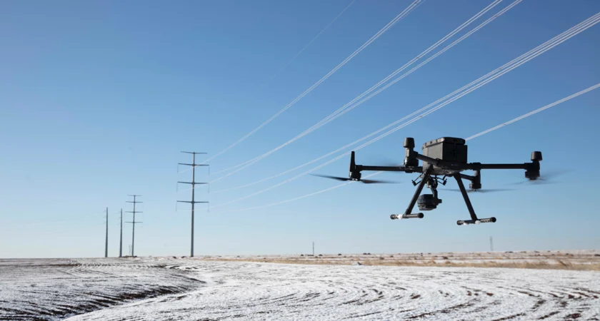
1. Utilities and Power
Typical assets inspected: transmission towers, power lines, substations, pole hardware
Electric utilities were among the earliest adopters of drone inspections. Power infrastructure is often elevated, remote, and distributed across long distances—making aerial inspection especially valuable.
Here’s how drones are commonly used in utilities and power today:
- Inspecting transmission towers and pole hardware for corrosion, loose components, or structural damage
- Scanning substations and electrical equipment with thermal cameras to detect overheating components
- Monitoring vegetation encroachment along power line corridors using LiDAR or visual imagery
2. Oil and Gas
The MFE Detect LW OGI camera on a Matrice 350 RTK
Typical assets inspected: storage tanks, stacks, flare systems, pipelines, refinery structures
Drone inspections are widely used in oil and gas facilities, where assets are large, complex, and often hazardous to access directly. Drones help teams document asset conditions without exposing workers to confined spaces or high structures.
Here’s how drones are commonly used in oil and gas today:
- Inspecting storage tanks, stacks, flare systems, and refinery structures for visible damage, corrosion, or coating issues
- Using optical gas imaging (OGI) cameras to screen for methane or hydrocarbon leaks (when conditions and equipment allow)
- Collecting targeted measurement data (such as ultrasonic thickness) or visual corrosion evidence in areas that are difficult to access manually
Wind Energy
Typical assets inspected: turbine blades, towers, nacelles, lightning protection systems
Wind turbine inspections are one of the most established drone inspection applications. Turbine blades and towers are difficult to access manually, and drones can capture detailed imagery in a fraction of the time.
Here’s how drones are commonly used in wind energy today:
- Inspecting blade surfaces for cracks, lightning strikes, and leading-edge erosion
- Capturing high-resolution imagery for maintenance planning and damage documentation
- Monitoring tower and nacelle condition during routine maintenance cycles
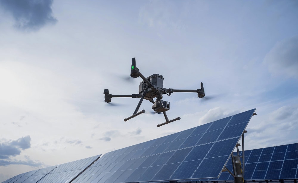
Solar Energy
Typical assets inspected: solar panels, inverter stations, mounting structures, electrical strings
Large solar installations often span hundreds or thousands of panels. Drone inspections allow operators to screen entire solar arrays quickly and identify underperforming modules.
Here’s how drones are commonly used in solar energy today:
- Using thermal imaging to detect hotspots or underperforming modules
- Mapping solar farms to document panel condition and layout changes over time
- Identifying physical damage such as cracked panels, debris accumulation, or loose mounting hardware
Construction
Drone shot of a construction site | Credit: 4Blades Digital
Typical assets inspected: building facades, earthworks, structural steel, concrete structures
In construction, drones are used both for inspection and for ongoing project documentation. They provide a way to capture progress data without interrupting site operations.
Here’s how drones are commonly used in construction today:
- Documenting construction progress with repeatable aerial imagery
- Measuring stockpiles and earthwork volumes using photogrammetry
- Inspecting building facades, structural elements, and hard-to-reach areas during construction
[Case Study: From Side Hustle to $250K a Year: How Calvin Ludwig Built 4Blades Digital Into a Construction Drone Powerhouse]
Roofing and Building Exteriors
Typical assets inspected: residential roofs, commercial flat roofs, chimneys, gutters, facade surfaces
Drone roof inspections are common in both residential and commercial property assessments. They allow inspectors to examine roofs and exterior structures without climbing onto steep or potentially unsafe surfaces.
Here’s how drones are commonly used in roofing today:
- Assessing storm damage, missing shingles, punctures, or other roof surface issues
- Documenting roof condition for insurance claims, maintenance planning, or repair records
- Inspecting tall building facades or architectural features that are difficult to reach safely
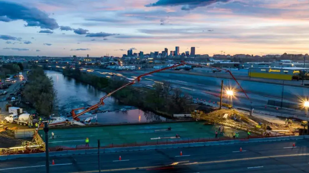
Transportation and Infrastructure

Credit: Skydio
Typical assets inspected: bridges, rail lines, highways, port infrastructure
Public infrastructure such as bridges, roads, and rail corridors often requires frequent inspection but can be difficult to access safely. Drone inspections provide a fast way to document structural conditions without extensive lane closures or scaffolding.
Here’s how drones are commonly used in transportation and infrastructure today:
- Inspecting bridge decks, piers, joints, and support structures with high-resolution imagery
- Monitoring rail corridors, roadways, and transportation right-of-ways for visible issues and changes
- Capturing imagery for condition documentation and maintenance planning—especially in hard-to-access areas
Industrial Facilities and Confined Spaces

A Flyability Elios 2 flies into a confined space for an industrial inspection
Typical assets inspected: tanks, vessels, boilers, stacks, silos
Some inspections take place inside tanks, boilers, silos, or other confined spaces where GPS signals are limited or unavailable. Specialized indoor drones allow operators to inspect these environments without sending personnel inside.
Here’s how drones are commonly used for industrial inspections today:
- Inspecting internal structures where access would otherwise require rope access or manned entry
- Documenting corrosion, buildup, deformation, or structural damage inside confined spaces
- Capturing visual data in GPS-denied environments using drones designed for indoor flight
How Drone Inspections Work
While the details vary by industry, most drone inspections follow the same general workflow: define the inspection goal, collect the right data safely, then turn that data into something useful for decision-making.
The steps below walk you through the process, from initial planning to final reporting.
1. Define the Inspection Goal and Deliverables
Every drone inspection should start with a clear definition of what the inspection is meant to accomplish. The goal determines everything that follows—from sensor selection to flight distance and reporting format.
Common inspection objectives include:
- Identifying visible damage, corrosion, or missing components
- Monitoring condition changes over time
- Screening for heat anomalies or electrical faults
- Generating measurements, models, or maps
It’s equally important to define the expected deliverables before the flight begins. For example:
- A folder of high-resolution inspection photos
- A photogrammetry map or 3D model
- A written inspection report with annotated findings
2. Plan the Mission
Once the inspection objective is clear, the next step is planning the mission. This includes reviewing the environment, identifying hazards, and determining how the aircraft will safely access the inspection area.
In industrial environments, planning may also involve coordination with site safety personnel, operational shutdown windows, or escort requirements.
Important planning considerations typically include:
- Site access points and takeoff/landing zones
- Nearby obstacles like towers, cables, cranes, or buildings
- Weather conditions, including wind and lighting
- GPS reliability or potential signal interference
- Airspace restrictions that may require authorization
3. Choose the Right Drone and Sensor
The inspection goal determines which aircraft and sensor payload are appropriate. Many drone inspections use a standard high-resolution camera, but more specialized inspections require additional technology.
Matching the right sensor to the inspection objective is often more important than the drone itself. A high-end platform won’t produce useful results if the sensor or capture method isn’t suited to the task.
Common payload choices include:
- RGB cameras for visual inspections and documentation
- Thermal cameras for detecting heat anomalies
- LiDAR sensors for precise mapping and 3D modeling
- Photogrammetry workflows for generating maps or digital twins
- Specialized NDT sensors for measurements like ultrasonic thickness
4. Plan the Flight Path
For inspections that will be repeated over time, consistency matters. Capturing images from similar angles and distances makes it easier to compare results across months or years.
Operators often standardize key capture parameters, such as:
- Flight altitude and distance from the asset
- Camera angle and inspection approach path
- Image overlap for mapping or modeling
- Camera settings such as shutter speed or thermal range
5. Fly the Mission and Get the Data
With the plan in place, the operator flies the inspection mission and captures the required data. Depending on the inspection type, this might involve hovering close to specific components, following a linear path along infrastructure, or executing a mapping grid.
During this stage, operators focus on:
- Maintaining safe separation from structures and people
- Capturing imagery from the angles defined in the inspection plan
- Monitoring battery levels and flight safety
- Ensuring each inspection area is fully documented
6. Review Data Quality
Before leaving the inspection site, most operators perform a quick review of the collected data. This step helps confirm that the images and sensor readings are usable and that no critical areas were missed.
If an issue is spotted during this review, it’s usually far easier to capture additional imagery immediately than to schedule another visit later.
A typical on-site review may include:
- Checking that key inspection areas were captured clearly
- Confirming images are sharp and properly exposed
- Verifying thermal or sensor data appears complete
- Ensuring enough overlap exists for mapping or modeling workflows
7. Process the Data
Once the flight is complete, the raw inspection data needs to be processed. This is where the inspection actually turns into usable information.
Sometimes, the data is also analyzed by the drone pilot or a colleague. Sometimes, it’s passed on to the client for analysis.
Depending on the inspection type, this stage may include:
- Organizing and labeling captured images
- Annotating defects or areas of concern
- Generating orthomosaic maps or 3D models
- Extracting measurements from LiDAR or photogrammetry data
- Reviewing thermal anomalies for possible equipment issues
8. Deliver the Data
The final step in the inspection workflow is reporting. The goal is to transform the captured data into something that helps engineers, maintenance teams, or asset owners make decisions.
Drone inspection reports commonly include:
- Annotated images highlighting observed issues
- Thermal imagery with anomaly notes
- Maps, measurements, or models when relevant
- A summary of observations and recommended follow-up actions
The format varies widely by industry. A simple inspection might produce a short image report, while an industrial inspection may require a structured engineering-style document.
Credit: DJI
How to Get Drone Inspection Work
Here’s a quick overview of the types of work out there for drone inspections:
| Inspection type | Typical jobs | Difficulty to enter | What you usually need |
|---|---|---|---|
| Entry-level visual inspections | Roof inspections, insurance documentation, property condition checks | Low | Part 107 certificate, camera drone, basic reporting workflow |
| Thermal inspections | Solar panel inspections, electrical hotspot detection, building envelope checks | Moderate | Thermal drone, training in thermal interpretation, stronger reporting |
| Industrial inspections | Wind turbines, power lines, tanks, stacks, bridges | High | Industry experience, specialized sensors, safety training, professional inspection workflows |
There’s a wide range of inspection work you can do with a drone.
Some inspection markets are fairly accessible with just a camera drone and Part 107 certification. Others require specialized equipment, industry experience, and additional training.
Let’s take a closer look at the three buckets this work typically falls into:
1. Entry-Level Drone Inspections
These are inspections like roofing, insurance, and property assessments
For many pilots, the easiest place to start is with simple visual inspections. These jobs typically involve capturing high-resolution imagery of roofs, building exteriors, or storm damage for property owners, contractors, or insurance adjusters.
- Roof inspections for homeowners, roofing companies, and property managers
- Storm damage documentation for insurance claims
- Exterior building condition checks for real estate or maintenance planning
- Basic visual inspections for small commercial properties
Many pilots find these opportunities by partnering with roofing companies, inspection firms, property managers, or local contractors who already perform site assessments.
2. Thermal and Technical Drone Inspections
A step up from basic visual work involves inspections that use specialized sensors, most commonly thermal cameras. These inspections often require additional training and a deeper understanding of how to interpret sensor data.
- Solar panel inspections to identify underperforming modules
- Electrical system screening for hotspots
- Building envelope inspections looking for heat loss or moisture intrusion
Because interpreting thermal data correctly matters, many companies prefer pilots who have completed thermal inspection training or who work alongside experienced inspectors.
3. Industrial Inspection Work
The highest-value drone inspection work is often found in industrial environments such as energy, utilities, manufacturing, and large infrastructure. These projects tend to involve complex assets, strict safety requirements, and specialized sensors.
- Wind turbine blade inspections
- Power line and transmission tower inspections
- Oil and gas facility inspections (tanks, stacks, flare systems)
- Bridge and infrastructure condition documentation
Breaking into this segment usually requires more than just drone skills. Many operators build experience in the industry they serve—such as electrical utilities, construction, or mechanical inspection—and then add drone capabilities to that background.
Where Drone Pilots Can Find Inspection Work
Most drone inspection work comes from a small number of predictable channels.
The difference between “I’m looking for work” and “I’m getting calls” is whether you have a clear offer and a repeatable outreach process.
1) Start with local service businesses that already sell inspections
These companies already have inspection demand. They’re often looking for a way to deliver faster, safer documentation.
- Roofing companies: pre-quote roof assessments, storm damage documentation, hard-to-walk roofs
- Property managers: periodic exterior condition documentation for multi-tenant and commercial properties
- Solar installers: post-install documentation, troubleshooting support, basic thermal screening (if qualified)
- General contractors: exterior documentation and progress capture on active jobsites
What to offer (keep it simple):
- A fixed-price “inspection photo package” with clear deliverables (labeled photos + brief summary)
- 48-hour turnaround
- Optional add-on: follow-up flight after repairs or after the next storm
2) Subcontract for companies that already win the big jobs
Many pilots don’t land industrial work directly at first. They land it through companies that already hold the relationship and just need a qualified drone operator.
- Inspection service providers (NDT firms, field service companies)
- Engineering firms and survey firms (when drone capture supports their deliverables)
- Industrial drone service providers who need overflow capacity
How to position yourself:
- Lead with reliability: safety mindset, documentation, and repeatable capture—not “cool drone footage”
- Be clear about what you can deliver: visual, thermal, mapping, confined space support, etc.
- Be honest about limits and what requires additional expertise or certification
3) Get on vendor lists once you have proof of work
Vendor lists tend to be easier after you have a small portfolio and a consistent workflow.
- Build a 1-page capability sheet (services, deliverables, coverage area, insurance, turnaround)
- Have 2–3 sample deliverables ready (what the client actually receives)
- Make it easy to rebook you (simple scheduling + simple pricing for common jobs)
4) Use relationships to turn one job into ongoing work
Inspection work becomes a business when it repeats. You earn repeats by making the client’s job easier.
- Deliver organized files (clear labels, simple structure, no “IMG_4938.jpg” chaos)
- Communicate constraints up front (airspace, weather, access) so there are no surprises
- Offer a basic routine cadence (quarterly exterior checks, post-storm flyovers, annual documentation)
How Much Do Drone Inspections Cost?
Drone inspection cost varies a lot because “drone inspection” can mean anything from a quick visual roof check to a multi-day industrial inspection with specialized sensors and formal reporting.
In practice, pricing tends to fall into a few common buckets:
| Pricing model | Typical range (commonly reported) | Usually includes |
|---|---|---|
| Hourly rate | About $200–$700+ per hour depending on experience, risk, and deliverables | Flight time + data capture; analysis/reporting may be included or billed separately |
| Per-project (simple visual inspection) | Often a few hundred dollars for smaller, straightforward jobs | Site visit + photos/video + basic summary |
| Thermal / specialized inspection | Often higher than basic visual work (scope-based) | Thermal capture + interpretation/analysis + more detailed reporting |
| Industrial / enterprise inspections | Frequently custom-quoted (scope-based) | Formal planning, safety requirements, repeatable capture, analysis, and structured reporting |
What drives the price up (or down) comes down to scope and risk:
- Access and environment: A clear residential roof is very different from an operating industrial site or a confined-space environment.
- Sensor requirements: Visual capture is usually the baseline. Thermal, LiDAR, UT, and OGI generally add equipment and expertise costs.
- Reporting depth: A folder of labeled images is different from a formal report with findings, annotations, measurements, and recommendations.
- Turnaround time: Rush delivery typically increases cost.
- Travel and site requirements: Mobilization, escorts, safety briefings, PPE, and scheduling constraints all matter.
If you’re comparing quotes, a good way to keep things apples-to-apples is to ask for two things in writing: (1) what data you’ll receive (and in what format), and (2) what decisions that data can reasonably support without additional follow-up inspection.
Drone Inspections FAQ
Here are answers to some of the most commonly asked questions about drone inspections.
Do you need a license for drone inspections?
In the U.S., if you’re performing drone inspections for compensation or as part of a business, the pilot typically needs an FAA Remote Pilot Certificate under Part 107. Even if the drone flight is “just taking photos,” it’s still considered a commercial operation when it’s tied to business activity.
How long does a drone inspection take?
It depends on the asset size, complexity, access constraints, and what data is required. A simple visual inspection might take less than an hour on site, while a complex industrial inspection can take multiple flights and more time for setup, safety coordination, and data review.
Can drone inspections replace traditional inspections?
Sometimes, but not always. Drone inspections are often best for screening and documentation—helping you identify areas of concern and plan follow-up work. Many high-stakes inspections still require hands-on verification or specialized NDT methods to confirm a finding.
What’s the difference between a visual inspection and a thermal drone inspection?
A visual inspection uses a standard camera to document what the surface looks like (damage, corrosion, missing components, etc.). A thermal inspection uses an infrared camera to detect temperature differences that may indicate an electrical issue, underperforming equipment, or another anomaly that needs follow-up.
Do I need special equipment for industrial drone inspections?
Often, yes. Some industrial drone inspections require specialized payloads (like thermal, LiDAR, or UT-capable systems), plus a workflow for processing and interpreting the data. In many cases, the sensor and reporting capability matter more than the aircraft itself.
What should I ask before hiring a drone inspection provider?
Ask what data you’ll receive, what the reporting will look like, and what decisions the deliverable is designed to support. It’s also reasonable to confirm that they operate under Part 107 (for U.S. commercial work) and understand the airspace and site constraints for your location.


