

CUAS Explained: How It Works and What’s Legal in the U.S.
BY Zacc Dukowitz
17 February 2026CUAS (also written C-UAS) is short for “counter-unmanned aircraft systems” and is an umbrella term for anti-drone tools and systems.
CUAS terminology note: In practice, “CUAS,” “C-UAS,” “counter-UAS,” “counter UAV,” and “counter small UAS” all refer to dealing with rogue drones. You’ll also see “counter-drone” and “anti-drone” used, especially in marketing materials.
The exact label matters less than what the system actually does:
- Detection and identification
- Mitigation (i.e., taking the drone down)
- Or both
According to federal law, interfering with aircraft or radio communications—including jamming, disabling, or seizing control of a drone—is prohibited. Only entities with specific authority can take down a drone, but your average person on the street can’t. And a private company typically can’t either.
This is why, when organizations talk about CUAS, they often mean detection, identification, and coordination with the authorities, and not just taking down drones.
This guide covers CUAS in depth, looking at how CUAS systems work, common technologies involved, and what’s legal in the U.S.
Here are all the topics we cover:
- What Is CUAS?
- How CUAS Systems Work
- Common CUAS Technologies
- What’s Legal in the U.S.
- Who Uses CUAS
- How CUAS Technology Gets Tested and Evaluated
- CUAS FAQ
What Is CUAS?
CUAS refers to technology used to detect, track, identify, and take down rogue drones.
Common technologies used in CUAS include radar, radio frequency (RF) detection, electro-optical and infrared cameras, acoustic sensors, and—when authorized—tools like drone jammers designed to disrupt or disable a drone’s operation.
But even an eagle trained to take down a drone could also be considered CUAS. (And yes, this approach has been tested, and apparently works pretty well.)
Why CUAS Exists
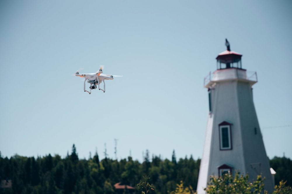
As drone ownership has grown, rogue drones have become more and more common. And that means we have to plan for them.
Note: A rogue drone is any drone flying in a way that is unauthorized, unsafe, or non-compliant with applicable airspace rules or security restrictions.
For example:
- An unauthorized drone flying over an NFL football game
- An unauthorized drone flying near a prison
- An unauthorized drone flying in a national park
CUAS is the response to the growth in rogue drones.
Building a reliable way to notice a drone, understand what it’s doing, and decide what to do next is now a necessity for any open-air event, whether it’s a football game or a political speech.
CUAS Is a System, Not a Single Tool
Because no single sensor is reliable in every environment, CUAS is typically a layered capability that includes:
- Sensors to detect and track
- Methods to confirm what’s really there
- Procedures that govern how alerts get handled
Using multiple data sources and making sure to include human review can help increase overall coverage. But the hard part of creating a reliable CUAS system isn’t finding the right sensors—it’s setting everything up so it actually works.
This is why two organizations can use similar hardware and get very different outcomes depending on how they define alerts, reduce false positives, and coordinate escalation.
What CUAS Is Not
CUAS is often misunderstood as only drone takedowns. This is understandable, because these are the stories we hear most often in the news.
But CUAS doesn’t just mean jamming, hacking, or disabling drones. In many real-world deployments, the focus is detection and identification—not takedowns.
CUAS is also not a consumer product. It’s typically an organizational capability governed by policy, legal authority, and trained personnel.
And CUAS is not one-size-fits-all. What’s realistic at a military base is very different from what’s appropriate at a stadium, airport, or power plant. Authorities, airspace rules, and risk tolerance all inform the CUAS approach for a given area and occasion.
A Brief History of CUAS
For most of the 2000s, consumer drones weren’t good enough to pose much of a risk to the public. Most of them were limited in range, capability, and availability.
But things changed in the 2010s, when consumer and commercial drones became inexpensive, easy to fly, and widely adopted.
As drones became more common, so did incidents: unauthorized flights over stadiums, disruptions near airports, contraband drops into correctional facilities, and battlefield use of small unmanned systems overseas.
What had been an occasional nuisance became a recurring operational challenge. To meet the challenge, CUAS began growing in importance, and in sophistication.
Here’s a quick overview of the history of CUAS:
- Late 2010s: Defense and security communities formalized “counter-small UAS” efforts as small drones became a persistent operational problem, pushing the need for standard doctrine, requirements, and evaluation.
- 2019–2021: The U.S. Department of Defense (DOD) published a dedicated counter-small UAS strategy and described establishing a joint office to synchronize counter-UAS work across services, signaling that counter-UAS had become a formal capability area, not an ad hoc problem.
- 2020: U.S. federal agencies issued public advisory guidance describing how U.S. laws can apply to detecting and mitigating threats posed by UAS operations, an indicator that the legal side of “counter-UAS” was becoming part of the mainstream conversation.
- 2022: Congress extended and incrementally expanded federal counter‑UAS authorities for the Department of Homeland Security and Department of Justice, reauthorizing their ability to detect, track, and, in limited cases, take down malicious drones around certain protected facilities and events through the mid‑2020s.
- 2023–2024: The DoD continued to refine its counter‑UAS posture, with Congress directing updated reporting and acquisition practices for counter‑UAS programs and DoD issuing an updated strategy focused on rapidly fielding scalable, affordable systems and synchronizing efforts with allies and other federal agencies.
- 2025: Counter-UAS remained a high legislative priority, with the FY 2026 NDAA continuing to strengthen DoD counter-drone authorities and emphasizing improved interagency coordination, reporting, and guardrails around any use of counter-UAS technologies.
- 2026: Federal investment and organizational have focused on counter-UAS continued to accelerate, with DHS creating a dedicated program office focused on unmanned aircraft systems and counter-UAS—signaling that C-UAS is being treated as an ongoing capability area, not a one-off problem.
How CUAS Systems Work
Most CUAS systems do the same job: turn “something is in the sky” into data you can act on.
In practice, that looks like a simple chain:
- Detect something that could be a drone.
- Track it: where it is, where it came from, and where it’s heading.
- Identify it with enough confidence to avoid chasing false alarms.
- Assess whether it’s a safety, security, or operational issue.
- Respond in a way that’s appropriate and legally allowed.
That last step is where people tend to misunderstand CUAS.
In many real-world deployments, “respond” means alerting the right people, documenting what happened, and coordinating next steps—not automatically taking a drone down.
1. Detection
Detection answers the first question: is there something in the air that could be a drone?
Depending on the setup, detection might come from radar, RF sensing, cameras cued by other sensors, acoustic detection, or a combination. The goal isn’t “detect everything.” It’s “detect reliably enough that someone trusts the alert.”
2. Tracking
Tracking answers the next question: where is it now, and what is it doing over time?
This is where CUAS starts producing operationally useful information—position, movement, direction of travel, and whether the object is lingering, approaching, or leaving. Because every sensor has blind spots, CUAS systems often combine multiple inputs to improve coverage and reduce false positives.
3. Identification and Classification
Once something is detected and tracked, the system has to separate signal from noise. This is where CUAS either earns confidence, or burns it.
“Identification” can mean a few things:
- Confirming it’s actually a drone (not a bird, balloon, or unrelated RF source).
- Classifying the situation (benign, unknown, suspicious) based on behavior and context.
- Determining whether it’s cooperative (broadcasting expected signals like Remote ID) or non-cooperative (not broadcasting, spoofed, or behaving in a way that doesn’t match what’s expected).
Importantly, identification is rarely a single “yes/no” moment. Good CUAS systems build confidence by correlating signals across sensors and time, then presenting a clearer picture to a human decision-maker.
Where Remote ID fits: A “cooperative” drone is one that broadcasts expected identifiers (such as Remote ID) and behaves in a way that’s consistent with compliant flight. A “non-cooperative” drone may not broadcast Remote ID, may be out of range of receivers, may be misconfigured, or may be intentionally operating without those signals.
That’s why CUAS systems can’t assume Remote ID will always be present or reliably received—many deployments still plan for a mix of cooperative and non-cooperative activity.
4. Assessment and Decision-Making
This is the part that can get glossed over: what happens between an alert and an action.
Assessment is where an organization applies rules, context, and risk:
- Is this drone actually inside a protected area, or just nearby?
- Is it moving toward people, critical infrastructure, or an event?
- Do we have enough confidence to escalate, or do we need verification first?
In other words, CUAS is as much about avoiding bad decisions as it is about spotting drones. A system that “detects everything” but overwhelms staff with noise isn’t a safety upgrade, it’s just a new problem.
5. Response vs. Mitigation
Response is the full set of actions taken after a drone is detected: notifying staff, logging the incident, dispatching observers, coordinating with law enforcement, or initiating site protocols.
Mitigation is a narrower category: actively interfering with the drone’s ability to operate. Because mitigation can create safety risks and implicate federal law, many organizations treat it as a tightly controlled last resort that requires specific authority and clear procedures.
That’s why you’ll see many CUAS deployments focus heavily on detection, tracking, identification, and coordination. Those pieces create real value on their own—and they’re the foundation you need before “take it down” is even a responsible conversation.
Common CUAS Technologies
Most CUAS systems use more than one sensor type for the same reason pilots use more than one reference in the cockpit: any single input can be wrong.
Radar might see “something,” but not tell you what it is. RF might tell you “a controller is nearby,” but not where the aircraft is. Cameras can confirm visually—but only if conditions cooperate.
So real deployments layer sensors and fuse the data to answer three questions that actually matter:
- Is it a drone?
- Where is it and what is it doing?
- How confident are we before we escalate?
This chart provides an overview of the most commonly used CUAS technologies:
| Technology | What It’s Good At | Common Limitations |
|---|---|---|
| Radar | Detecting objects at range and tracking movement over time, especially when the drone is beyond visual range. | Small drones can be hard to separate from clutter (trees, buildings, terrain); performance varies by radar type and environment. |
| RF (Radio Frequency) Detection | Detecting drone-related radio emissions and, in some cases, helping infer the presence of an aircraft and/or pilot activity. | Limited when a drone is autonomous, using uncommon links, or operating with minimal/no detectable RF; dense RF environments can create noise. |
| Optical / EO/IR Cameras | Visual confirmation and classification—turning “possible drone” into “yes, that’s a quadcopter” (or “no, that’s a bird”). | Line-of-sight, lighting, weather, and occlusion can degrade performance; cameras often need a cue from another sensor to know where to look. |
| Acoustic Sensors | Detecting distinctive drone sound profiles in some environments, especially at closer ranges. | Background noise (traffic, crowds, wind) and distance can reduce reliability; performance varies widely by environment. |
In practice, the value isn’t any one sensor. It’s the combination.
A CUAS setup that can correlate an RF hit with a radar track and then hand a camera an exact point to look at will usually outperform a “single-sensor” system, even if the individual components are similar.
Mitigation Options
Mitigation is the part of CUAS everyone jumps to, and it’s also the part most organizations take very seriously.
At a high level, mitigation means taking an active step intended to stop, disrupt, or control a drone’s flight or operation.
It can introduce real safety risk, and in the U.S. it also has strict legal limits.
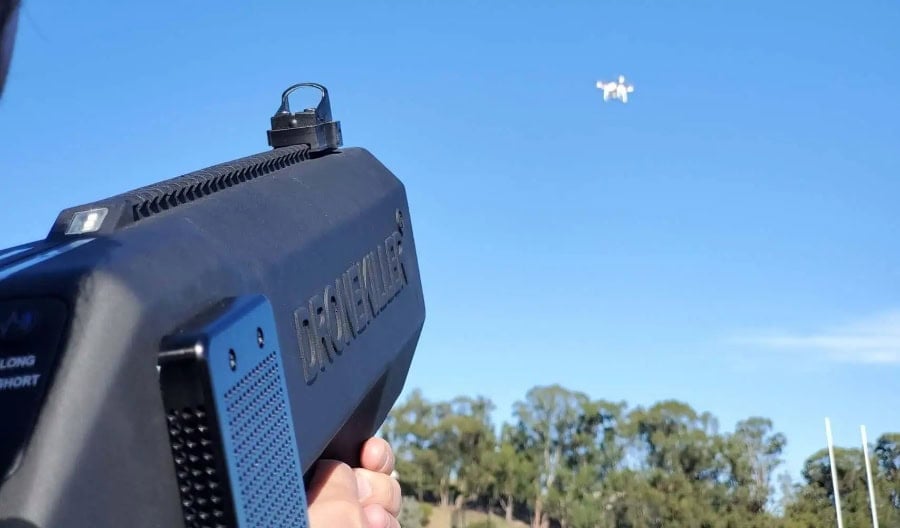
Credit: DroneKiller
Here are the most common mitigation options for CUAS:
1. Electronic Interference
This category aims to disrupt a drone’s ability to receive commands or navigate by interfering with signals.
When people talk about “jamming,” this is usually what they mean, but the umbrella is broader than that.
Examples of electronic interference CUAS:
- Disrupting command-and-control links (preventing the aircraft from receiving pilot inputs)
- Disrupting satellite navigation reception (degrading a drone’s ability to use GNSS for position hold or return-to-home)
- Creating a “denied” bubble in a limited area (intended to force the drone into a failsafe behavior)
Reality check: effectiveness depends on the drone’s link type, power, antenna orientation, environment, and built-in failsafes—plus whether the operator is close, skilled, and persistent.
2. Protocol or Cyber Takeover
This category is often described in marketing as “taking control” of a drone, but the practical reality is narrower: it depends heavily on the drone’s make/model, firmware, how it’s configured, and whether the system can interact with it in a way that actually changes behavior.
Examples of cyber takeover CUAS:
- Attempting to force a landing or “return” behavior through known command pathways
- Leveraging manufacturer- or ecosystem-specific interfaces (where applicable)
- Using a system’s awareness of the drone’s protocol to attempt a controlled outcome
Reality check: this is not a universal capability. The more modern and secured the platform, the harder “takeover” becomes—and legal authority is a gating issue even when it’s technically feasible.
3. Physical Capture
This category uses physical means to intercept, disable, or capture a drone without relying on radio interference. It’s often discussed as an option when RF-based approaches aren’t viable—but it introduces its own safety and liability considerations.
Examples of physical capture CUAS:
- Capture methods designed to entangle or contain the drone
- Interception approaches that aim to remove the drone from a protected area
- Physical barriers or containment concepts in controlled environments
Reality check: anything physical creates risk to bystanders and property. Even “clean” captures can go wrong if the drone falls unpredictably or reacts to interference.
4. Directed Energy
This category refers to systems that use focused energy to disable a drone. It’s typically associated with specialized military or federal applications because of cost, safety controls, and governance requirements.
Examples of directed energy CUAS:
-
- Systems designed to disable electronics from a distance
- Platforms intended for high-consequence sites with strict operating controls
Reality check: not a realistic option for most civilian operators. It tends to be relevant in defense contexts or at very high-security facilities with dedicated programs and authorities.
Questions to Ask CUAS Vendors
If you’re comparing counter drone systems, these questions can help you find technology that will hold up in a real environment:
- What threat set was this tested against? Ask which drone types, flight profiles, and ranges were used, then compare that to your real risk.
- What does “detection” mean in your metrics? Clarify whether it’s first alert, continuous track, confirmed classification, or operator-verified detection.
- How do you measure false alarms and nuisance alerts? Ask for rates and examples in environments like yours (RF-dense, urban, near trees/buildings, crowds, etc.).
- What’s the identification path for cooperative vs. non-cooperative drones? Confirm how they use Remote ID and what happens when it isn’t present.
- What are the known blind spots? Every sensor has them. Ask where performance degrades and what “layering” is required to close gaps.
- What does the response look like operationally? Who gets alerted, what evidence is captured, how is escalation handled, and how does it integrate with existing security workflows?
- What mitigation capabilities are real vs. theoretical? Ask what is available under your legal authority, how it’s governed, and what safety controls are required.
What’s Legal in the U.S.
CUAS is as much a legal and policy topic as it is a technology topic.
In the U.S., the ability to actively interfere with a drone’s operation (for example, by disrupting its communications or navigation) is limited and context-specific.
That’s one reason many real-world CUAS deployments emphasize awareness and coordination more than hands-on disruption.
The FAA has also been tasked—through Section 383 of the FAA Reauthorization Act of 2018—with ensuring that authorized federal detection and mitigation technologies don’t interfere with the safe operation of the National Airspace System, and with developing a path toward certifying/permitting/authorizing these systems in the NAS.
Detection vs. Mitigation
It helps to separate two buckets that often get blurred in marketing:
- Detection / monitoring is about sensing what’s in the airspace—finding potential drones, tracking movement, and building enough confidence to make a decision.
- Mitigation is about taking action that affects a drone’s ability to operate (which can raise safety issues and trigger stricter legal constraints).
That’s why you’ll see many organizations stop at detection + identification, then hand off the situation to the appropriate authorities for actual mitigation.
Why Most Organizations Focus on Awareness
For airports, utilities, venues, and other private operators, CUAS usually means:
- Detecting and tracking activity near a protected area
- Documenting what happened (time, location, track history, supporting evidence)
- Assessing whether the flight is likely authorized or a safety/security issue
- Coordinating with law enforcement or other authorities when escalation is warranted
In other words: find it, confirm it, record it, and route it—because the “take direct control” part is not broadly available.
What This Means in Practice
If you’re a private company or property owner, you generally can’t treat an unknown drone like a nuisance you can simply “switch off.”
Even when mitigation is discussed at a high level, the real-world question becomes: who has the authority to do what, in this context, with what safety controls?
| Activity | General legal reality |
|---|---|
| Monitoring and detecting drones | Often feasible, but the details matter (technology choice, location, privacy considerations, and applicable laws/policies). |
| Interfering with communications or navigation | Highly restricted and typically associated with specific authorities and tightly controlled contexts. |
| Disabling or taking control of a drone | Not a “standard option” for most organizations; generally limited and controlled due to safety and legal constraints. |
Who Uses CUAS
CUAS shows up most often in places where an unauthorized drone could create a safety risk, a security incident, or an operational disruption.
The details vary, but the common thread is the same: decision-makers want reliable awareness of what’s in the air, and a clear path for escalation when something looks wrong.
Here are the places where CUAS is most commonly used today.
1. Airports
Airports care about the obvious: collision risk, runway incursions, and operational disruption.
In practice, CUAS discussions here tend to emphasize early detection, confident identification, and fast coordination—because even a small drone can trigger delays and safety protocols.
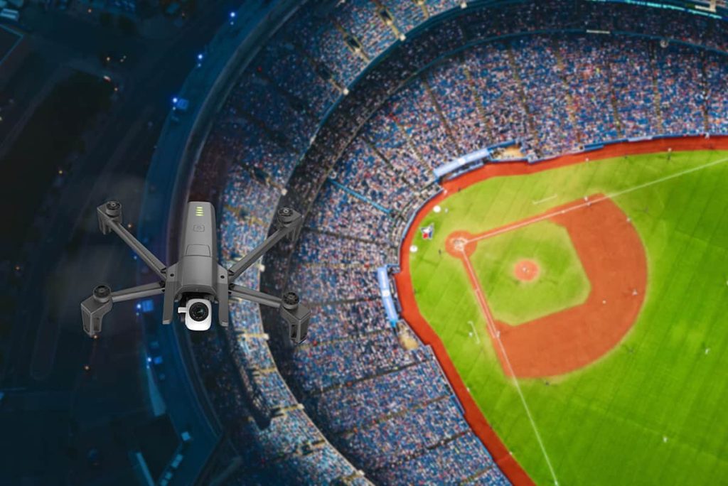
2. Large Public Events and Venues
Stadiums, concerts, rallies, and other high-attendance gatherings often treat drones as a crowd and perimeter-security concern.
CUAS is typically framed around situational awareness and response planning, especially when temporary flight restrictions (TFRs) or heightened security conditions are in place.
3. Borders and Secure Perimeters
In government and high-security contexts, CUAS is often tied to monitoring defined perimeters where unauthorized drones could support surveillance, smuggling, or interference.
The emphasis is usually on persistent awareness and a clear escalation chain when an object is detected and classified as a credible issue.
4. Prisons
Facilities sometimes evaluate CUAS for contraband prevention and perimeter awareness.
In this setting, the value proposition is often less about “a drone near the facility” and more about documenting patterns, improving response time, and supporting investigations when drops occur.
5. Critical Infrastructure
Utilities, power generation sites, energy facilities, and other critical infrastructure operators may evaluate CUAS as part of incident response planning.
The goal is often to distinguish routine activity from potential reconnaissance and to support coordinated response—not to treat the system like a standalone solution.
6. Military and Defense Environments
Defense contexts may involve a broader set of capabilities, but the operational flow still starts with detection, tracking, and identification.
The key difference is usually the authority and resourcing around response options—not the fact that you still need to reliably find and classify the object before anything else happens.
How CUAS Technology Gets Tested and Evaluated
CUAS systems aren’t typically “installed and hoped for the best.”
In serious deployments, evaluation is a process: establish requirements, validate performance in controlled settings, and then test again in the real environment where false alarms and clutter are unavoidable.
At a high level, testing tends to focus on three practical questions:
- Detection performance: Does it reliably detect the drone types you care about, at the ranges and angles you need?
- Confidence and false alarms: How often does it misclassify birds, vehicles, RF noise, or other clutter as a drone?
- Operational usefulness: Does it fit into real workflows without overwhelming the people who have to use it?
Laboratory and Controlled Testing
Early evaluation often happens in controlled environments where specific drone types, flight paths, and environmental variables can be introduced intentionally.
This helps establish baseline performance—detection range, tracking stability, and classification confidence—without the unpredictability of live operations.
Operational Environment Testing
Real environments are where systems get stressed: multipath RF, dense buildings, weather, background noise, and other aircraft.
Operational testing looks at how the system behaves under those conditions, and whether it can support decision-making without generating so many alerts that operators start ignoring the system.
Requirements and Integration
A CUAS system is only as useful as the process wrapped around it.
That typically means defining requirements and workflows up front, such as:
- What counts as a “confirmed” drone vs. an unconfirmed track
- Who gets notified (and at what threshold)
- What documentation is captured for follow-up
- What escalation path is followed when the risk level changes
CUAS FAQ
Here are answers to some of the most common questions people ask about counter-UAS.
What is CUAS?
CUAS (counter-unmanned aircraft systems) refers to tools and procedures used to detect, track, identify, and respond to potentially unauthorized or risky drone activity. In many real-world deployments, “response” is primarily alerting, documenting, and coordinating—not actively disabling the drone.
What does C-UAS stand for?
C-UAS is just another way to write CUAS. Both mean counter-unmanned aircraft systems.
Is CUAS the same as counter-drone?
In most conversations, yes. “Counter-drone,” “counter-UAS,” and “CUAS” are often used interchangeably, though government and defense documents frequently prefer “counter-UAS.”
What are CUAS systems?
A CUAS system is usually a combination of sensors (radar, RF detection, cameras, acoustic sensors, or multiple at once), software that correlates and displays what those sensors see, and a defined operating procedure for what happens when something is detected.
How do CUAS systems detect and identify drones?
Detection and identification are often separate steps. Systems may detect an object at range (for example, with radar), then use other methods (RF detection, electro-optical/infrared cameras, or acoustic signatures) to confirm whether it’s a drone and build confidence about what’s happening.
Is “mitigation” the same thing as detection?
No. Detection and tracking are about awareness—seeing what’s in the air and where it’s going. Mitigation is an active step intended to disrupt, control, or stop a drone. Because mitigation can create safety risks and trigger strict legal limits, many organizations focus on awareness and escalation procedures first.
Are counter-drone jammers legal in the U.S.?
Generally, no for private individuals or most private organizations. Interfering with radio communications, navigation signals, or aircraft operations is heavily restricted under federal law. Active jamming or disabling typically requires specific legal authority and is tightly controlled.
Can I shoot down or “take down” a drone over my property?
In most situations, that’s a bad idea legally and physically. Even if a drone feels intrusive, attempting to damage or disable it can create safety hazards and legal exposure. The practical approach is usually to document what you’re seeing and report it through appropriate channels.
What should I do if a drone is flying near a sensitive site?
If you believe a drone is creating a safety or security issue, prioritize safety and documentation: note the time, location, direction of travel, and what you observed, and contact the appropriate authorities or security team. Trying to interfere with the drone yourself can create both legal and safety risks.
Does Remote ID affect CUAS?
It can. Remote ID can help with identification when a drone is broadcasting as expected, but not every drone will be cooperative, and not every environment makes Remote ID easy to receive reliably. Many CUAS concepts assume a mix of cooperative and non-cooperative activity.


