

BRINC Launches First Ever 911 Response DFR Drone
BY Zacc Dukowitz
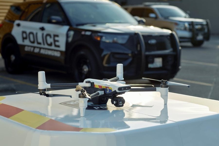
29 May 2024BRINC has launched a drone called the Responder made just for DFR programs.
DFR stands for Drone as First Responder, a term used to describe public safety drone programs in which a drone is automatically deployed to the site of an emergency to provide real-time aerial data.

Credit: BRINC
According to BRINC, the Responder is the first UAV ever “purpose-built” for responding to 911 calls.
The Responder is part of an end-to-end solution BRINC is offering for DFR programs, which means police can work only with BRINC to get a program up and running from a technology perspective. (Getting regulatory permissions for a DFR program, which involves approval to fly BVLOS, is another kettle of fish.)
Here’s everything BRINC offers with the Responder:
- The Responder drone—UAV made for 911 call response
- The Responder Station—charging nest, making the Responder a drone-in-a-box
- LiveOps—teleoperations platform to fly the drone + live stream the visual data it collects
Specs & Features for the BRINC Responder
BRINC is the first and only drone company devoted to making police drones and technology to support them.
Its first drone, the LEMUR, came with an attachment that let it break a window so the drone could enter. The LEMUR also has two-way comms, so SWAT teams can communicate directly with barricaded suspects or hostages in emergency scenarios.
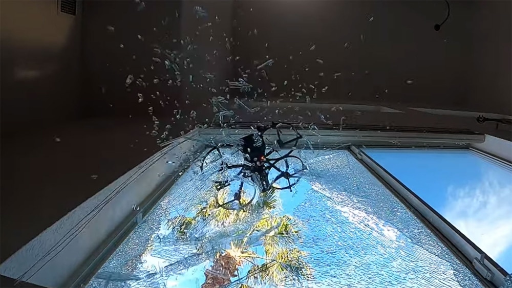
The LEMUR | Credit: BRINC
Building on the success of the LEMUR and LEMUR 2, the Responder is designed specifically to respond to 911 calls—the target use case for drones in DFR programs—and can reach the location of a call in under 70 seconds, live streaming as it arrives.
The Responder is also designed for deliveries, so it can be used to carry and deploy life-saving items like EpiPens, automated external defibrillators (AEDs), personal floatation devices (PFDs), and naloxone (Narcan).
Here are the main specs for the BRINC Responder:
- Visual camera. Full HD, 60° FOV with 42x total zoom.
- Flight time. 42 minutes.
- Thermal camera. 64px with 4x digital zoom.
- Water resistant. IPX4 rating, which means it can be operated in light rain.
Credit: BRINC
Additional features just for law enforcement include:
- Loudspeaker. To enable 2-way communication in real time.
- Emergency lights and sirens. To alert others of danger and identify the drone as an emergency response craft.
- Attachment rail. To carry medical supplies or other items to support emergency response work.
- Customizable agency markings. To identify the drone as used by law enforcement, the fire department, or other public safety agencies in the area.
- Spotlight. To light up suspects or areas during active tactical situations.
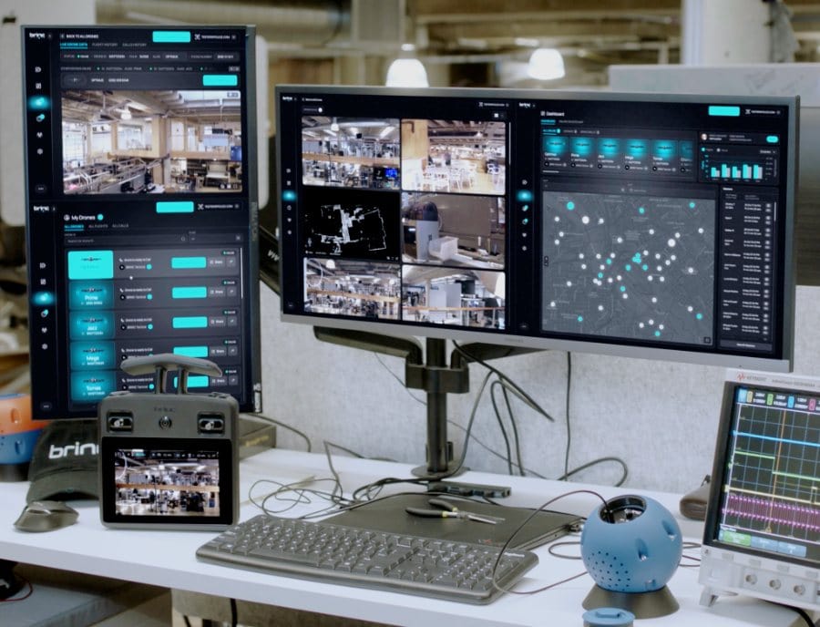
What Comes with BRINC’s LiveOps Platform?
It’s remarkable that BRINC is offering not only hardware for DFR programs—the Responder and the Responder Station—but also software to power the drone’s operations.
Credit: BRINC
That software is called LiveOps, and it’s a crucial piece to the end-to-end solution BRINC is offering law enforcement.
Here’s everything that comes with LiveOps:
- Teleoperations. Fly BRINC’s Responder drones from anywhere in the world on a browser tab with your arrow keys.
- Manage district-wide deployments. View calls for service and available drones, select a station to launch from, and quickly deploy drones to emergencies.
- 2-Way communications. Provide life-saving instruction and de-escalate critical situations.
- Augmented reality overlays. Contextualize live feeds by overlaying map data on drone video feeds.
- Integrated airspace awareness. View local weather information, ADS-B data, ground-based radar detections, FAA map tiles, and more to deconflict airspace.
- Transparency portal. Provide communities with flight logs and a program dashboard to promote transparency.
- Integrate with existing public safety infrastructure. Connect with existing computer-aided dispatch (CAD), digital evidence management systems (DEMS), 911 call systems, and more.
Reducing Injury by Reducing Officer Response
One of the main benefits BRINC highlights for the Responder is its ability to help law enforcement avoid having an officer show up at all.
BRINC’s DFR solution can resolve approximately 25% of calls for service without dispatching officers.
How does this work?
By providing real-time information before anyone arrives, a DFR drone like the Responder can help officers determine the appropriate response to an emergency call.
This information can literally save lives.
If an officer goes speeding into an emergency believing people are in danger, they may be quick to use their weapon. But if they know in advance that the situation doesn’t call for force, they can temper their response before arriving. And, in many cases, they can decide they don’t need to go at all.
In the Chula Vista Police Department (CVPD), which pioneered the first DFR program, police use both drones and a system called Live911 to get real-time information about emergencies. Live911 allows officers to listen to 911 calls as they’re happening while en route to calls, so they get both the aerial live feed from the drone and the caller’s input to inform their response.

Credit: Chula Vista Police Department
In one instance in Chula Vista, a woman called 911 saying that her son was at the door threatening her with a hammer and a gun—the type of scenario that could provoke a tactical response from law enforcement.
But using Live911 and drone data officers were able to determine that the son wasn’t a threat, and was actually mentally ill. Though he often claimed to have weapons, he never actually did, and the woman’s life was not in imminent danger.
Knowing this changed how officers arrived on the scene—and may have saved the man’s life.
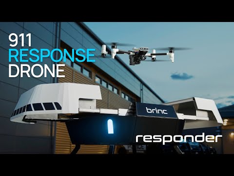
Watch the video below from BRINC for another scenario where real-time drone data makes all the difference in how officers respond to a call. (The scenario in the video is based on a real call police received in Santa Monica, CA).
The Rise of DFR Programs
A few years ago there were only a few DFR programs in existence.
But thanks to the hard work of Skyfire Consulting—the company that helped Chula Vista launch its DFR program—we’re seeing more and more DFR programs get started throughout the U.S.
Although police departments are the main public safety agencies launching these programs, they’re not the only ones.
Fire departments are also starting to use drones as first responders, and Skyfire recently helped launch the first ever dual police/fire department DFR program in the city of Fremont, CA.
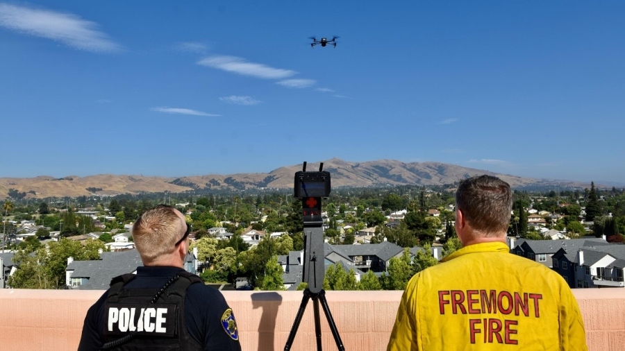
Credit: The City of Fremont
Skyfire helps public safety agencies navigate not only the technology needed to launch DFR programs, but also the regulatory complexity. It recently opened a training facility devoted to DFR programs in Huntsville, AL, called the Rise DFR Village.
More and more police departments are launching these programs. The NYPD, a UAV Coach partner, just announced its own DFR program, which will use drones and a system called ShotSpotter to respond immediately to the scene of gunshots.
As time passes, we’re sure to see even more DFR programs launched. Within a decade, we wouldn’t be surprised if the majority of police departments have them.


