

FAA Issues First National Approval for Remote, Dock-Based Drone Operations to BNSF Railway
BY Zacc Dukowitz
1 July 2021The FAA has issued a first-of-its-kind waiver to BNSF Railway that allows it to remotely operate Skydio drones in docks flying BVLOS (Beyond Visual Line of Sight) above rural parts of its network.
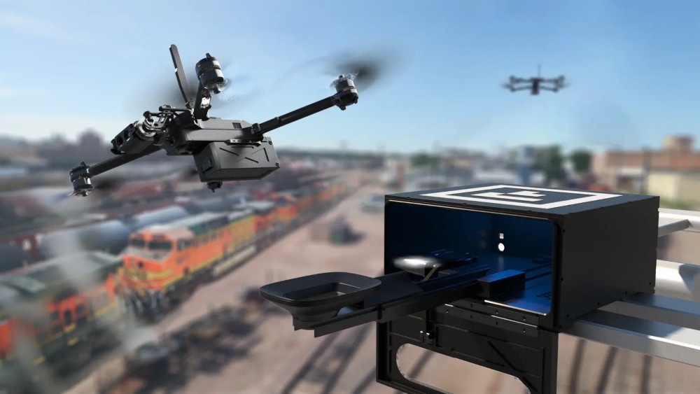
Image credit: Skydio
To put it plainly, the waiver lets BNSF fly drones from a remote location without a pilot being physically present. Further, the drones that the company operates remotely can be deployed from and land back in a docking station, completely removing the need for a person to be present.
One aspect of the waiver that makes it a first is that it applies nationwide for any type of mission that BNSF Railway wants to undertake, and not just to a specific area for a specific period of time.
Another aspect of the waiver that makes it a first is that it grants the company permission to fly for work, and not just for testing remote BVLOS operations performed with the support of a docking station.
The FAA has issued waivers for remotely operated drones in docks for use in R&D work before, but this is the first time it has allowed these operations to take place in real-world applications.
[Related read: Skydio Launches Skydio 3D Scan for Commercial 3D Mapping]
Here are a few more details about the waiver:
- It allows remote, dock-based operations 100 feet above the ground only.
- It applies nationwide to all of the airspace above BNSF Railway’s private property, so long as it’s located 3 nautical miles or more from any airport.
- It is good for two years, until June 29, 2023.
- BNSF Railway must use detect and avoid technology when flying BVLOS.
How Will BNSF Railway Use the Waiver?
There are three main ways the company plans to use its new remote ops permissions:
1. Security at Railyards
Monitoring the perimeter of railyards to make sure there aren’t any security breaches by providing regular visual data of key parts of the yard.

Image credit: Skydio
2. Emergency Response on Train Tracks
Deploying a drone to provide key visual data when an incident occurs on a rail line, which can inform tactical decision making in real time.
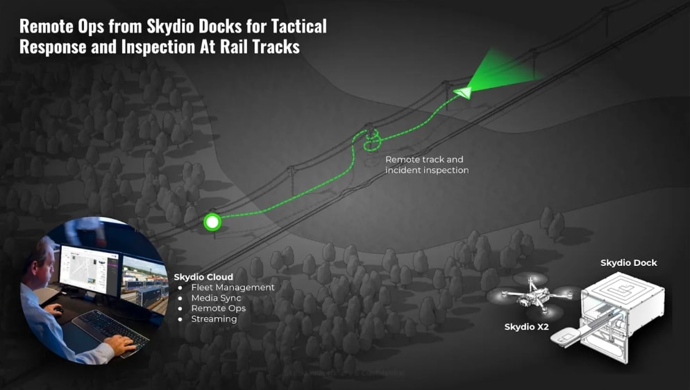
Image credit: Skydio
3. Infrastructure Inspections
Flying over railway infrastructure for planned inspections to identify any potential problem areas that may require maintenance.

Image credit: BNSF Railway
Given the broad scope of the waiver, BNSF Railway will also probably use these new permissions for spot checks of infrastructure—that is, doing quick reconnaissance flights to collect visual data showing the conditions in a location where a worker may have noticed something that needs further investigation.
The company might also investigate new ways to use the data you can collect remotely by drone, like conducting safety surveys of sites or proactive security reviews to identify weak areas in a fence or other barrier.
BNSF Railway’s Leadership in Testing Commercial Uses for Drone Technology
BNSF Railway has been working to push the limits of commercial drone operations for a long time.
The company was one of the FAA’s first private partners. Through the Pathfinder Program—the FAA’s first program to test drone operations that were prohibited by the Part 107 rules—BNSF Railway conducted several tests of BVLOS flights for inspections.
When other companies go to the FAA and say that they want to explore drone technology, sometimes [the FAA] will send them to us and say ‘Have you talked to BNSF yet? They’ve already done it.’”
– Nick Dryer, Field Operations Manager for BNSF’s UAS Program
Back in 2014, when many people didn’t even know that drones could be used for work, BNSF created its first drone program.
The next year, it conducted the first civil BVLOS flight in the U.S., flying over a flooded section of its train tracks to assess the extent of the damage.
And they didn’t stop there. To date, the company’s UAS program has flown a whopping 28,000 miles of BVLOS missions.
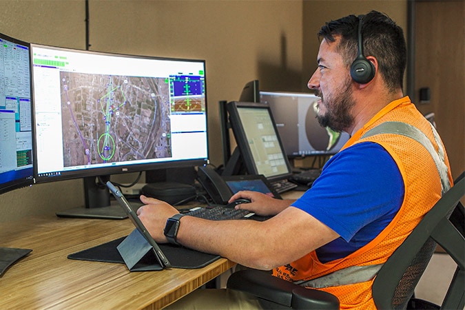
Image credit: BNSF Railway
Skydio’s autonomous drones are just one type of UAS in BNSF’s fleet.
The company has several other commercial drones, as well as large, fixed-wing drones that it uses specifically for BVLOS inspections. Fixed-wing drones can be ideal for long-range inspection missions, such as flying over miles and miles of train tracks, because they have greater endurance and payload capacity than other drone types.
But fixed-wing drones can be expensive to operate and maintain, and overly complex to deploy.
That’s why BNSF wanted to test using Skydio’s smaller drones in docks. When operated from a distant control center, these smaller drones can be strategically placed all along a rail line, offering the advantage of already being near the place where an inspection needs to take place.


