How LiDAR Is Being Used in the Field: An Interview with Daniel Hubert, Founder of Modus Robotics
BY Zacc Dukowitz
27 June 2018Daniel Hubert first started working with drones in 2009, when he was recruited from a Top Gun Helicopter Tactics and Instructor position to work for Army Special Forces as a commanding officer of several drone units, and develop flight and intelligence collection procedures. Because of his innovation and his unit’s successes while in the Middle East, Dan was awarded the Joint Commendation Medal, and his unit received the Joint Unit Commendation.
Following his service, he was recruited by General Atomics to oversee engineering teams working on several cutting-edge Predator and Reaper military drone projects. Seeing what was about to come in the small commercial drone market, Dan founded Modus Robotics, where he was able to use his skills in aviation and remote sensing to help companies transform drone-driven data into actionable business intelligence.
Daniel also has a background in tactical imagery and satellite remote sensing, making him an expert in Light Detection and Range (LiDAR). In fact, he just launched a free course to help drone pilots learn about LiDAR called LiDAR Basics, and his company’s website offers an entire library of free LiDAR resources you can peruse if you’re want to learn more about the topic.
We wanted to sit down with Daniel to learn more about LiDAR and how he first started working with drones—read the interview to learn what he had to say.
—
Begin Interview
What is LiDAR?
LiDAR is light detection and range—it stands for a principle.
At its essence, what you’re doing with LiDAR is the same thing as RADAR or SONAR. You send the signal out, it bounces off something, and you time how long it takes to return.
That’s essentially what LiDAR is. The big difference between LiDAR and RADAR or SONAR is the precision. With RADAR you’re using these very, very large waves that crash into something and come back, and it’s the same thing with SONAR.
Because LiDAR is so precise, it yields incredible resolution and precision—when you’re using light, or more specifically, a laser, you’re using photons, so it’s very, very precise.
https://vimeo.com/277115593
Check out this intro to LiDAR video created by Modus Robotics
Is LiDAR better than photogrammetry?
They’re both excellent, and they’re both necessary in different scenarios.
I think the debate about which is better is just based on who can afford what. Comparing the two is comparing apples and oranges. With photogrammetry, light is generated from somewhere else and reflected, and the camera captures it. But with LiDAR, light is generated by the LiDAR sensor itself, so you know the precise distance and angle from the sensor.
What I recommend is to use LiDAR when you need measurable data quickly. Use drone photogrammetry when you need spectral or color information. I use both, using LiDAR as the base layer for BIM (Building Information Modeling) and GIS (Geographic Information System), and then draping the photogrammetric imagery over the base layer. The commercial drone market seems to think this is a new thing, but we have been doing this for years. It is proven technology. In the end, keep your processes simple, and you will be more efficient and make more money in the long run.

We hear much talk about accuracy these days. What level of accuracy do you think is important when using LiDAR, or does it just depend on the specific application?
I think most people don’t understand what they mean by accuracy these days. For instance, in both photogrammetry and LiDAR, we see many people in the market claiming their products provides millimeter level of accuracy.
But when we talk about accuracy, there are two types of accuracy, relative and absolute. As you certify either criteria of accuracy, that certification has to be qualified and quantified. So let’s look at examples of each type of accuracy.
Relative accuracy is the integrity of the object that you scanned—the photograph. As an example, if you’re looking at a house and you know that the door ledge is 36 inches and it shows up on your scan as 36 inches, well, then you can say it has high relative accuracy.
The other kind of accuracy is absolute accuracy, which is certifying each point’s geospatial location in reference to the earth. So let’s use the same door ledge from the previous example. How accurate are the points at the corners in reference to a known position on the earth’s surface? We know that the door ledge is precisely 36 inches long, but what if those points are 2 feet higher than the actual ground? We can say it has 2 feet of absolute error.
This may not seem like a big deal but absolute error uses vertical measurement, so this means your door could be 2 feet above the pavement. So how does it match with other scans or drawings? Being able to match your product with other products is what gives it value.
I think many people get these two types of accuracy confused, and it’s crucial to understand the difference for certain kinds of industrial work. If you’re doing civil engineering work, relative accuracy is the most important thing.
However, in the geodetic world, or in the world of mapping and GIS, absolute accuracy is critical. So it’s important to define your terms and understand what kind of accuracy you’re talking about, and why it matters for the specific type of work you’re doing.
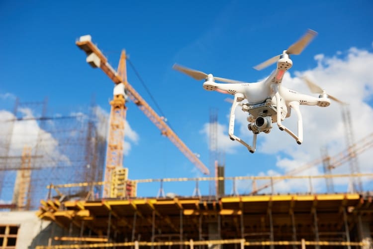
Can you walk us through how LiDAR is being used in the field? Let’s use the construction industry as an example.
LiDAR data is so flexible—it has many uses and products in the field. Its applications can be broken into three primary segments: mapping, vegetation, and structural modeling. One of the most obvious use cases is in pre-construction, when you’re evaluating the land to see if it’s suitable for building.
Using the traditional method, you would send out a team of surveyors to take a survey. For a small area, this requires a group of three or four all day. Most times they use differential GPS, a highly accurate GNSS base station, and a radio positioning sensing stick, and record a series of points they call survey lines. Using this approach, they can get about 80 to 100 points a day—usually, a survey line is drawn along these points, and each point is separated by 500 yards.
So after they pick these exact points and create these lines, there are still 500 yards gaps between each point, and typically a surveyor will do an interpolation to fill in the differences to account for these gaps.
Using traditional methods, this product, from order to deliver, takes three weeks. Now let’s look at LiDAR.
With LiDAR, whether it’s ground-based, mobile, or aerial, you’re getting thousands of points along those survey lines. You’re getting the terrain. You are getting the vegetation. You are collecting the structures. With the new sensor and drone technology that’s available, you’re just getting so much more precision.
To make this concrete, where a surveyor might typically provide 50 points per acre, a drone equipped with LiDAR can produce 450 to 500 points per meter squared.
So, for using LiDAR in construction, you now have all of this incredibly precise data.
The next thing you do with that data is input it into a program and strip off all the vegetation and manmade features so you have the bare earth, creating different layers for vegetation and other criteria so we can review it later if we want.
Then we use the equivalent of machine learning to identify different patterns and classify them. So we get to go through and do quality control for these classifications—that’s what usually takes the most time.

In the end, we’re able to generate different renditions of the earth’s surface, all of which are highly precise. You can use this information to do things like go into different contour levels of the earth’s surface, or do shade analysis—how light hits the earth surfaces. Alternatively, we can do flood mapping to determine how water’s going to run off the land. All of this is possible with the data collected.
So it took the surveyor three weeks to generate a map with elevation contours and precise locations of key features. With LiDAR we have the base product in 2 hours and comparable products in less than two days. Plus aLiDAR analyst can recreate 3D visualization models, volumetrics, feature identification and change detection in a fraction of the time.
All of this is crucial for construction. An error costs lots of money to fix it. Back when I was 19, I worked as a layout engineer for a construction outfit and dug a very long ditch in the wrong place, and it cost one hundred thousand dollars—literally—because of my mistake.
So with LiDAR drones, we could have done a daily LiDAR survey, and by the next morning we would have the survey data and compare LiDAR data from the CAD (Computer Aided Drafting) drawings, preventing expensive mistakes and providing real-time program management business intelligence. That’s priceless.
How does your background in the military inform the work you do now, helping companies use technology to make their operations more efficient?
The first real job I had in the military was as a tactical imagery analyst for Naval intelligence. I worked for a three-star admiral and gained a ton of experience studying other nations’ capabilities just from pictures—and it’s funny, because in many ways that is still what I do today. Through that work I developed a deep appreciation for making a decision based upon data and measurable facts.
I built imagery programs that monitored and tracked other countries’ capability via imagery. The program was so successful that it was adopted by all the armed forces, and I was awarded a naval officer commission and slot to become a pilot.
In flight school, 9/11 happened, and that changed everything. I was rushed to a squadron in Japan, and shortly after that, we invaded Afghanistan. For the next four years, I was all over Southeast Asia working in support of the war on terror—flying helicopters, tracking down smugglers and pirates, providing humanitarian aid, performing search and rescue . . . you name it. It was a hard four years. Just tons and tons of flying and doing really neat stuff, and not very much sleep.
Being a pilot, I was able to see the other side of the intelligence equation. As a tactical imagery analyst, I would download what a satellite or pilot gave me. Now it was my job to plan and collect information. It made me very effective, since I knew what information was needed.
From there I was again given a choice about what do next, and I ended up going to Top Gun and becoming a helicopter weapons and tactics instructor. I did two basic things. One, break down and teach young pilots how to solve problems, communicate, and lead dynamically in real time. Two, figure out how to actually use all the new technology in the field, such as satellite communications, airborne shared tactical displays, and some very cool high powered sensors.
One of the things you realize in that kind of training is that, in some instances, we have too much technology available—the technology is so sophisticated that it’s hard for a human being to actually use all of it. So how do you plan with all this technology? And I think that’s what’s starting to happen in the drone industry right now—we have a ton of amazing tech, but people are asking, “OK, cool, but what do you do with this?”
Which is why we created Modus Robotics: to make technology simple, so small businesses can be successful.
Often, what I find is that companies don’t know what their primary objective is. They buy software because of marketing or a perceived capability of what they think they can do, not based upon need and return on investment.
I’ve worked with the Army, the Air Force, the Navy, and it’s usually just the same as what I do now for private companies. When a client first shows up, we spend a lot of time clarifying what exactly their objectives are. Then we match process, the technology available to achieve it, and your return on investment. In the military, we call that mission success.
How did you first get into working with drones?
I was at the height of my career in the military, and I lost vision in my left eye.
It was temporary, and I did regain vision in that eye eventually, but that kind of thing is a career killer. In aviation, your physiology is so important. So while waiting to get approved to fly again, I managed a new helicopter program—figuring out how to man, train, and equip $350 million in high tech helicopters for 13 squadrons of over 2,000 people.
Part of my position was overseeing the Navy’s brand new helicopter drone, Fire Scout. We had to figure out from the ground up things like: Who was going to fly it? Was it safe? What were the operating limits? What could it do?
It’s so important to emphasize that this isn’t a toy airplane—Fire Scout is the size of a police helicopter without a pilot. We were landing them on the back of moving ships in an area the size of half a basketball court.
After that work, I was asked to join the Army special forces and sent to the Middle East, where I ended up overseeing several sites between Iraq, Afghanistan, and many other locations.
We had several drones as part of our operations. My first day on the job, I opened and started to study the drone’s operator manual, as any good pilot would do. It was 10 pm at night when the operations door opened up and a kid who was about twenty years old told me, “Sir, there’s nobody here, and we have an engine out in one of our drones.”
I told him, “Just do your in-flight engine restart procedures.” I’m still reading the manual. I hadn’t read the part in the manual yet that tells you this is not possible for this particular drone, but based upon my flight experience, it was the first logical thing to do.
He said, “We don’t have air restart. We can’t restart in the air.”
“Oh, okay. Well, where are you?”
“Downtown Baghdad,” he said.
This was not good.
I walked into the ground control station, and luckily the interface that I saw was something that I was familiar with, and sure enough, we are in the middle of Baghdad. We ended up gliding safely outside of the city and landing it. Then I was told that there was they planned to leave it out there because it’s just a drone.
“Bullshit,” I said. “We go get it.”
So we went out at 2 in the morning with two helicopters and retrieved it, which was not an easy task. To retrieve it, I had to step on both wings literally, duct tape it, and throw it into the back of the helicopter.
That was my first day in Iraq.
What did you do next to get things up to speed with the drone program there?
We were still learning back then, and we were losing many aircrafts due to pilot error. That was not going to continue under my watch.
So the next thing I did was to shut down my site for two weeks for drone training. The most significant part of this training was not visual flying but adopting flying by instrument procedures and operational risk management. We didn’t lose any more drones after that. In fact, we had a perfect safety record, which is unheard of.
Something you might not know is that all of my units overseas were co-located with airports. To increase safety, we developed instrumented flight procedures for drones, and we increased the airport’s flight efficiency by 25%.
Previously the air traffic controllers and pilots didn’t know where the drones were, which led us to do instrumented procedures, so everybody knew where he or she was, and this dramatically increased safety.
Want to learn more about LiDAR? Check out Daniel’s Intro to LiDAR Training Course here.


