Building a Drone Services Business that Will Last: An Interview with Rachel Gilmore, Founder of Florida ProFly Drone Services
BY Zacc Dukowitz
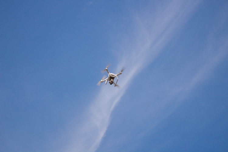
20 February 2023Rachel Gilmore is a Drone Pilot Ground School alum and the founder of Florida ProFly, a fast-growing drone services business based out of Daytona Beach, Florida.
Florida ProFly currently focuses on mapping for industry, property development, excavating, and mining. They provide maps and data to their clients, and are currently expanding into agricultural mapping.
Given Rachel’s success, we wanted to pick her brain about how to start a drone services business, and find out what she would tell others who want to break into offering commercial drone services.
—
Begin Interview
How did you first get involved in drone services work?
The simple answer is that it found me. I grabbed onto the idea of flying drones and I turned it into a new career. I was losing interest in my career of publishing and printing and wanted to make a change.
I’d been flying drones as a hobby for some time, and already had experience with RC hobbies as far back as childhood, with airplanes, cars, and so on.
I have been very fortunate to have worked at Smithsonian Magazine and at National Geographic Society in Washington DC. At both places I was a print production manager—they were two really phenomenal places to work.
Through that work I gained an expert level skill set with regards to software applications, graphics, photography, and all the computer skills that you need to be able to do drone services work.
In 2015, I did something crazy and moved to the U.S. Virgin Islands. I jetsurfed, swam with sea turtles, and flew drones. The Islands are where things really took off with my skills as a drone pilot. I created a new job for myself that is exciting, creative, and changing every day.
While living in the Virgin Islands I worked to master flying, and since then I’ve taken baby steps to get to where I am now, to be a real professional drone services provider.
When I passed my Part 107 test that was awesome! I was the first official drone pilot in the U.S. Virgin Islands. UAV Coach helped me get here today. So, thank you Alan.
How did you build up your drone pilot skill set to the point where you felt comfortable taking on customers?
Flying drones started out as a hobby—I was still working at National Geographic when I started flying.
But when I moved to the Virgin Islands, I really buckled down and started developing my drone skills.

I just decided, “This is what I want to do,” and I created a new career for myself. First I focused on developing my mapping skills, really mastering them, as well as mastering flying itself.
It was a good place to do this, because St. Thomas is mountainous, and flying and mapping in different terrain and elevations is challenging.
So I would practice with the drone, getting different kinds of shots, and making maps and models. I practiced every week, often on the golf course and out over the ocean. I practiced until I understood exactly how to do the maps, exactly how to make the models, and how to make them perfect.
Drone services are about providing perfection. At least it is to me. Having a touch of OCD helps too.
How did you start your drone services business?
I came back to Florida after hurricane Irma and Maria last year. I started the business right away and I got my team together. I called people that I had worked with in Washington and Maryland who I knew I could trust, and who I knew had complementary skills to my own.
My team has a skill set from previous careers that adds value to the business. The combined amount of knowledge we have, including computer skills, photography, film editing, color correction, graphics, marketing, sales, construction, building, and architecture, plus what we’ve learned about the drone industry itself—it’s pretty impressive.
All our previous professional careers and combined skills are making this work. You have to have the right team and I have that, which is really special.
Right now we’re working on rolling out agricultural mapping with some amazing data packages as a new offering. Helping us understand how to do this is one of our team members, who actually grew up on a dairy farm in Wisconsin.
Knowing how agricultural professionals think and what’s important to them is vital to making this new endeavor work, since understanding what a farmer needs will dictates the potential value of what we can do for them.
How did you go about getting your first clients?
People have a theory that when you open a business, you’re supposed to immediately start getting customers and immediately start getting clients, but we didn’t do that.
Instead, we opened up a business and spent time crafting our end products. We made absolutely sure we could deliver what we were saying we could do at the highest quality. Whether it’s an aerial photo or a map, you need to deliver the best product you can to your client.
Being able to explain to your clients the specific value you can offer with your drone services, and how that value will directly impact their business, is what you need to be able to do. People generally know what drones do, but you have to be able to anticipate their needs and questions before you start talking to them, and this requires preparation.
So we created and tailored everything we do for industry people, agriculture people, construction people, and so on, and we spent months creating data packages and end products for each of those types of industries before we even started trying to get clients.
You really need to be very organized. In addition to creating a business plan, you must have lists and charts and plans for everything concerning your drone business. Protect yourself, and make sure to document things just as a real airplane pilot would, and any business owner would.
After all the T’s were crossed and I’s dotted, we started getting our first clients through our connections in the community. Word of mouth gets things going and that’s what will keep you going. So, don’t make mistakes, and foster good relationships right from the start.
We have a very nice office in Daytona now, which is our base of operations. Our office location allows us to give presentations to potential and existing clients. Plus we have a cargo van in the back garage that is our mobile drone van and a really large rolling advertisement at the same time.
Why did you do all of that prep work before launching your business?
The difference between running a drone services business and a retail store is that, with retail, you can just open up and start selling things.
But if you think you’re going to open a drone services business and start offering those services, you’ve got to make sure that you really know everything you have to know about what you’re offering. Plus you have to have a multifaceted team with an understanding of the people you want to do work for.
You can do any kind of marketing that you want, and you might get some clients, but you’ll only attain a certain level of success if you don’t focus on your offerings and the quality of your drone work. Make your maps and models something people want and find valuable so they come back for more.
Because your drone services business is basically going to be within a radius of your location at first, many of your first clients will be from word of mouth. Keep that going. That’s how you build your base.
What kinds of services do you currently offer?
Up to this point we’ve done mapping for property development, mining, excavating, large areas of land, and we’re starting to break into agricultural mapping now.
The word mapping has a lot of little tangents—there isn’t just one kind of mapping. You really have to tailor your mapping skills for who you’re working for.
For instance, when you map for an excavating company, you’re not just providing a map. That company will want the data to go with it, too—for instance, temperature readings of mulch piles, elevation data, or cubic volumes.
When you map for the different kinds of industries, you have to understand their needs, and what other data points go along with the map and into the map. If you don’t have the computer skills and the knowledge to create the data package to go with your map, you really don’t have a lot to offer them.
You and your team have to figure out what you can offer, how to present it, and what the value is for your drone product. Clients won’t return unless they see value.
Also, be aware of your state’s laws. Some states actually have laws that say, “If you are not a licensed surveyor, you can’t provide a measurable map.” Every state has their own wording and interpretation.
Do not claim you can do things like surveying unless one of your team is actually a licensed surveyor. Keep in mind that surveyors went to many years of school, as did all the engineers out there, in order to claim those job titles.
The best way to handle this is to find one a surveyor who will work with you, which is actually not as hard as it might seem since people are really into the idea of using drones.
[Related read: Drone Surveying—An In-Depth Guide]
What advice can you give to others out there trying to get their own drone services business off the ground?
Only promise what you can deliver.
When it comes to building a drone services business, I believe that taking baby steps is crucial. You have to be able to fully understand what it is you’re doing, what it is you’re offering, and to be able to do those things perfectly.
Bottom line, there’s not a lot of room for error with drone services.
So make sure to do your planning—have all your paperwork right, your contracts right and tailored to the construction industry, or to agricultural services, and so on.
As an example of your approach to rolling out new services, what are you doing to get ready to offer agricultural mapping to new customers?
We’re about two-thirds of the way into tackling agricultural offerings.
Right now, as we’re starting to rollout agricultural mapping, we’ve first found a small handful of farms and ranches to start with as beta testers.
But before we even got into this beta testing phase, we did a tremendous amount of research about precision agriculture. We’ve looked into not only sensors and the outputs that farmers need, but also into how a farmer thinks and how they view the rest of the world.
Typically, farmers want to be told right out front what the cost and potential value is. They don’t want a sales pitch, they just want the information.
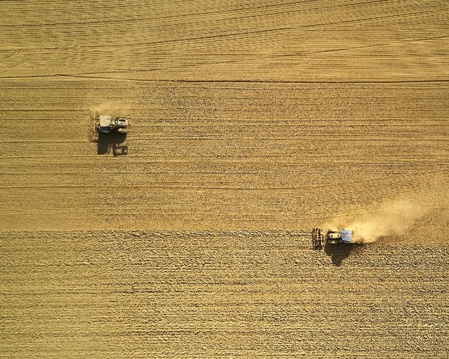
And what it comes down to in precision agriculture, from the research we’ve done, is that drones can help the farmer detect something in time to make a correction. That’s the value proposition, and that’s what farmers want to hear up front.
The correction that can be made might be for an irrigation problem, for a plant disease, a drainage problem, weather damage to a part of your crop, an infestation, a weed problem, soil erosion—the list goes on.
You could even have a small mechanical problem on one of your tractors that’s costing you in efficiency, and not know it until you have that aerial perspective—farms have a dozen tractors sometimes, and one of them could have a little problem and be messing up the corn rows as they’re working. When you’re on the ground, you wouldn’t notice something like that.
It’s all about providing value to your clients using your drone skills and knowledge.
Most importantly, have confidence in yourself and in your flying, and always keep safety and privacy your primary concerns. Remember, the public is watching all of us, and so is the FAA.


